|
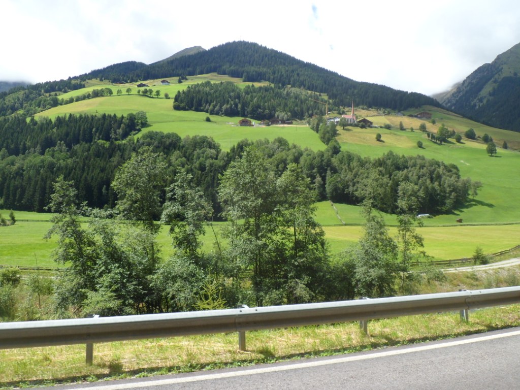
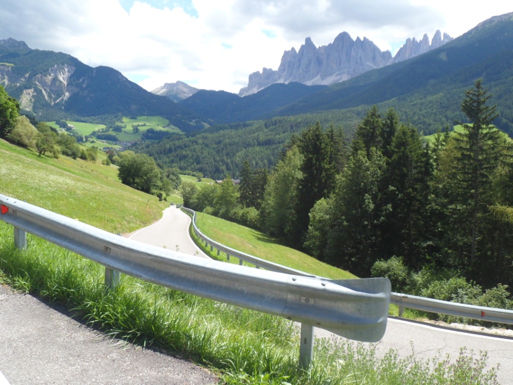
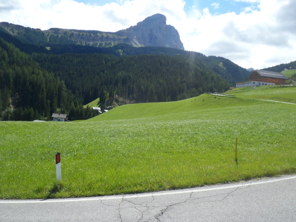
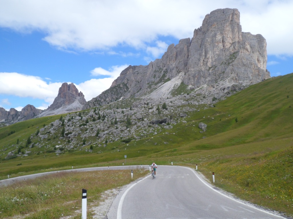
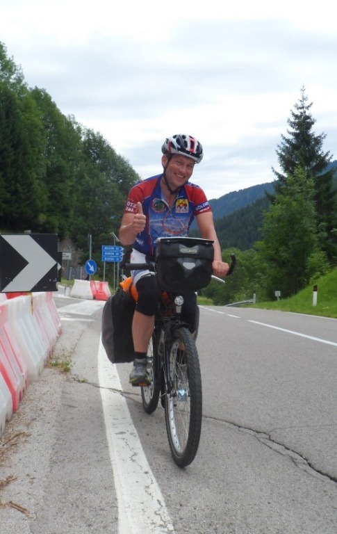
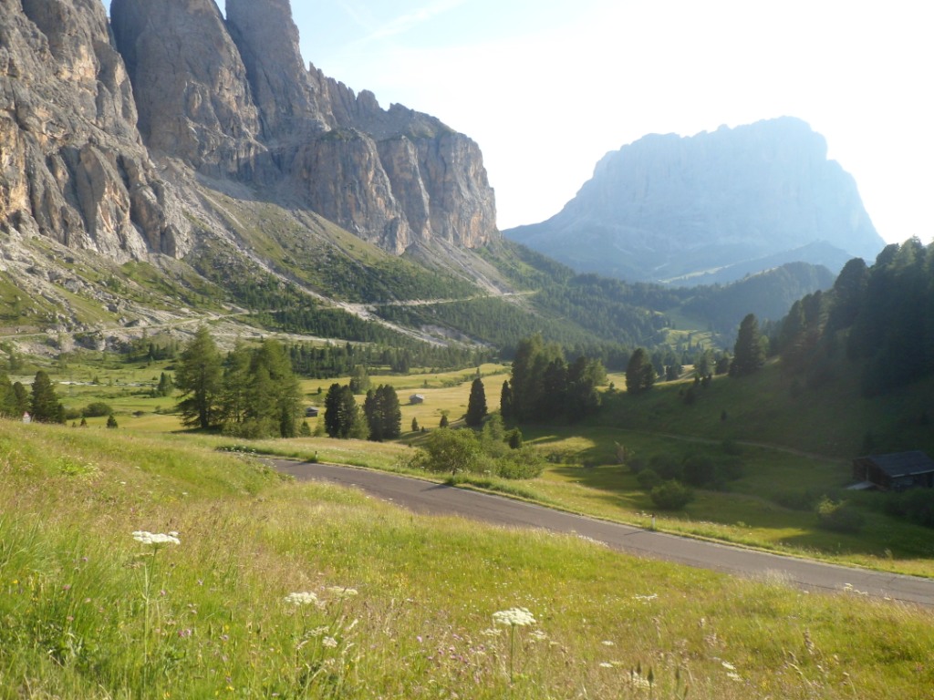
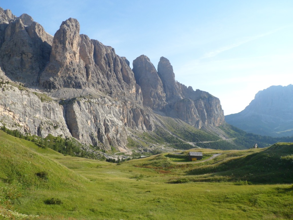
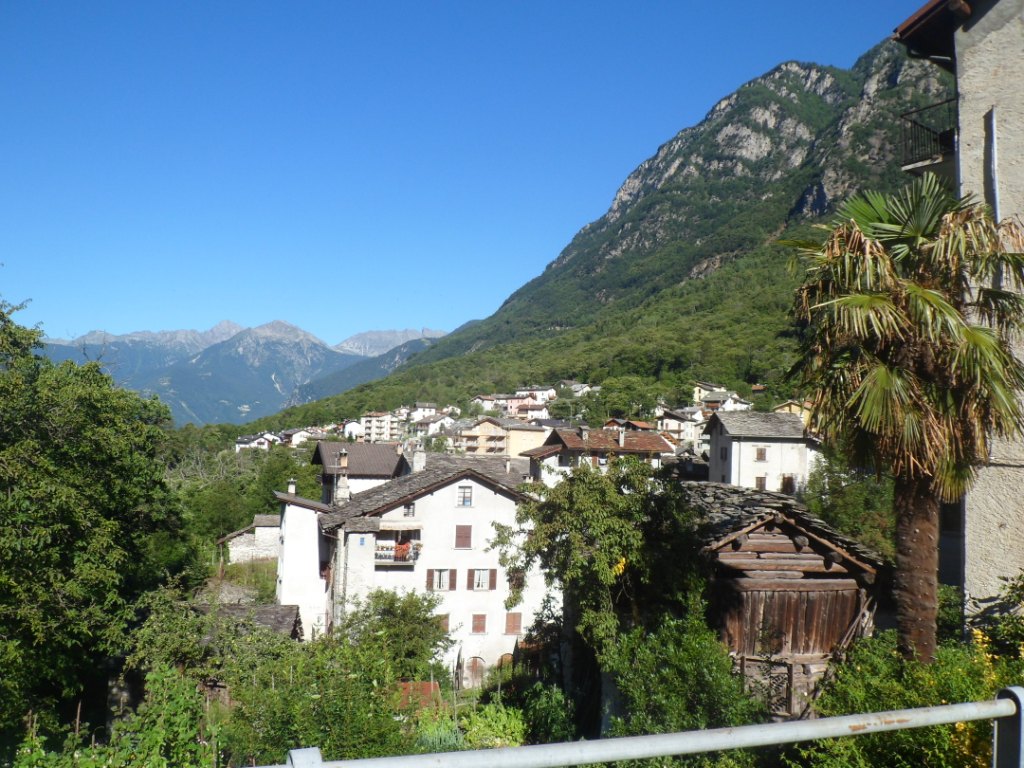
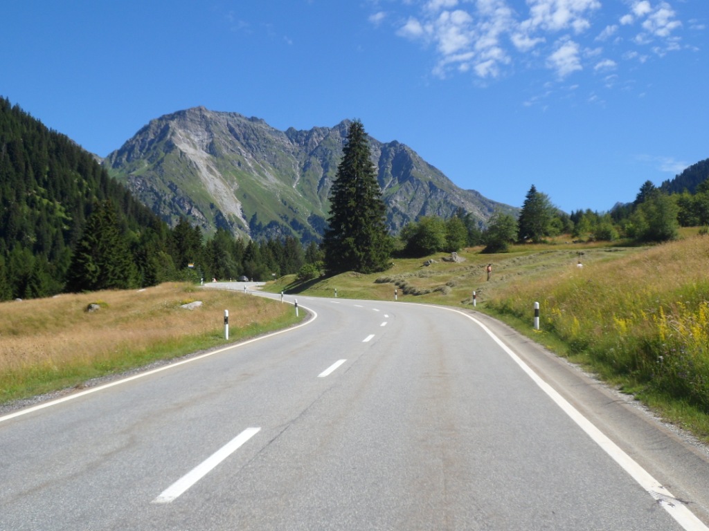
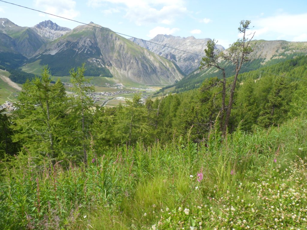
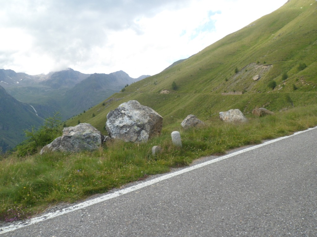
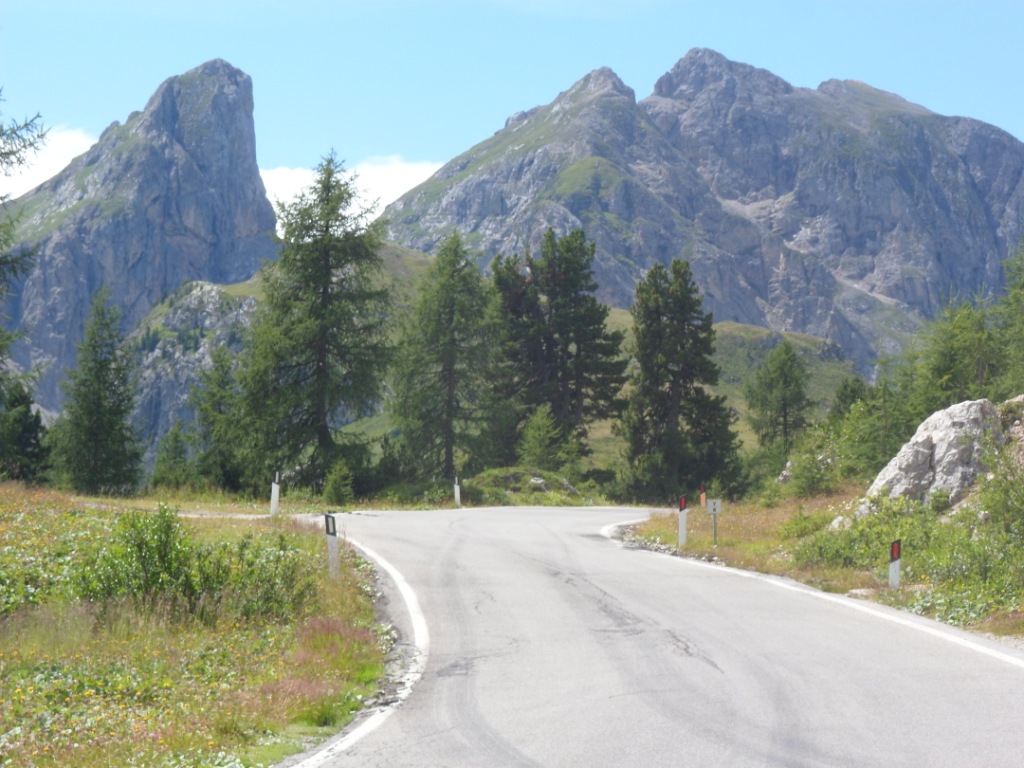
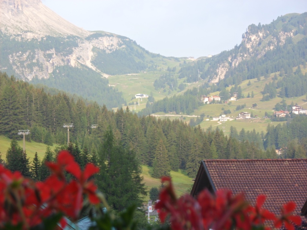
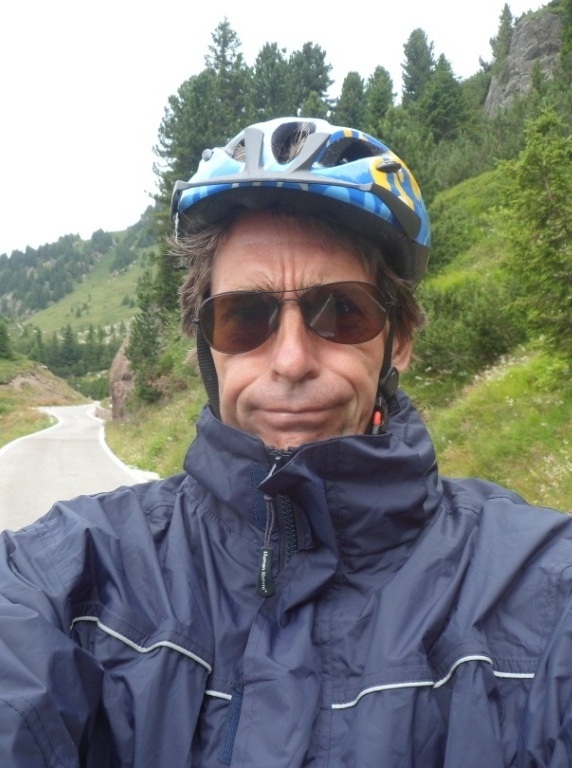
18-07-2012 CHIAVENNA → BORMIO, distance 134 km, dķnivelķe 3000 m
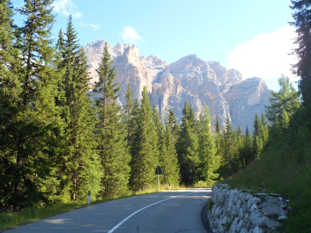
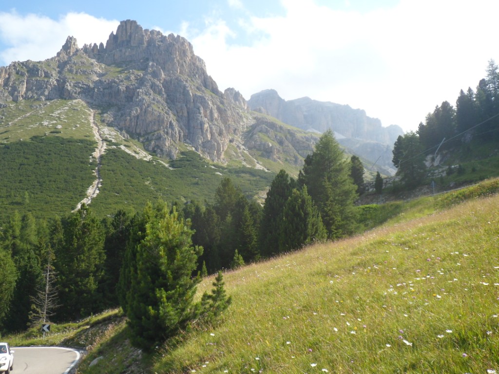
Today will bring a long ķtape, with much climbing, so I have set
my alarm at half past six. Also I have to make my own breakfast,
which takes more time (for one thing, I have to wash
the dishes) so it's about eight when I leave, under the admiring looks
of four motorcyclists. Again a nice morning – with the sun behind the
mountains it's
already 27 degrees – and a long first climb with an easy start. Although
the main road is rather busy, which is a bit disappointing, at the
beginning of
this long stage I'm no too keen on (unpaved) cycling alternatives,
certainly not when one I try leads into a dead end.
I had no coffee at breakfast, which I compensate just before the
Italian-Swiss border with two delicious cappuccinos.
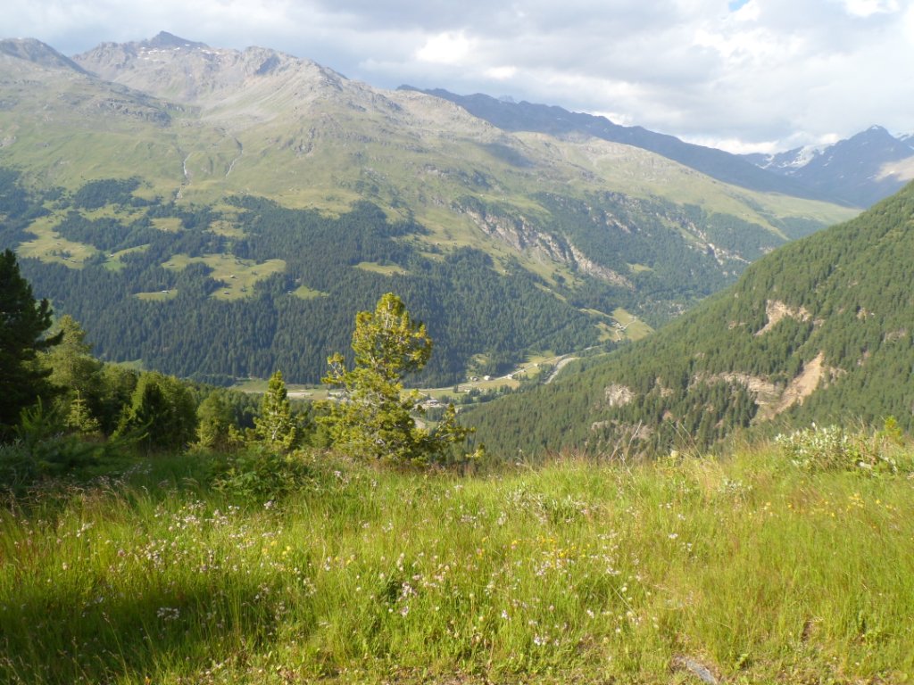
Nice morning
|
Nice weather
|
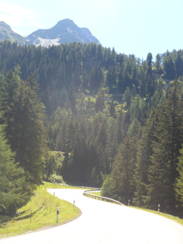
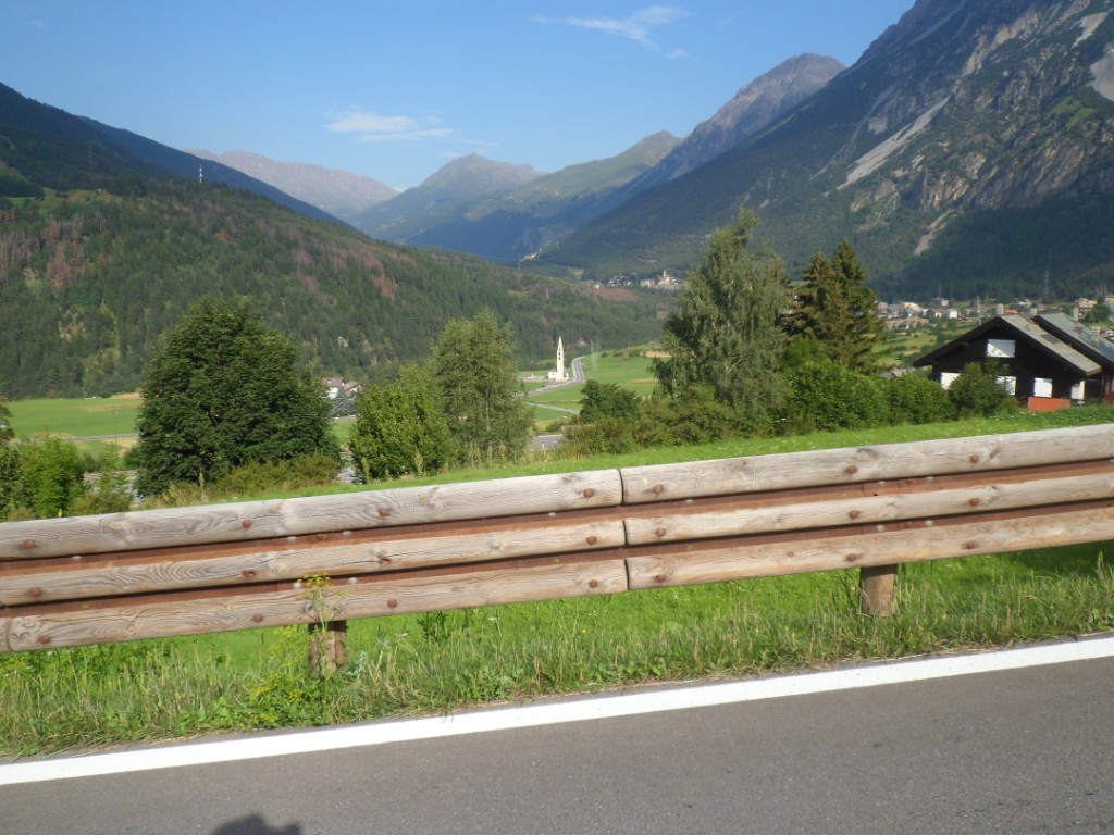
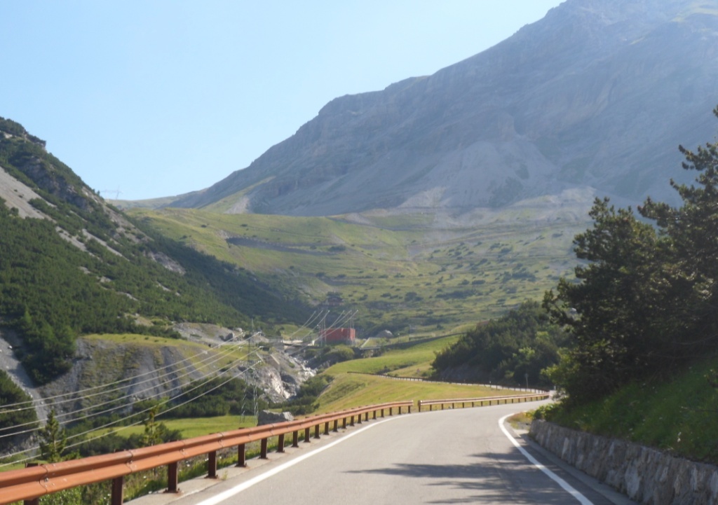
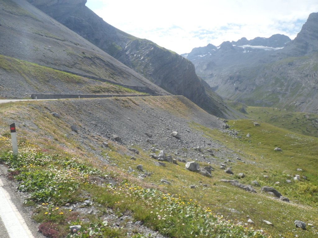
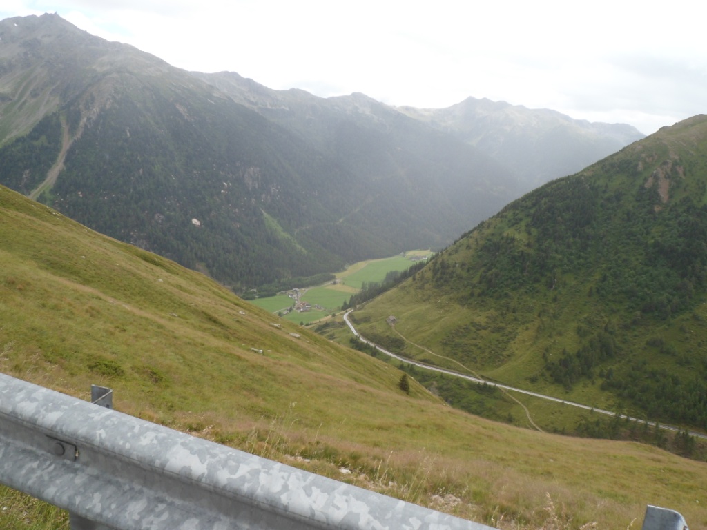
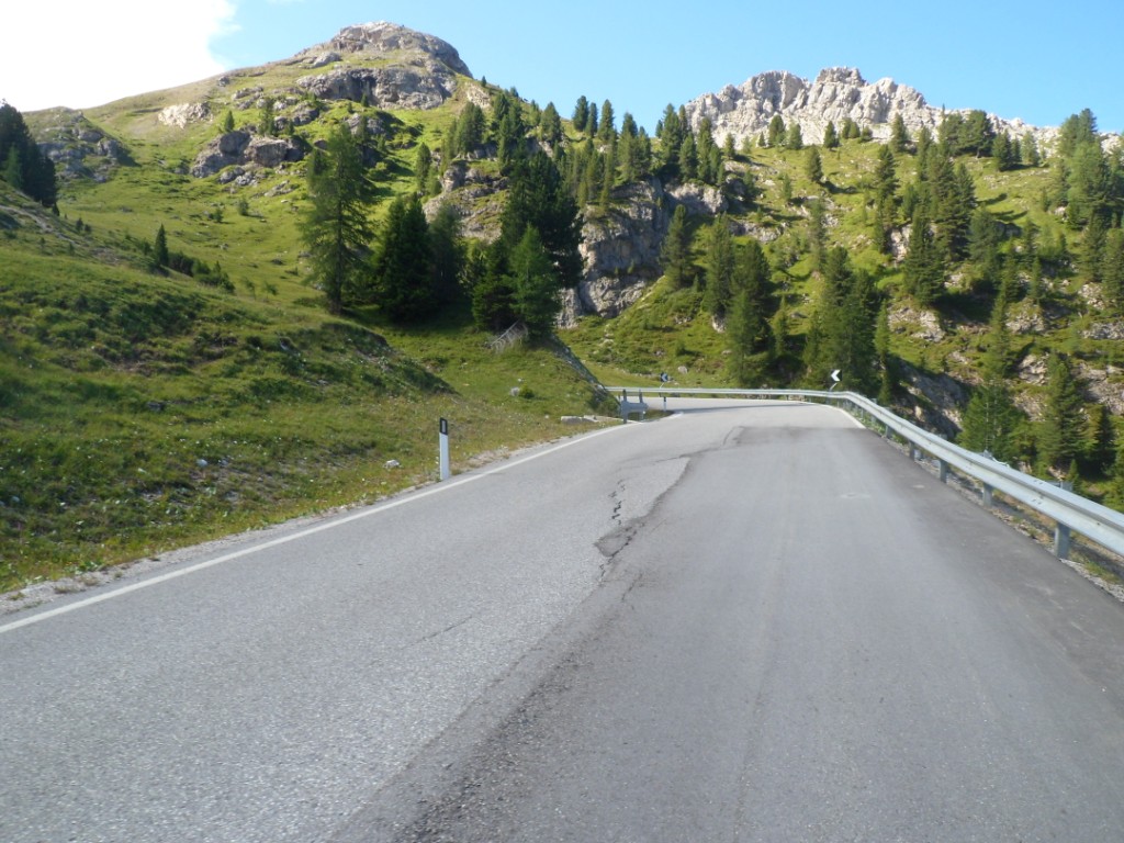
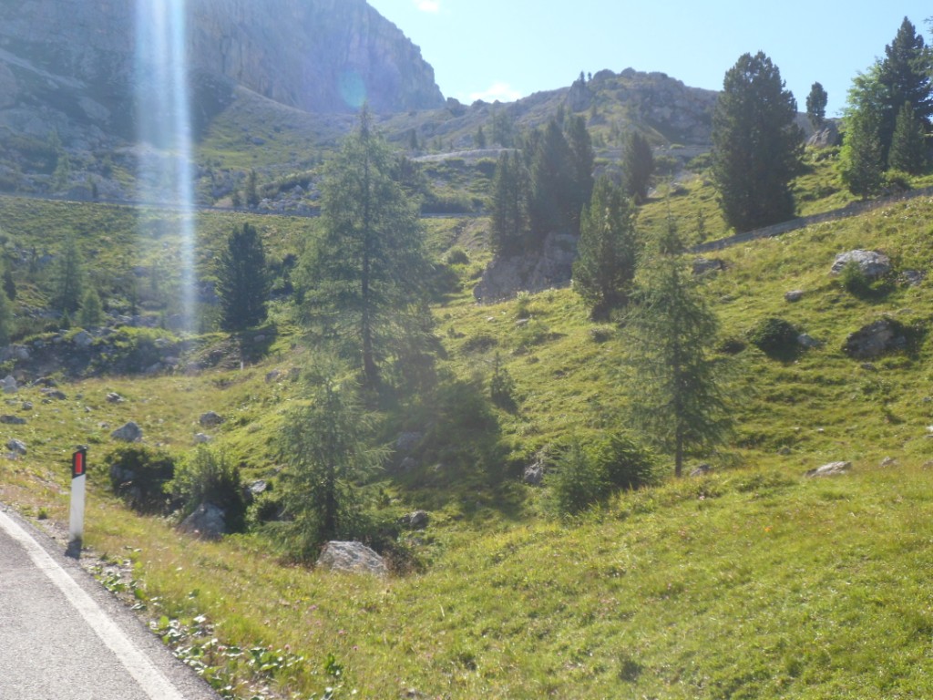
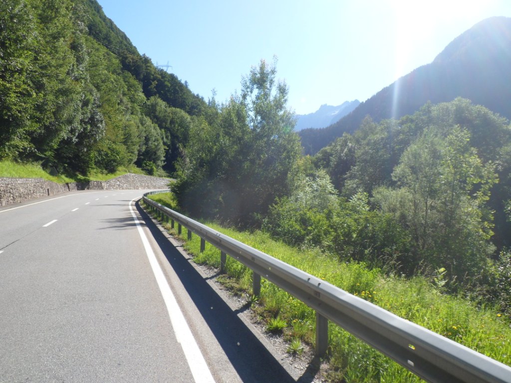
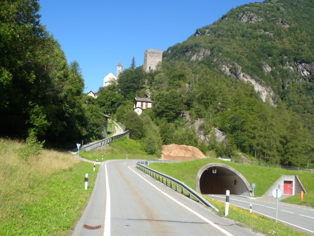
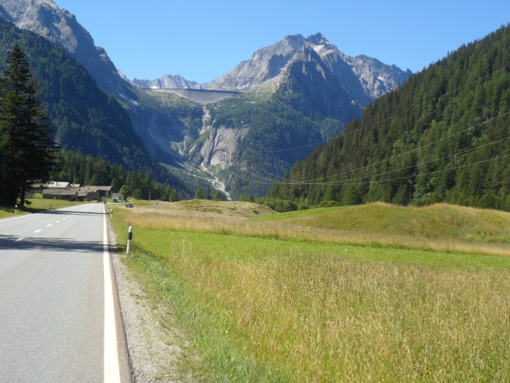
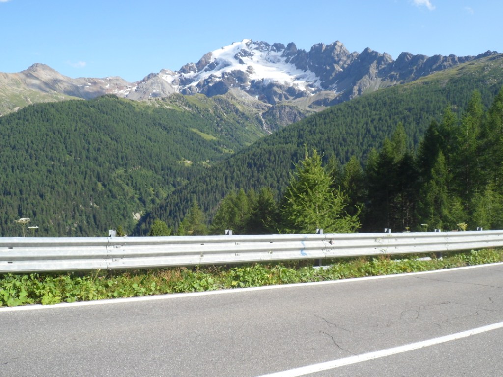
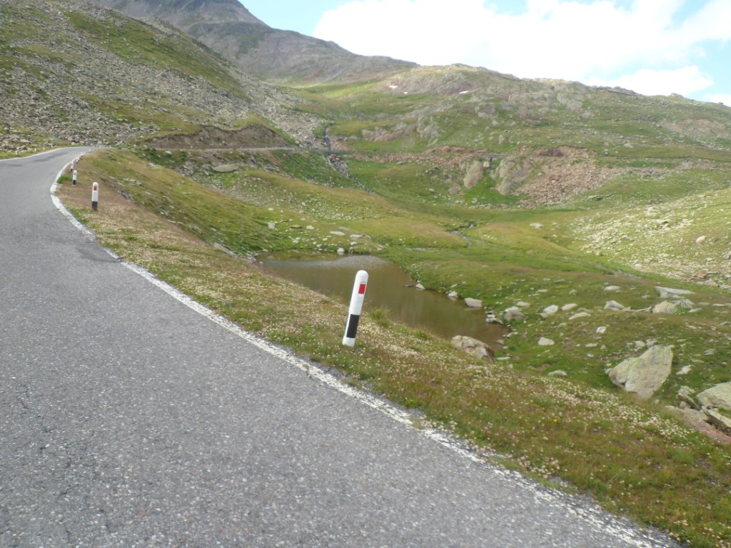
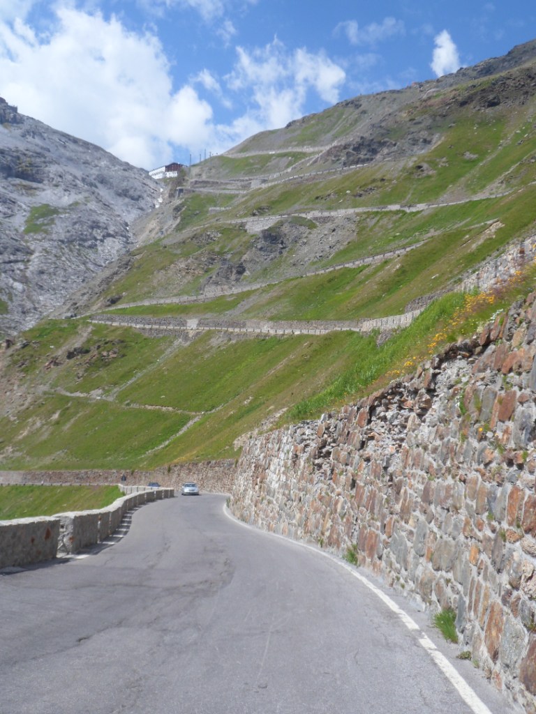
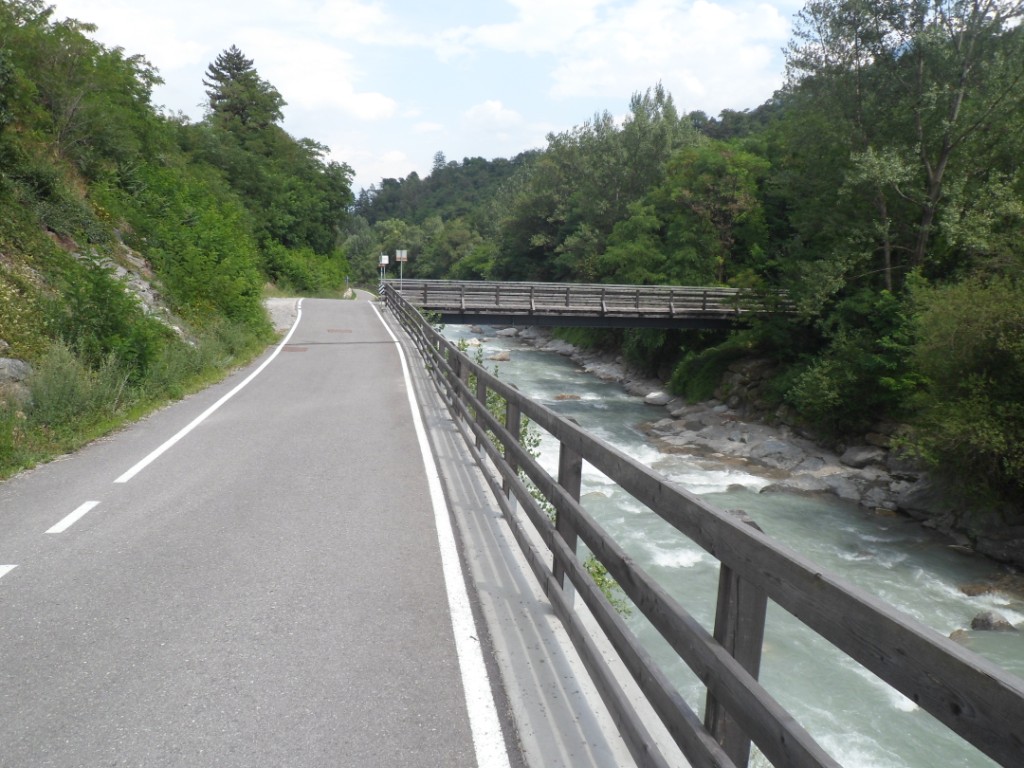
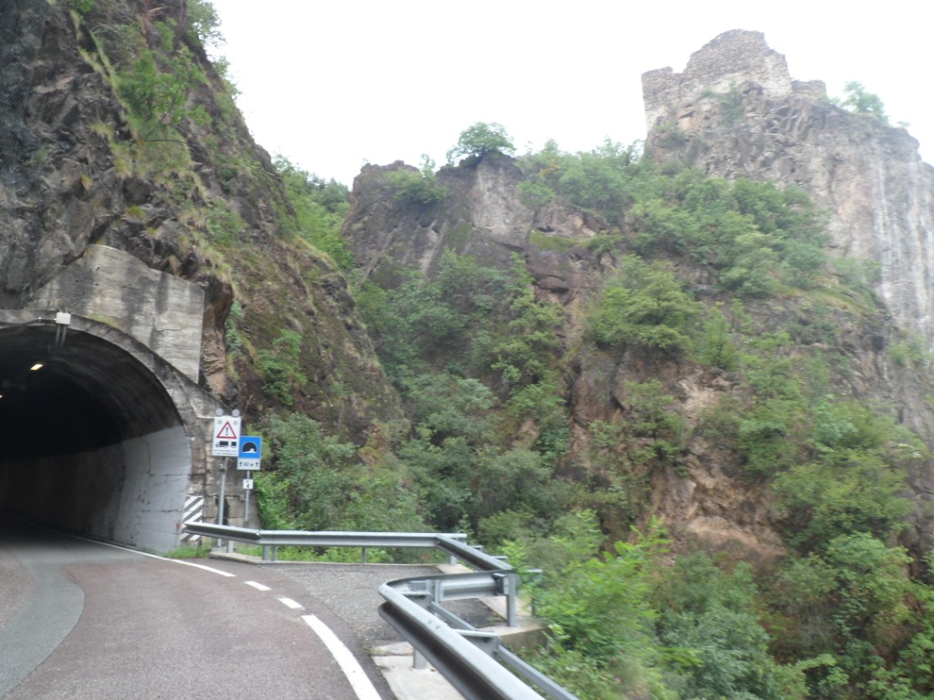
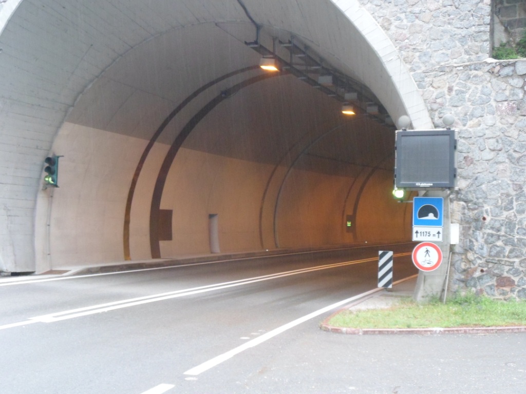
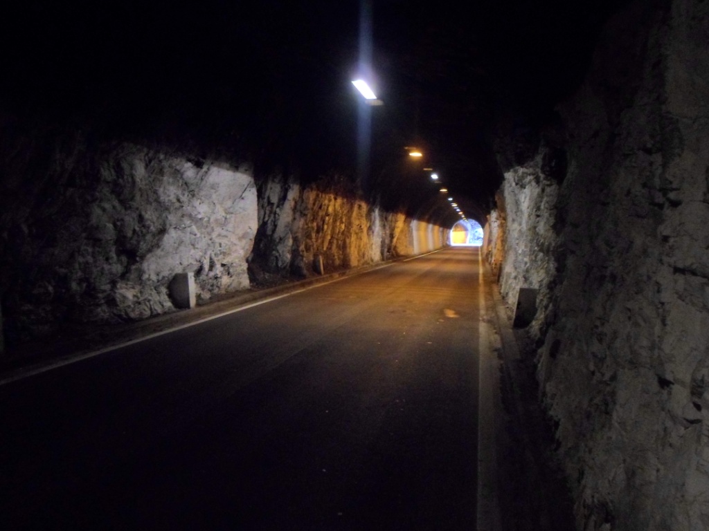
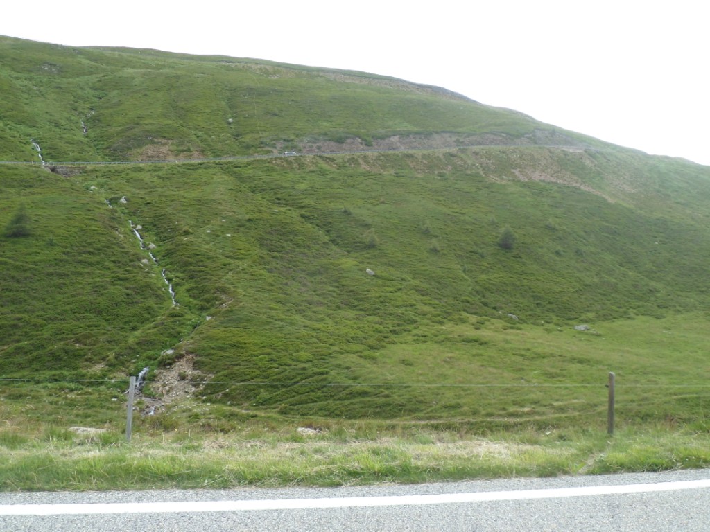
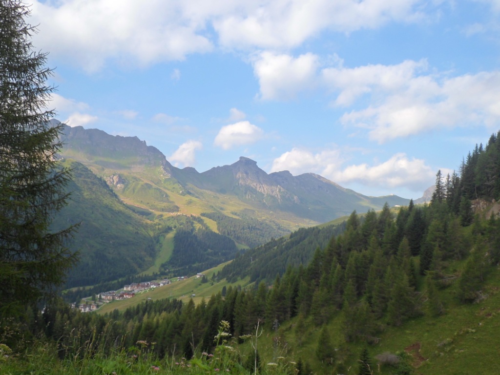
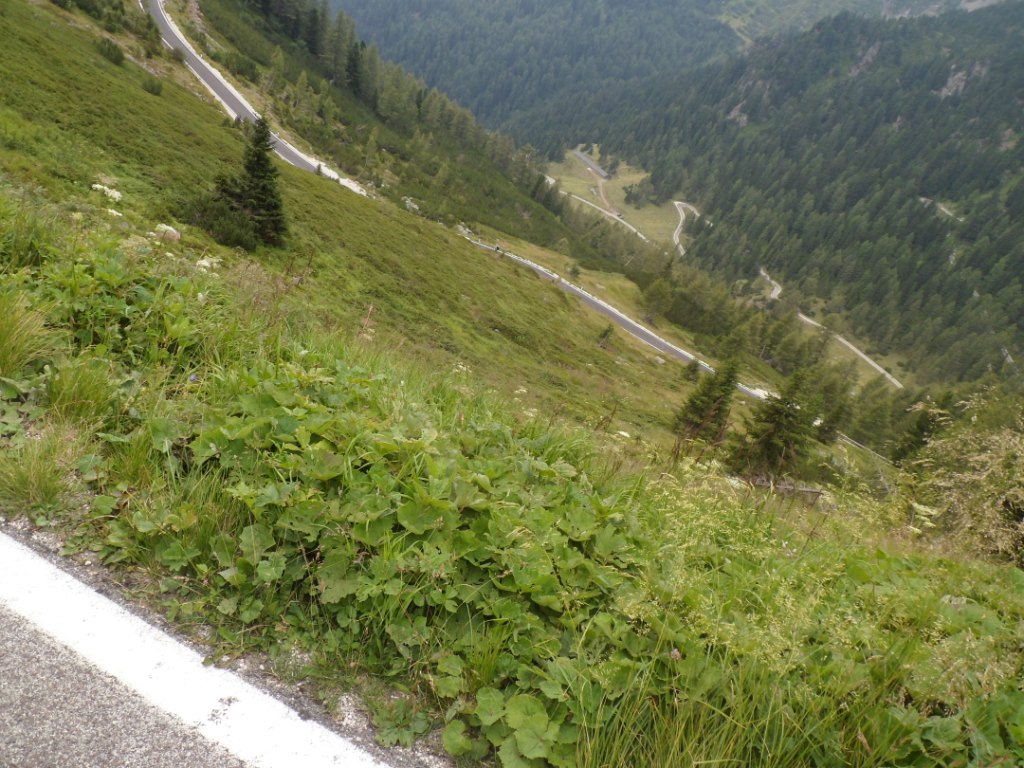
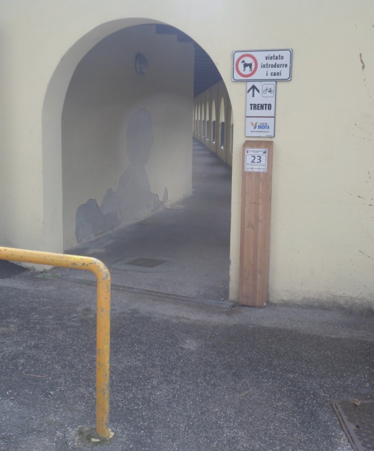
At one point I am forced to leave the main road because of a tunnel, and
that does give a few nicer kms. Gradually I gain altitude, especially
during a
long stretch of at least 5%, but I do not have to change to my lowest
gear.
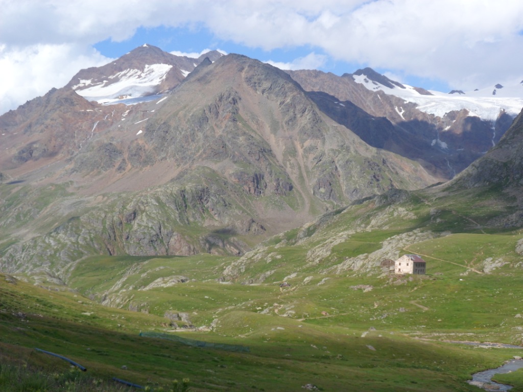
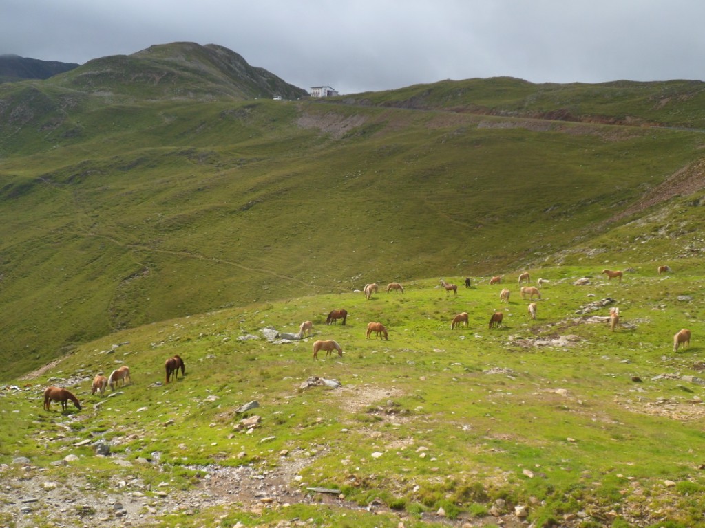
High up in the east I notice a huge dam (of the Lago d'Albigna, I learn
later).
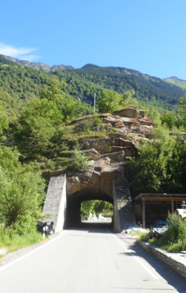
Interesting tunnel
|
Forbidden tunnel
|
I'm getting higher
|
And ... there's the dam
|
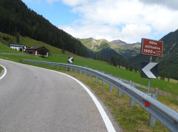
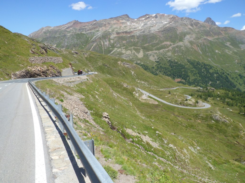
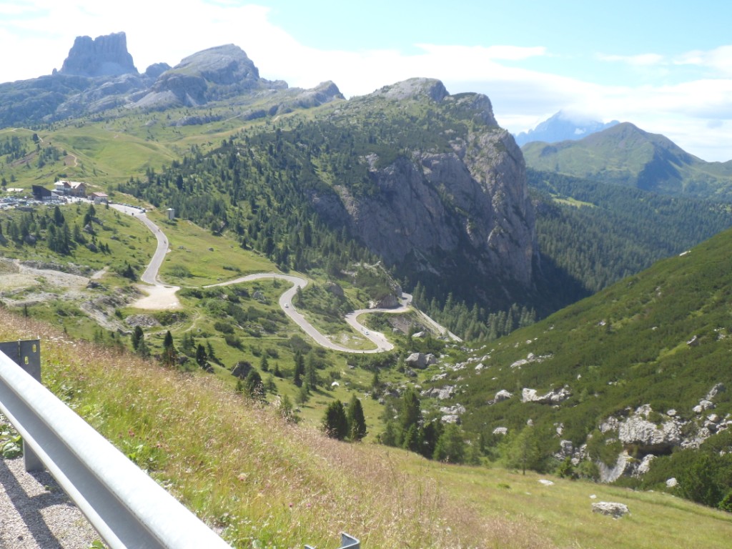
In L÷bbia I can see on the map that I'm already at 1450m altitude, which is quite
good. However, not much happens in the next kms, so at the end there's
still a gap
to be filled, which happens with another 'staircase against the slope',
with in this case about fourteen hairpin
bends. Half past eleven I have them all behind me.
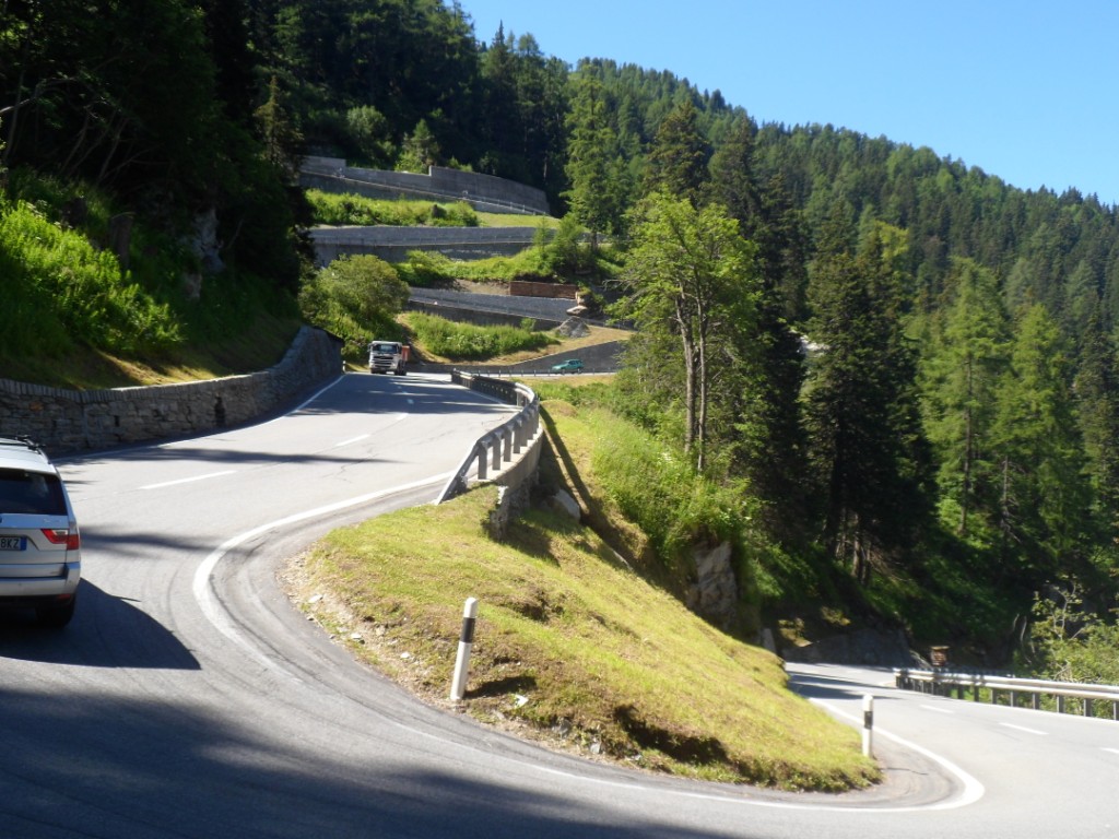
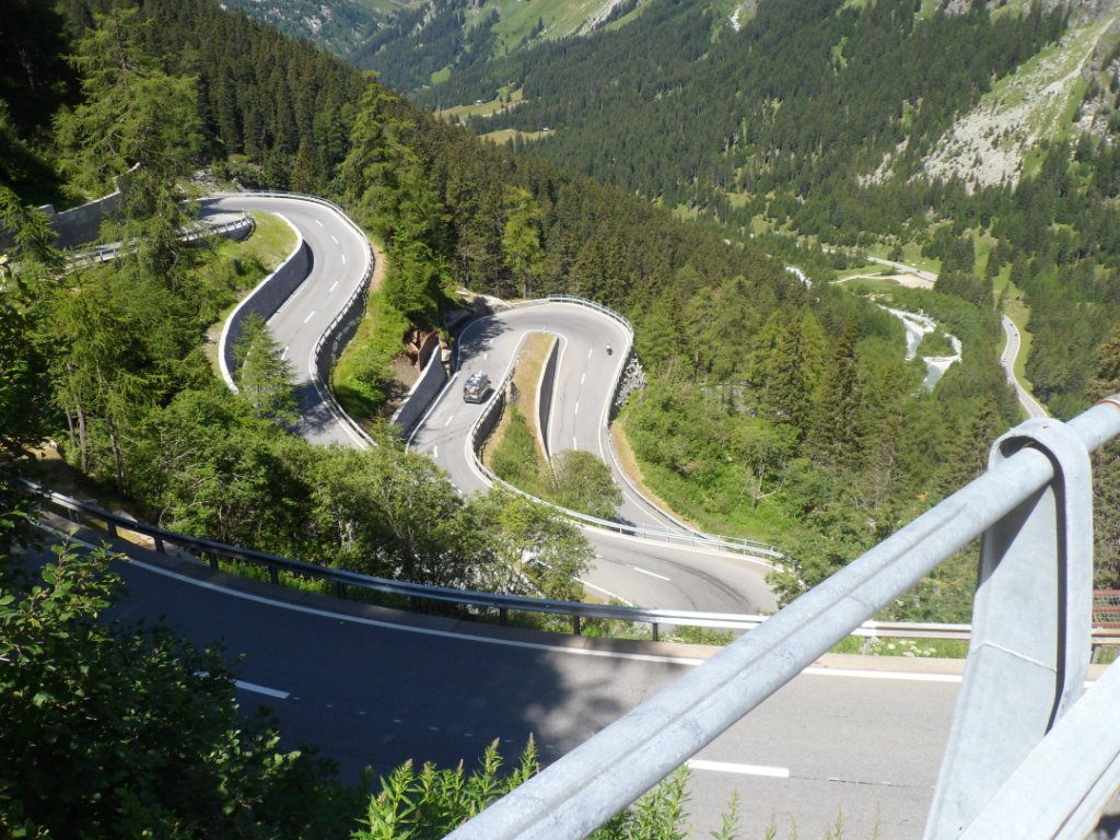
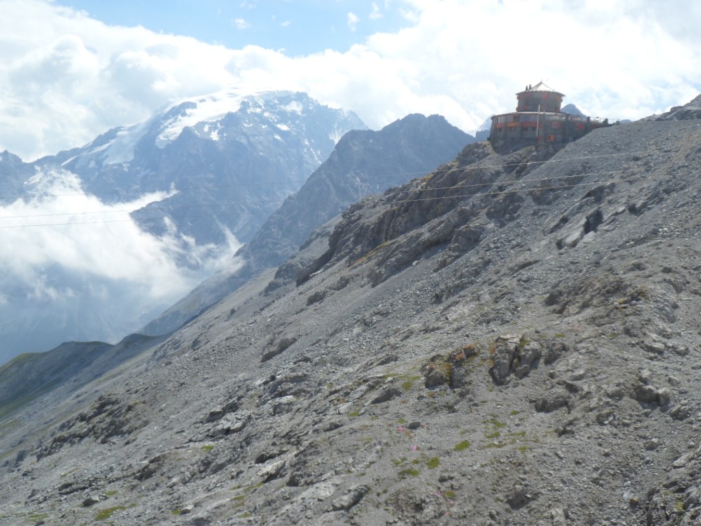
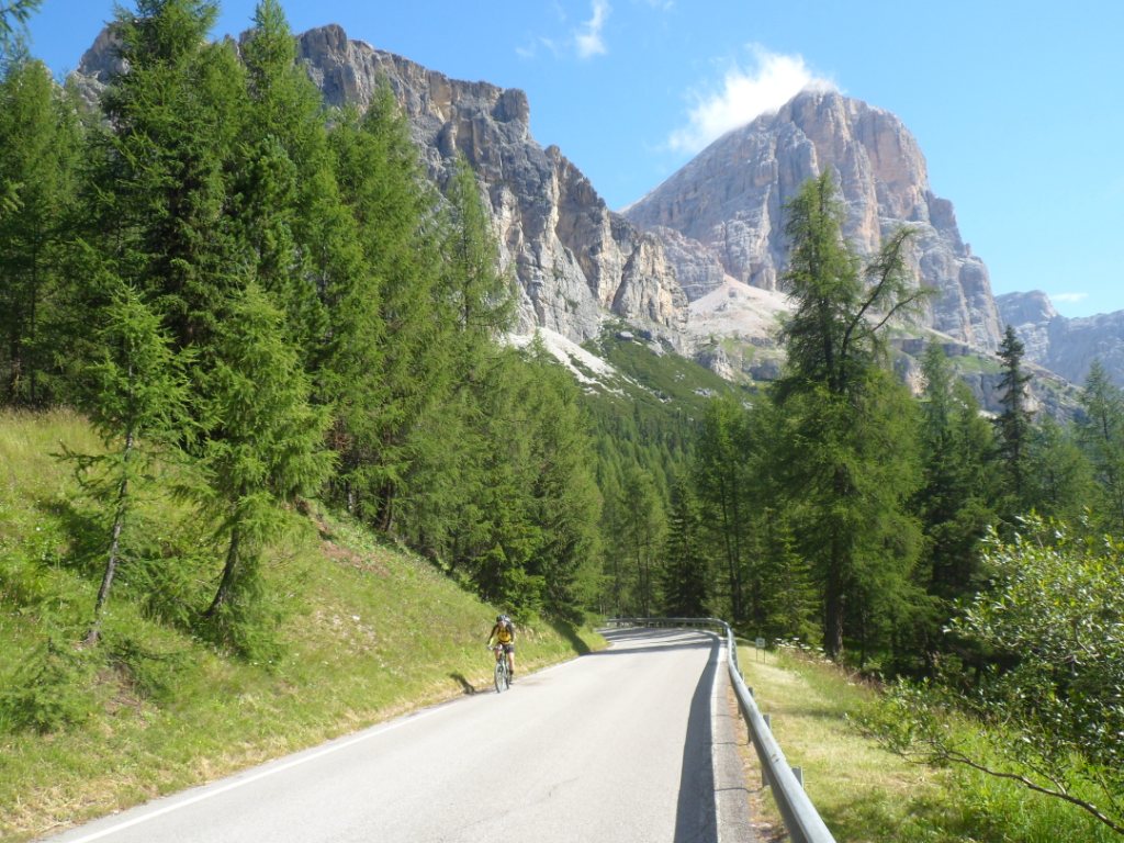
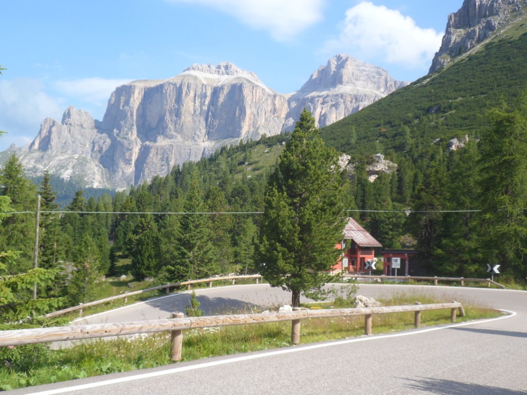
The last (steeper) part till the Maloja Pass
After a short stop at the (busy!) Maloja Pass I
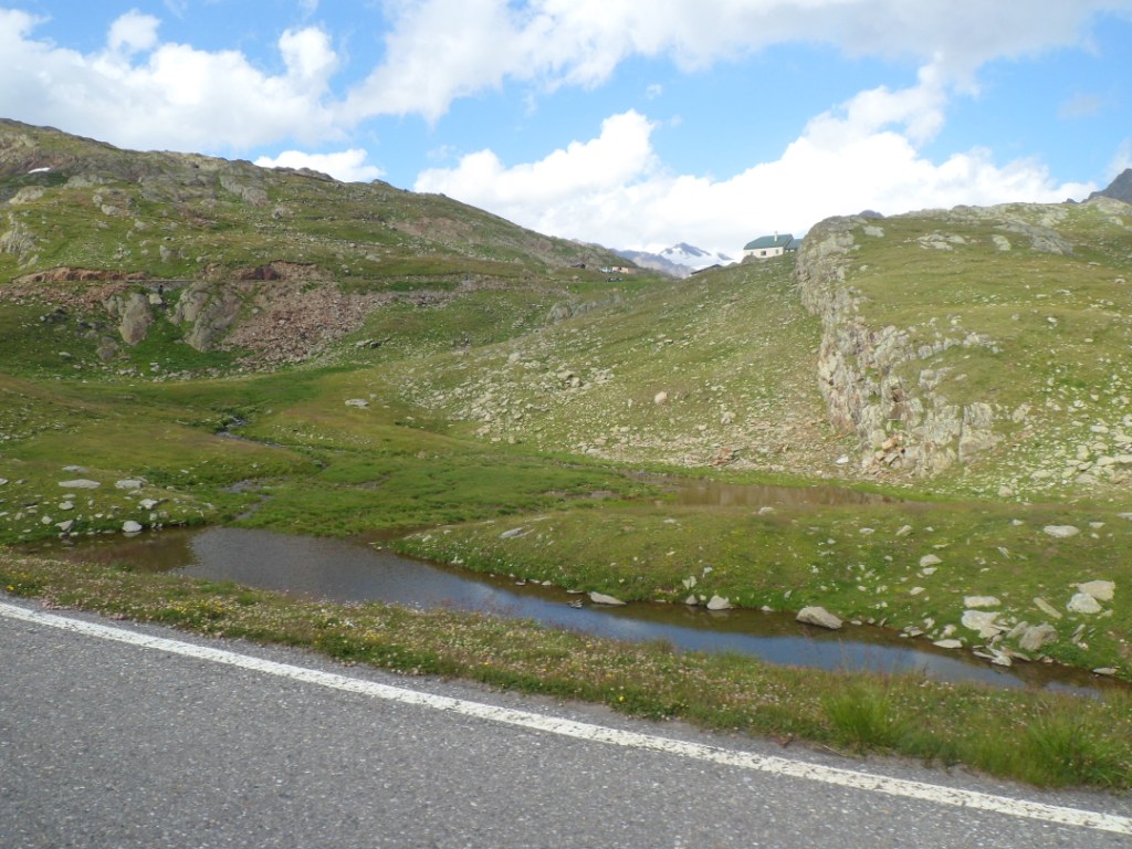
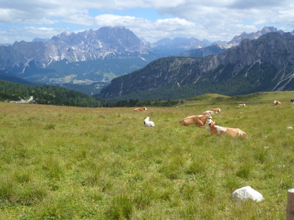
more or less stay on the same altitude, along four long lakes.
Finally big/crowded (Bad) Sankt Moritz comes into view; very busy. I
ride on and on and on, turn
right at Schlarina, onto the Via da Bernina. I fear I don't have enough
food/drink, so I make a sidestep to the railway station of Pontresina,
where I spend
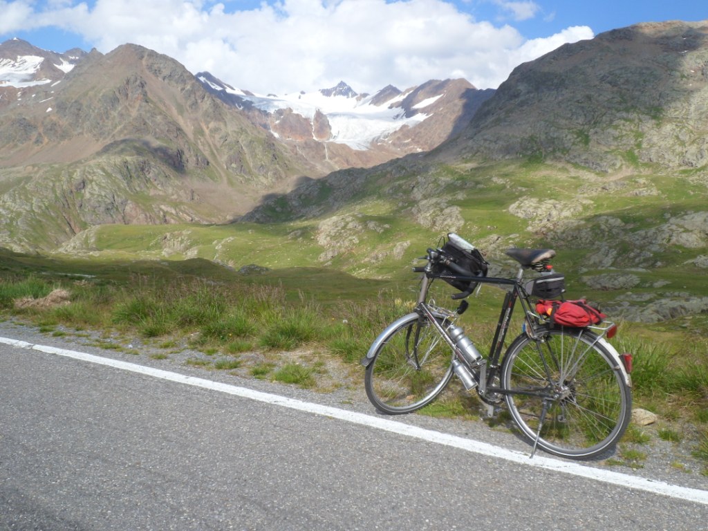
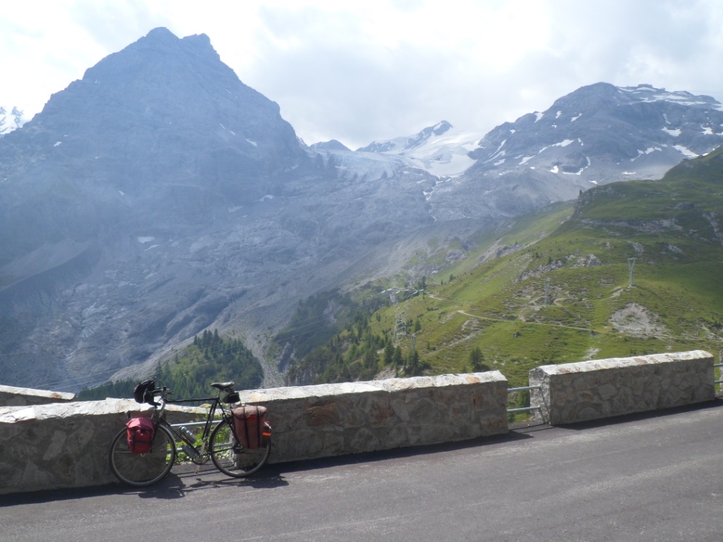
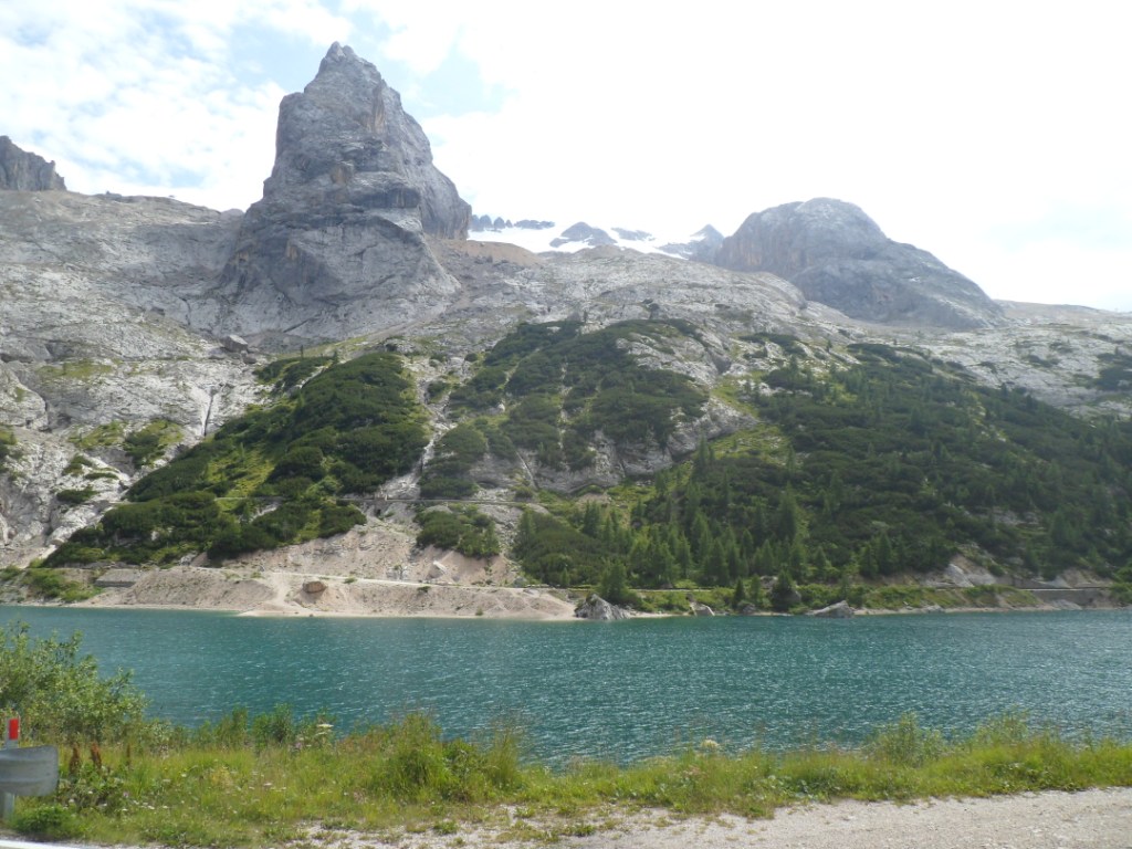
some last Swiss francs. The second climb of the day, to the Berninapass, is also the second in ranking, but it's by
far not as hard as the Maloja Pass. The view onto the
Morteratsch glacier is beautiful – will my daughters descend from it again, in three weeks' time?
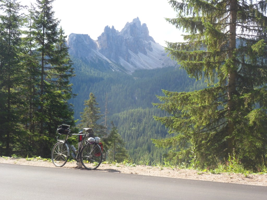
|
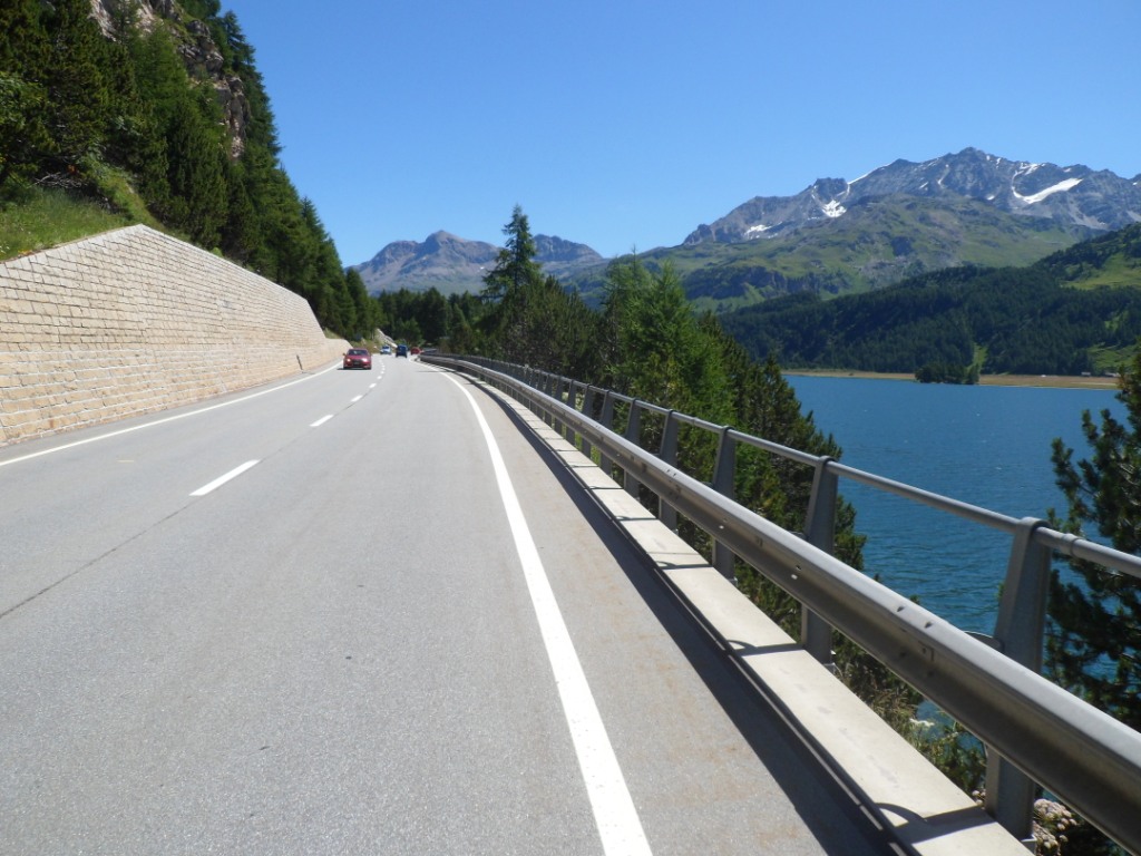
Silvaplanersee |
| 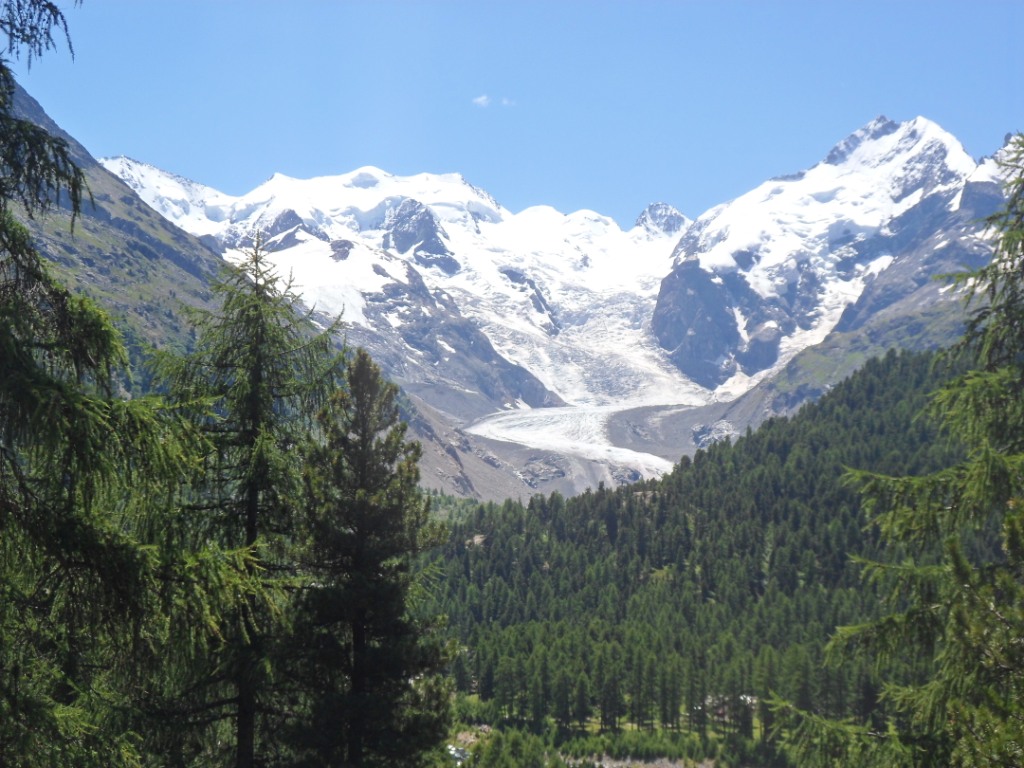
Morteratsch Glacier |
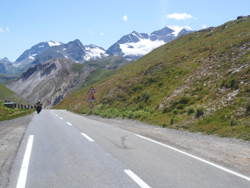
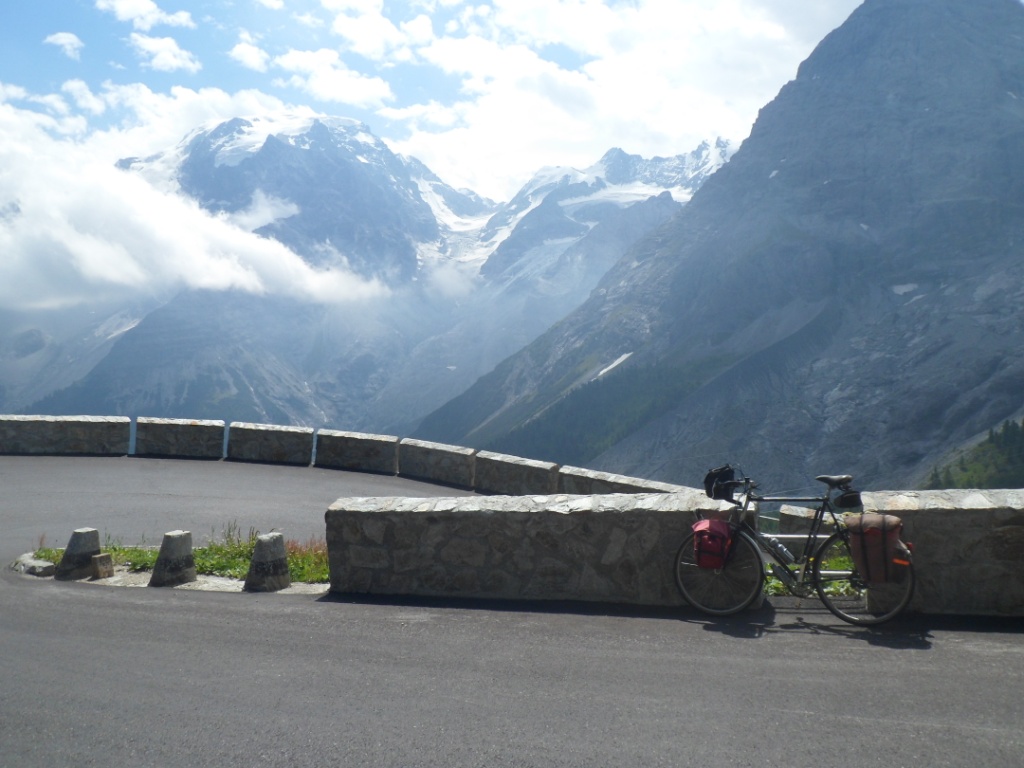
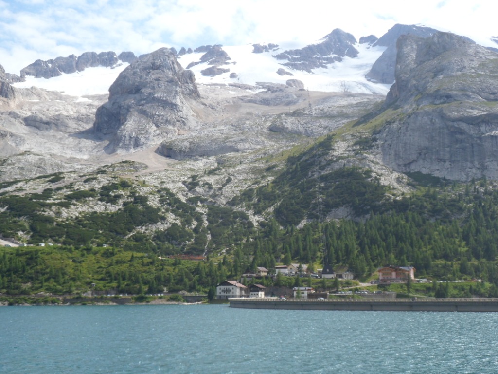
The last four km till the Berninapass are a bit harder than I
remember from '88 – but then it was the first pass of the day (and I was
24 years younger). There's quite a bit of snow and there are quite a
few glaciers
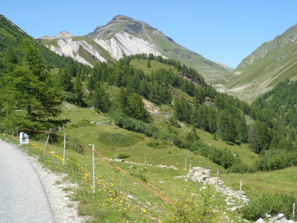
up there. The 4 km descend is fast. I turn left for the Forcola di Livigno,
which I remember from '88 as a very
rude/hard climb. Maybe that was due to the wind
then; this year the climb is certainly doable. And, I'm not the only
sportsman at the top, right on the Swiss-Italian border. Follows a
descent into the
Livigno valley, while I feel I need food/drinks. I reckon I can 'score' a
pizza, but it's not the right time for this in the first restaurant I
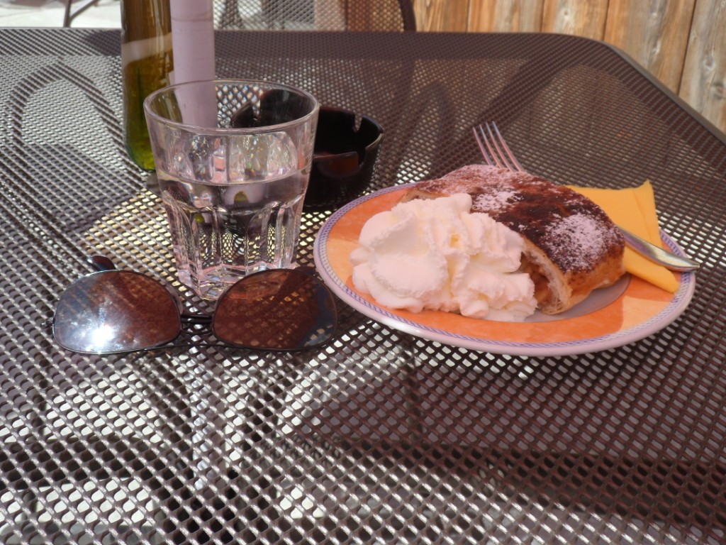
enter. They do
have Apfelstrudl, and that's good too. And it's warm, even on
this altitude (1800m above sea level). This, and the exercise that I
have behind me already
make the climb to the Passo d'Eira – 400m up in 6 km – rather strenuous, but I have enough energy to 'race' down and
up (12-15 km/h) to the last col of the
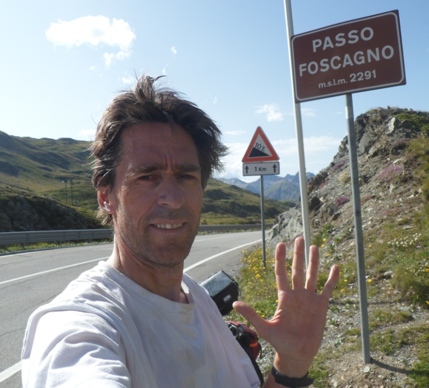
day, the Passo di Foscagno, which comes nicely into view from the Passo d'Eira. Even so, I cannot keep up with a young
girl on a racing bike.
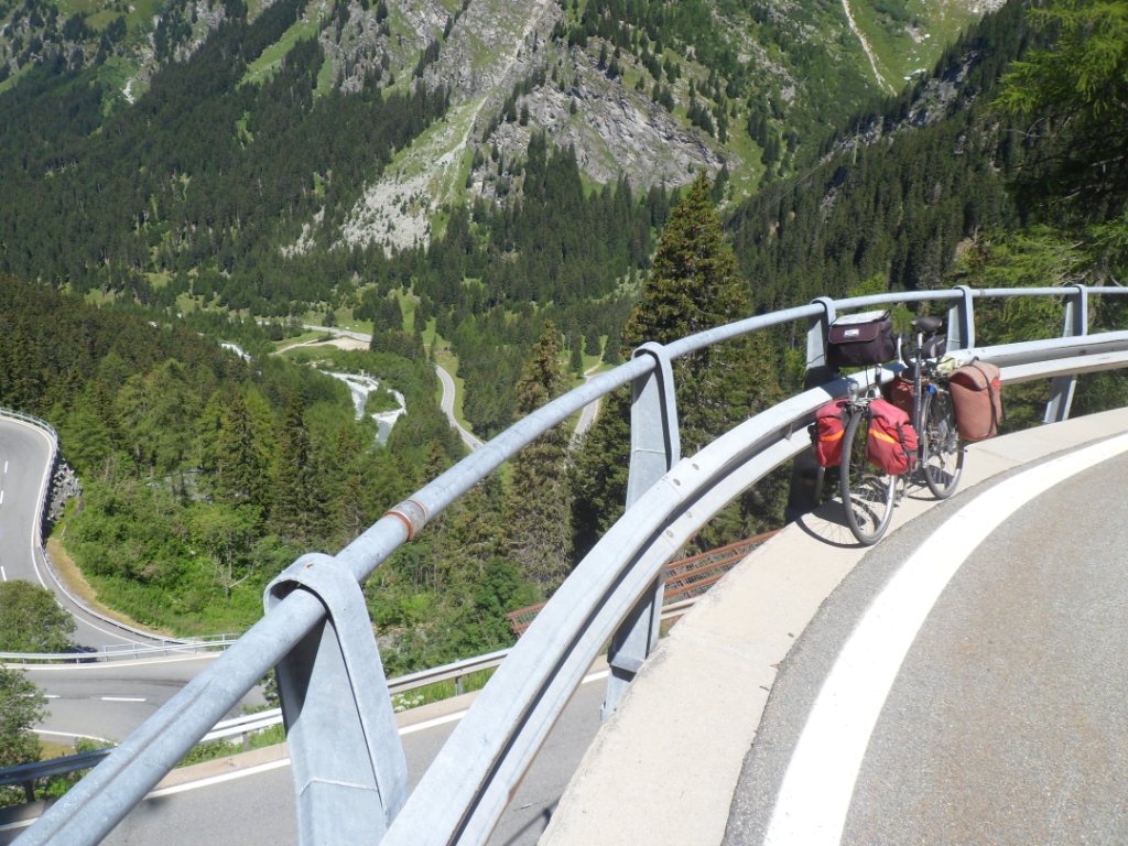
Pix of the rest of the day ...
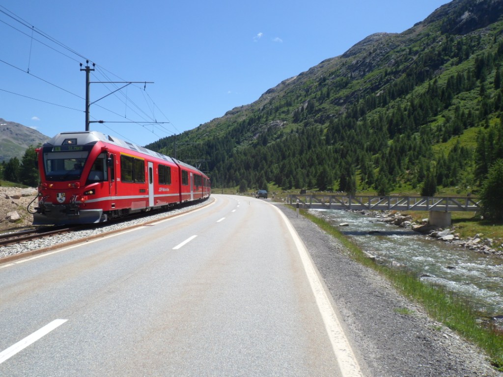
Bernina Express
|
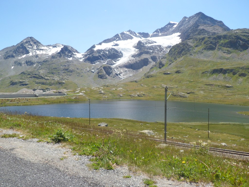
Glaciers around Bernina Pass
|
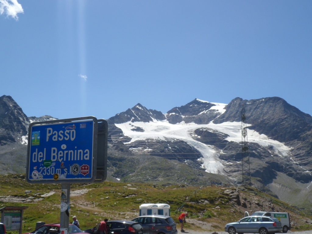
The highest point of the day
|
Descent from Bernina Pass
|
Way up to Forcola de Livigno
|
View back from this Forcola
|
Calories
|
View into the north, valley of Livigno
|
View from Passo d'Eira to Passo di Foscagno
|
I did it!
|
Shortly after Passo di Foscagno
|
Side view in the descent to Bormio
|
As a final dish
of this day's menu the long descent, 1000m down, to Bormio. I pass some
hotels, but think I'll be in time for the tourist office. After some
asking I get
there shortly before 6:30, and will be the last customer of the day. The
brochure I'm given contains at least forty pages: what a load of hotels
they've got
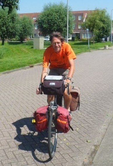
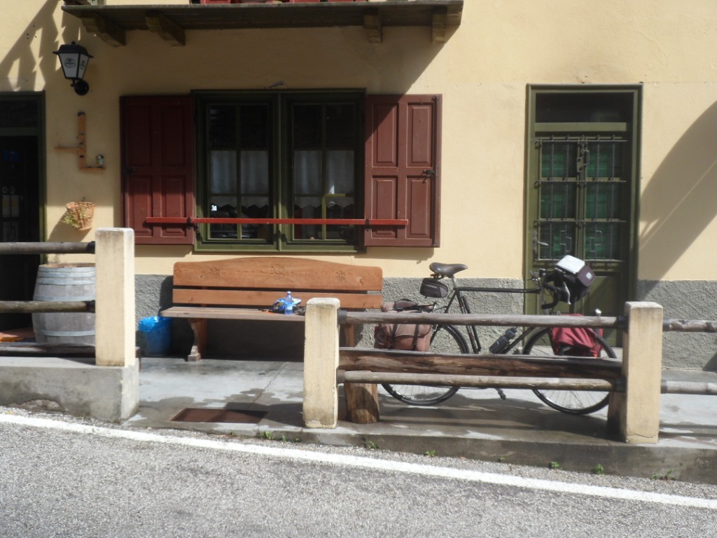
around here! (and not quite so cheap) On my way to a reasonably
priced hotel, not too far from the T.I., I pass a hotel where a bicycle
is hanging at the
frontage, and a sign says 'bikers welcome'. I have a look, notice there
are many peers, am heartily welcomed and lured into a 'very beautiful
room', 'not
expensive' (€ 50 for bed & breakfast, € 20 for dinner) and 'good
meals'. I book for two nights in this Hotel Funivia, and to my delight
all the information
turns out true; it's one of the nicest places where I stay during the trip.
I share a table with David and Pegfoon (that's how her name is
pronounced), a couple from San Fransisco, who travel around on a
tandem, not avoiding hard climbs. I had already met David downstairs in
the bike room, providing every tool I could possibly need. David tried
to help readjusting
my brakes, which unfortunately didn't work out completely
satisfactorily, leaving me a bit worried with all the long descents
(Stelvio!!) still in store.
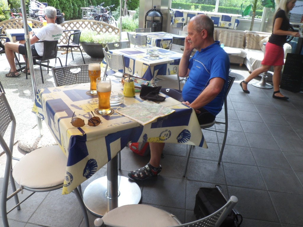
The three course dinner is delicious, though the servings are rather
small (for a cyclist's stomach), however, you can
compose your own (big) salad from the salad bar. Later, in bed, I can
only think of and fear the Passo Mortirolo of tomorrow.
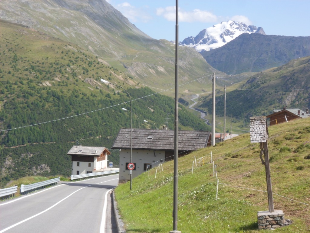
19-07-2012 BORMIO → BORMIO, distance 119 km, dķnivelķe 3300 m
Breakfast is super too (starting 'late', i.e. at eight, that's the only -
small – drawback here).
Almost all the guests are cyclists, most of them Dutch, some already in
cycling attire.
It seems a good idea to take in a lot of 'fuel'. The first hour is
mostly downhill, though I've been informed by the owner of the hotel,
also cyclist and
guide, there's a short climb around San Bartolomeo, a detour that's
possibly still a consequence of the collapsed mountain in (about) 1987. A
new road has been under
construction for a long time, and the alternative for cyclists has some
dubious (very small and steep) sections. What's nice: it's very quiet.
It does take
more time to cover the 30 km to Mazzo than expected. When I finally
cross the river Adda to enter Mazzo I can still see nothing of any
steep road going up to the Mortirolo.
Cycling alternative
|
Mazzo (with no sign of the steep road up)
|
In Mazzo it's not easy
to find a place for a cappuccino (at least the third of the day) and
find courage for the biggest feat of this tour. Several scenarios are
possible;
walking is not an option: then I'll retrace my track. One or two short
breaks are okay; I'm not sure whether I'll manage 11% for such a long
time.
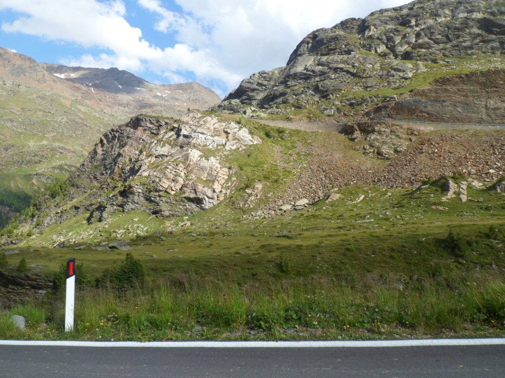
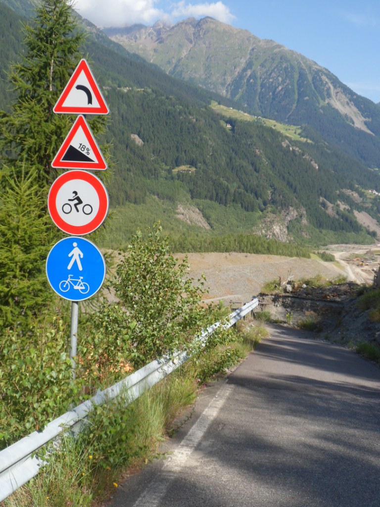
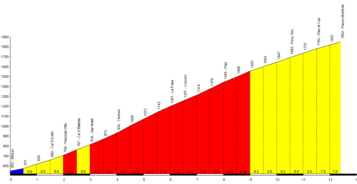
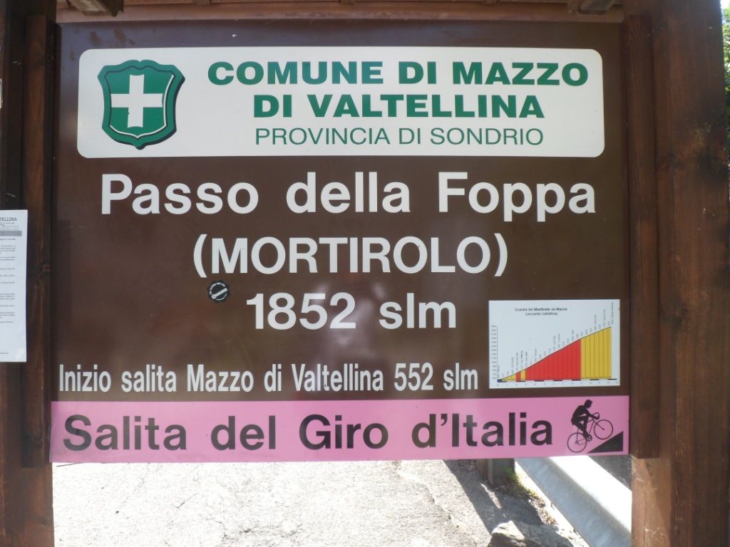
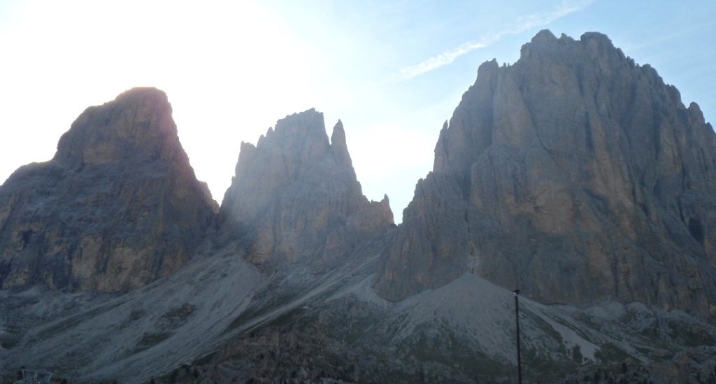
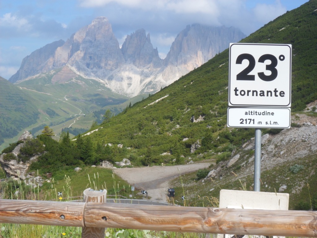
At the start of the climb – tornante 34 (or 35) – a board shows the profile of
the Passo Mortirolo: a middle section of 5 km at a rate of more than 12%. Sounds like hell!
|
|
I switch to lowest gears – before
I left from Holland I didn't even look how low they were, but I've seen even light bikes with much lower gears
(the Shimano set of my old Koga can only handle
3x6 gears). The first two km are quite okay, and the temperature is not too bad either.
From then on it gets hard, hard, hard. After every hairpin bend I
turn my head and have to look really up. For a long, long while it never falls below 10%, and there are stretches
well over 15%. In the turns the altitude is given, but I don't need to know how far/high I am all the time;
I do also ignore my speedometer.
I just focus on continuing, continuing, and when every now and then I do
take notice I'm never disappointed.
I cover 1 km, 2 km, 3 km, it seems that I'm going to make it. I get a
real boost when I pass a Belgian guy walking, (racing) bike at hand
('Tell them to wait for
Philippe', he asks me). 4 km, 5 km, I make it till hairpin bend 17 (the
counting is downwards) and still continue going.
I have no energy left, nor speed
enough to make pictures while cycling, but hey, who cares (and the
views are not that spectacular anyway, most of the time I'm in the
woods). After the
T-crossing where the road meets the (easier!) alternative from the
north, it gets a little easier, and feelings of a great satisfaction
overtake my tiredness.
I'm passed several times by couples that – I learn later – are in a
five-days' duo competition.
From tornante 9 it seems that tornante 8 never comes, but is does, and the other tornanti luckily follow each other much quicker.
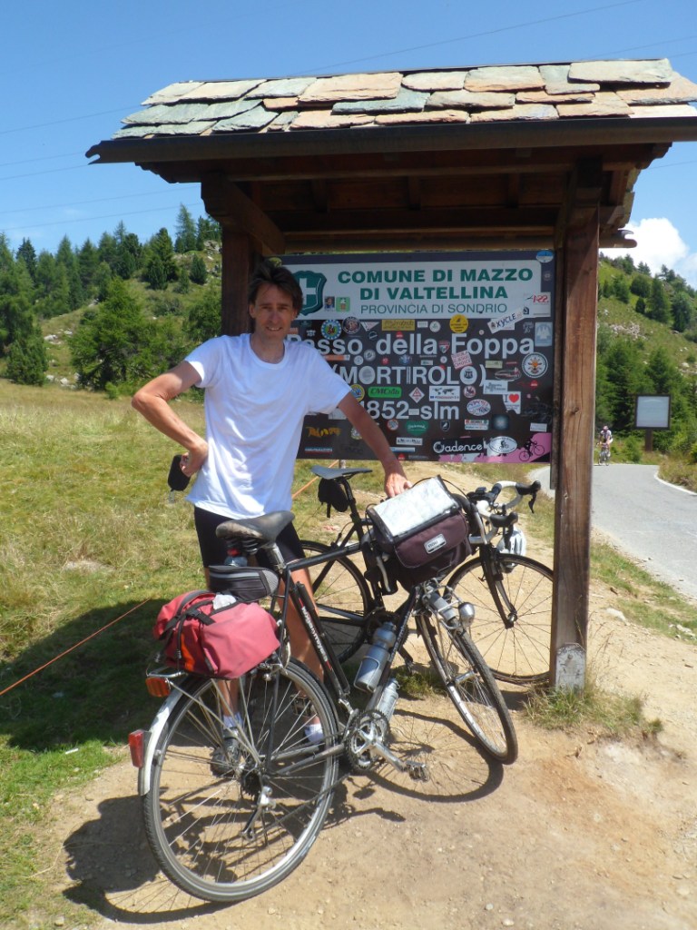
At the top I do make some pictures, a.o. of the official name "Passo di Foppa" and have a
few chats, mostly with compatriots and Belgians (to whom I can announce that Philippe is coming).
The start
|
The biggest accomplishment
|
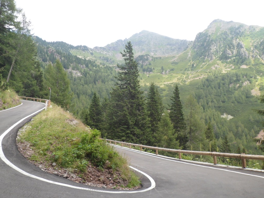
After this, I can 'easily' handle anything that's still on my program – the hardest part of which coming sooner than I expect.
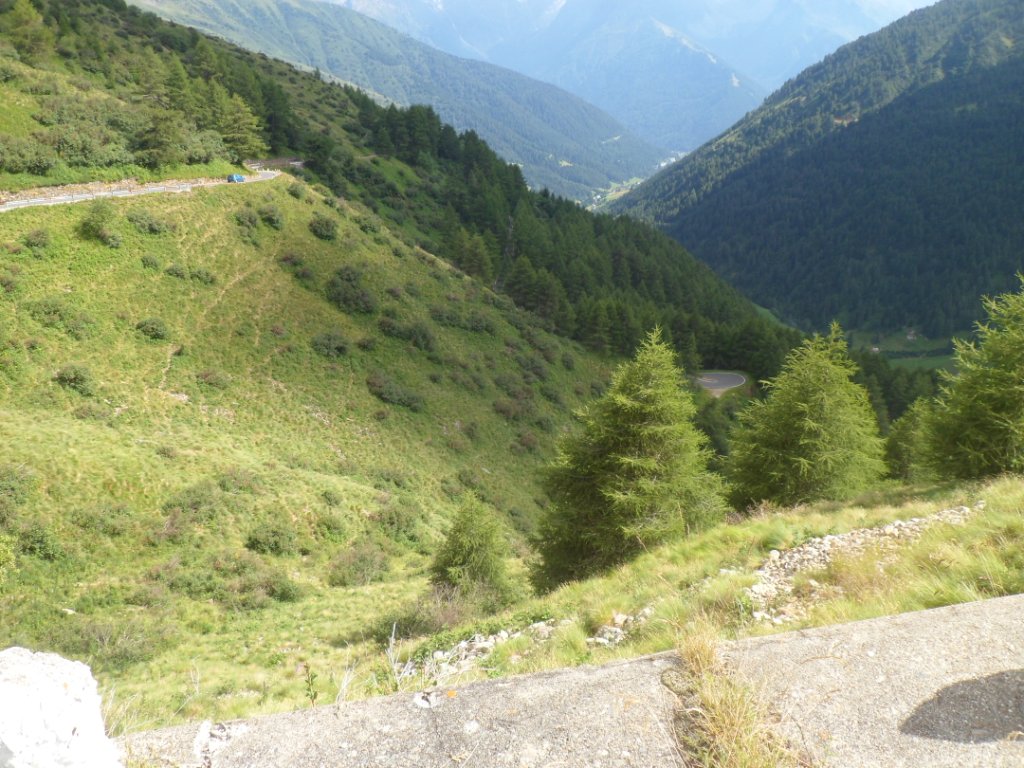
The descent is no fun: it's narrow, steep, and goes down further than I had hoped, and also further to the west.
The SS42 that I have to follow till Ponte di Legno is boring. And time is not on my side either.
The road is slightly uphill and is wearing me out.
In Vezza d'Oglio I have an Apfelstrudl lunch. A little before Ponte de Legno a road to the left is going up steeply. I don't want to 'risk' it, afraid I
may have to descend before the real climb to the Passo di Gavia begins.
Descent from Mortirolo
|
Ascent to Passo di Gavia
|
Three more pictures ...
|
... of the ascent ...
|
... to the Passo di Gavia
|
Bad decision! the second turn (also up) brings me nowhere, and when from
then I follow the
signs for the Gavia, I pass all around Ponte di Legno, and it seems I'm
almost halfway to the Passo di Tonale when I
finally leave the SS42 (for a descent
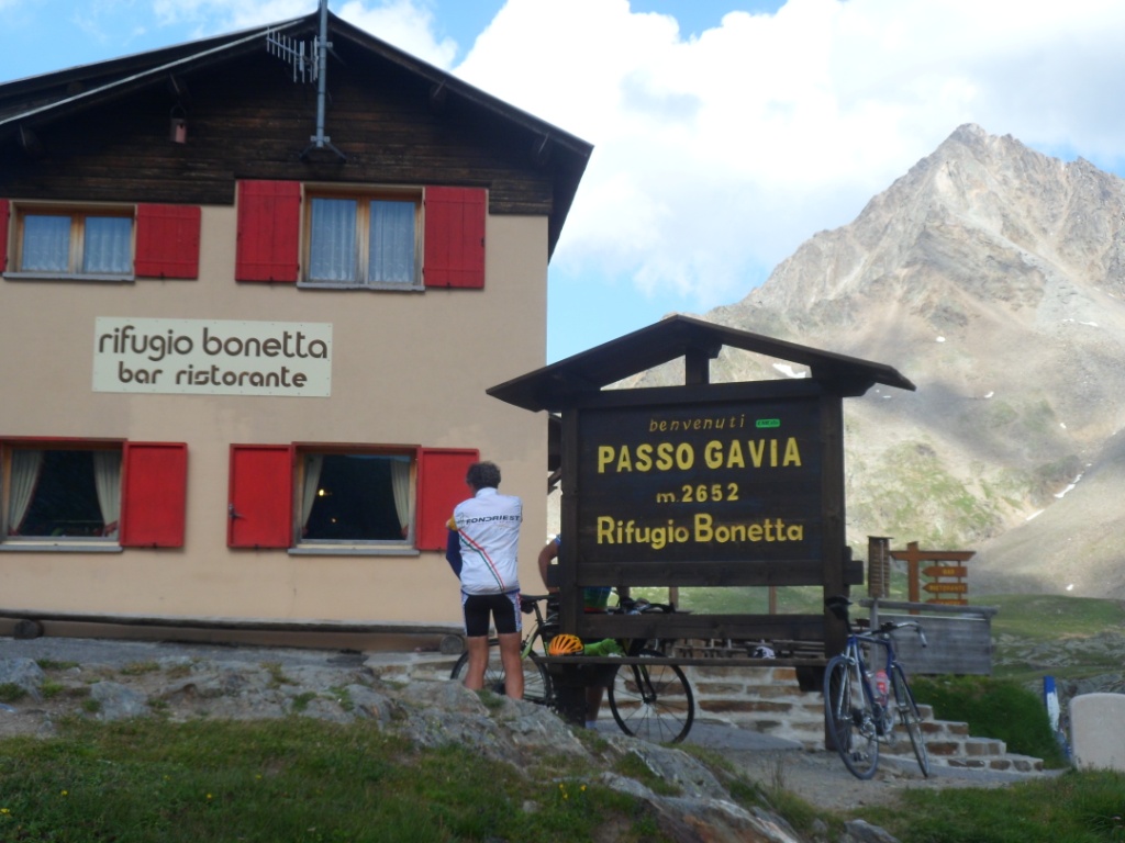
of 2 km. Hell!) I fill my water bottle and struggle onward – well, it's
okay, at times quite steep, but
mostly exhaustingly long. With the end in view I do need a break,
in a barren landscape. It's certainly a pass with a long history in the
Giro d'Italia; my history is restricted to one visit from the north in
'88.
Because of the short break shortly before, I don't need another stop at
the top, though it has been hard indeed.
Also it's around 5:30 p.m., and Bormio is 28 km away. What a beautiful
landscape I rediscover on that other side!
In the beginning I make a few photo stops and further down enjoy the speed and the views.
On the almost straight road from Santa Caterina against a mild wind I keep a good speed
and hardly need to brake. (The tandem couple later tell me they reached 70 km/h there!)
Dinner is delicious again, this time I share a table with a Canadian family,
father with two sons (18, 20 years) cyclists too,
and (the boys) behaving very like adolescents with regard to their father (especially when he starts talking
about (American) politics). In the late(r) evening I enjoy a soft sofa and the buzz around me.
I learn that the weather report for Saturday – the day after tomorrow – is rain the whole day.
And yes, the Funivia Hotel is a very nice place to stay!
Very scenic descent from Passo di Gavia
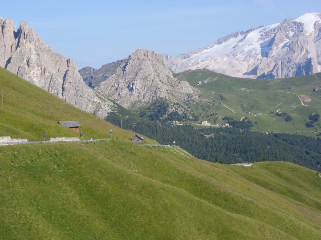
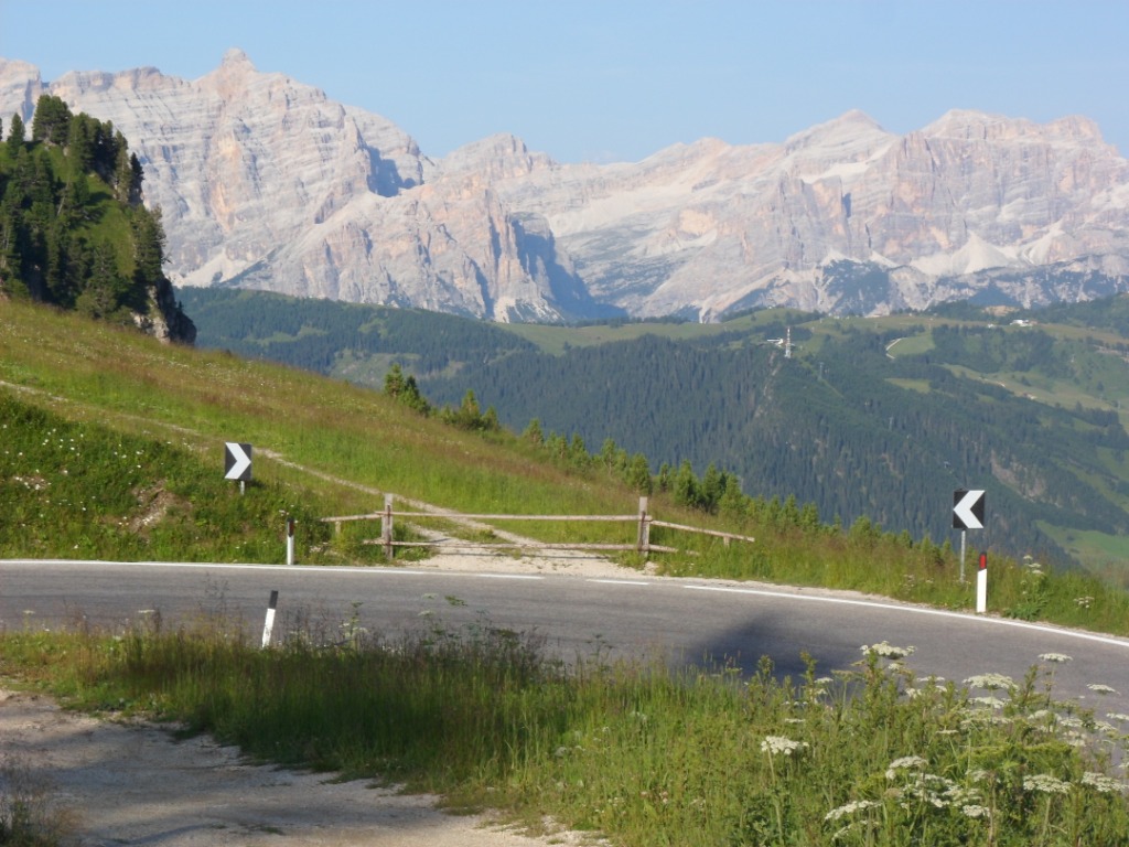
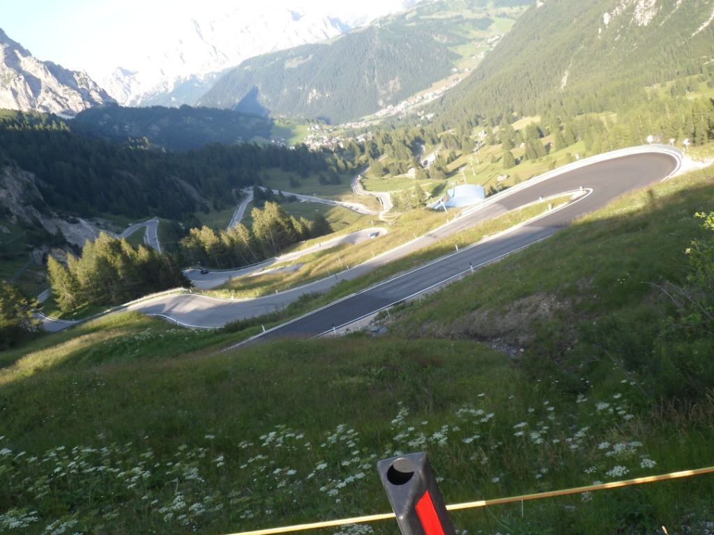
20-07-2012 BORMIO → BOLZANO, distance 131 km, dķnivelķe 1500 m
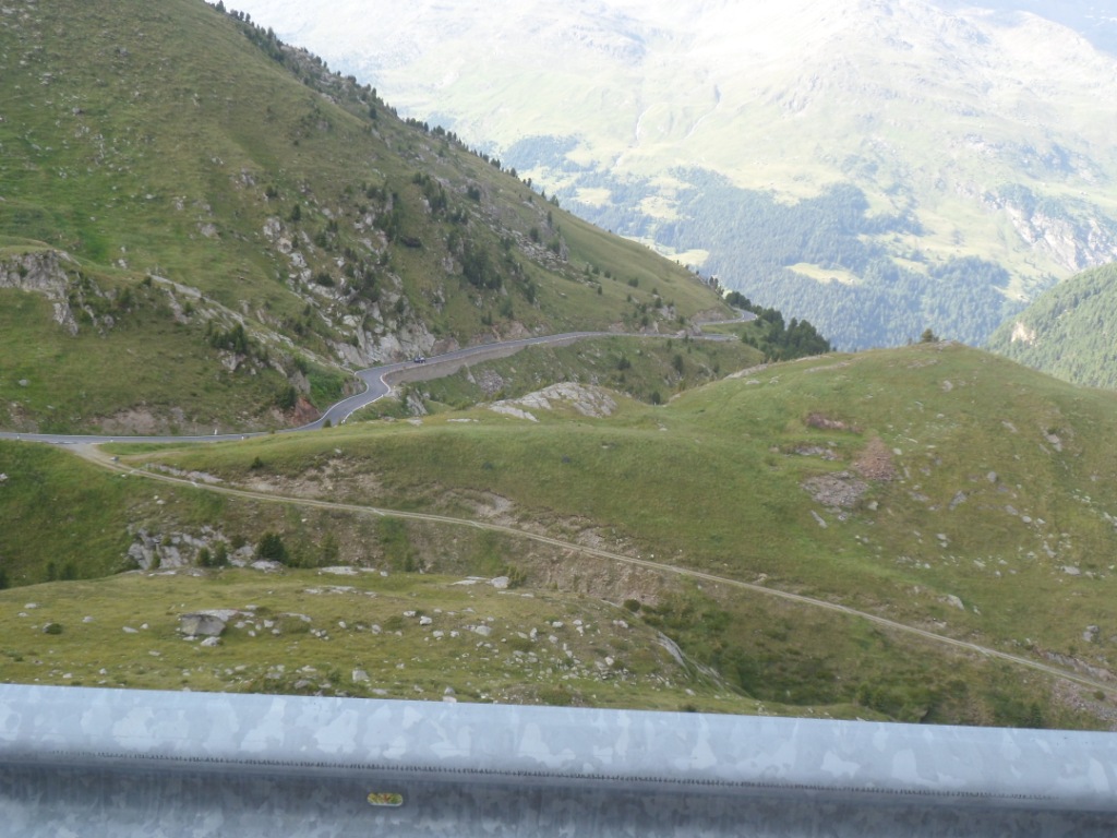
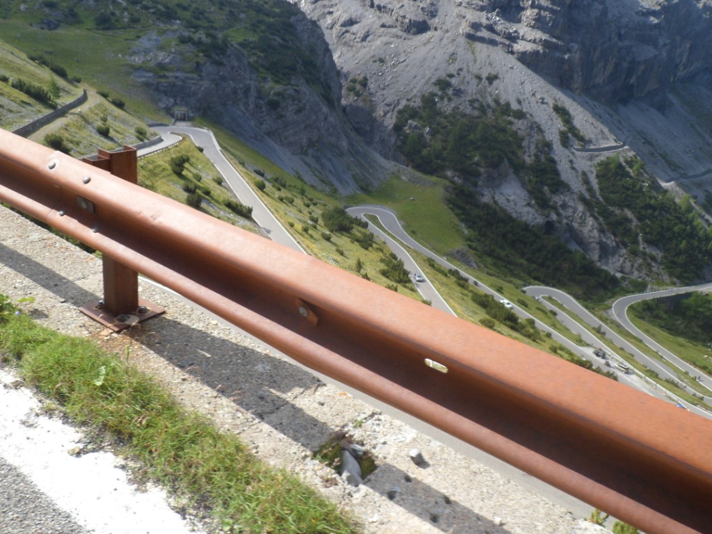
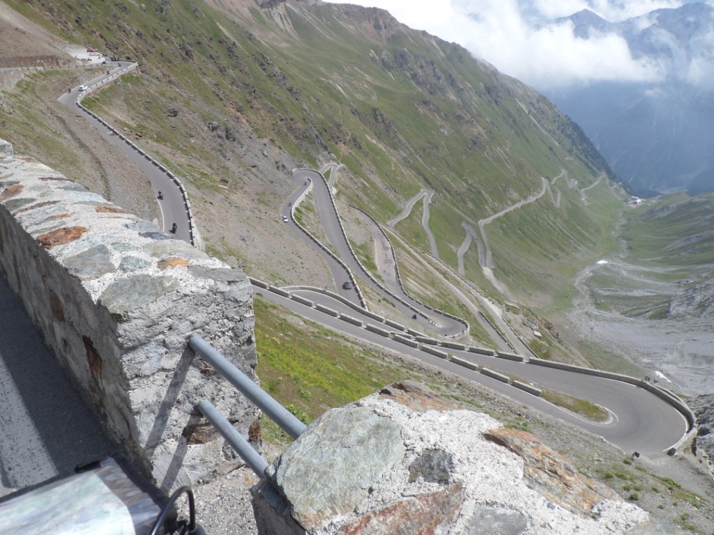
Even though today I will pass the Stelvio Pass
for the first time in my life with luggage,
I consider this day as a day of rest; from the start 22 km up and then
100 km down,
most of the time. I introduce myself to four compatriots – cyclists too
of course – who are a bit restless as they will return home today.
Lucky me, five days of the Dolomites still coming! Well stuffed up I
leave around 8:45 a.m.
It's a bit cloudy, but already T-shirt weather, definitely with
2.5 hours of climbing in store. Nice views back into/onto the valley
coming from the Passo Foscagno. The Stelvio is quite a regular climb
from Bormio, 6-9%
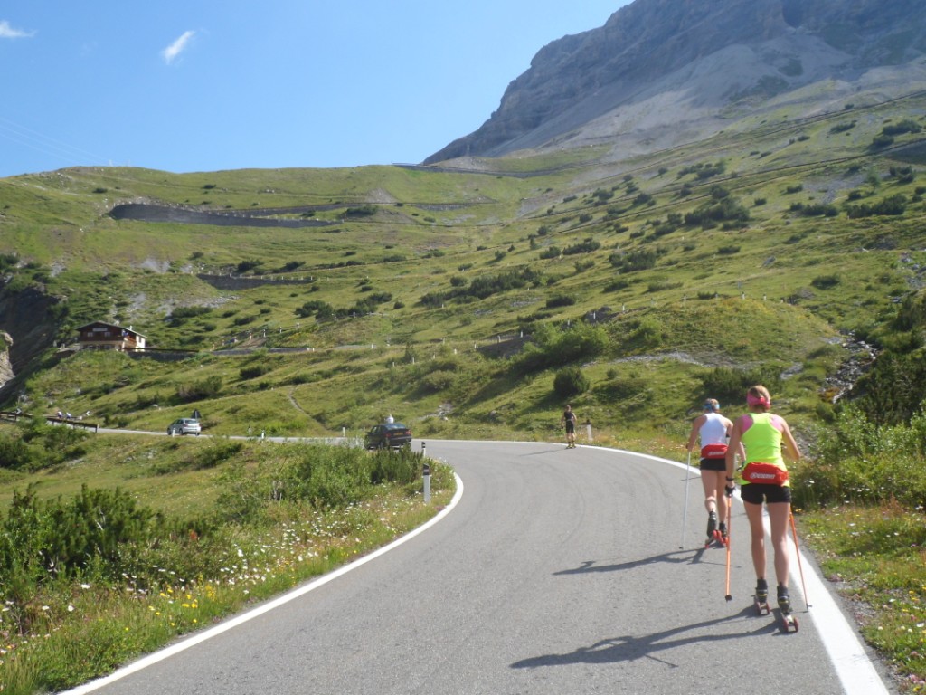
all the time, I would guess. I expect I'll need a break around km 14,
but right then I'm cycling up with a couple of roller-skiers (four or
five nice
butts ☺), and also this is a phase where the road nicely zigzags
against the slope (so I can see how much altitude
I win). I make many pictures (not of these butts, well, hardly any) and
shortly after this
'staircase' can see my destination high up (at about the point where in
1988 I had to turn around owing to irreparable trouble with my gears).
The last
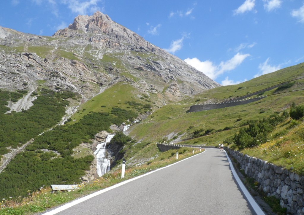
three kms, from the Umbrail Pass are hard work for me. It looks like
they changed the road between 2008 and this summer.
At 11:20 I reach the pass (the highest after
the Isķran) where I meet the usual crowd. I ignore the Bratwurst and
restrict myself to some chocolate and a coke.
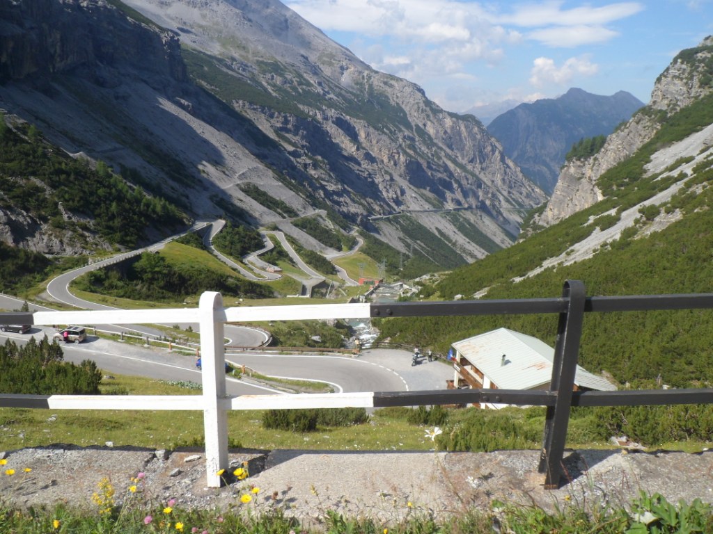
The climb to the Stelvio in 10 pictures
Around the top
I'm not too keen on the descent -
the 'operation brakes' in hotel Funivia has not had the effect I'd
wished for. So I take it easy, especially during
the first twenty hairpin bends,
also not minding several photo stops, the last one in front of the
Ortler glacier. From there I let the wheels
roll a bit more freely.
The last days during long descents my shoulders hurt a bit, but the
second part of this descent is quite relaxed –
not much braking, I can sit upright a lot of the time – and so I'm okay,
keeping a good speed
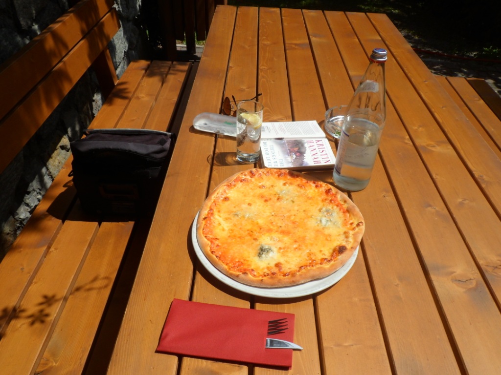
until Prato. Even so, the supermarket there is closed, so I have a warm
(in two ways) lunch, with pizza, an ice coupe
and a litre of sparkling water, on a
sunny terrace.
|
|
|
|
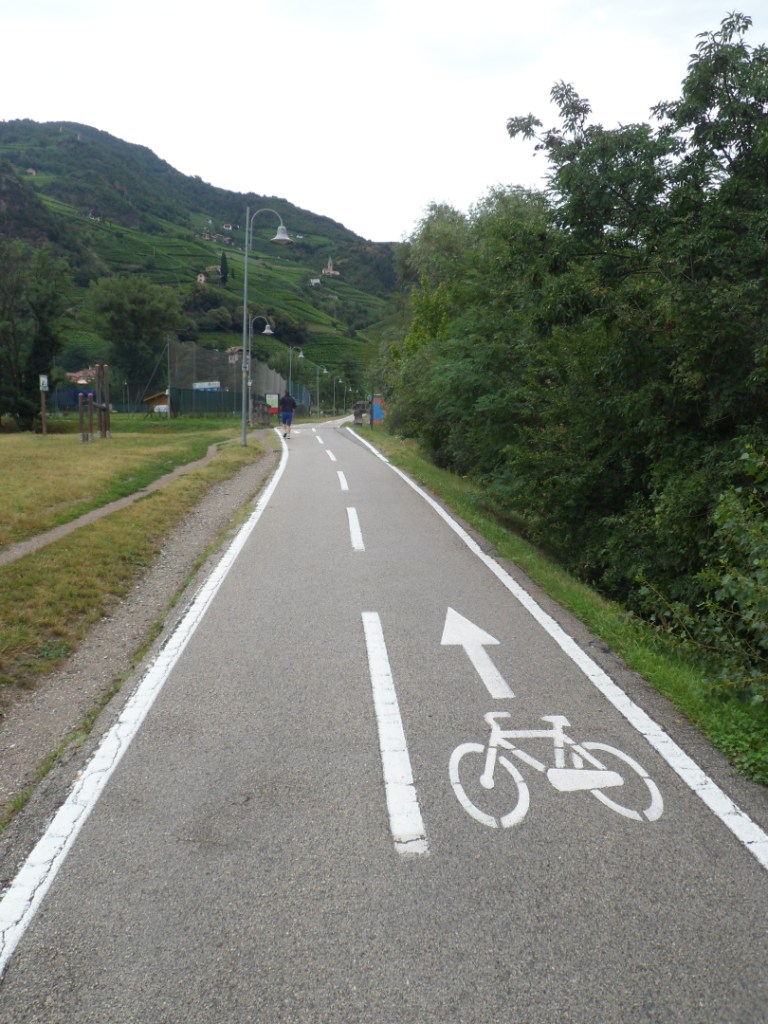
From Prato I will follow the bike route through the
valley of the Adige till Merano, still some 600 m down in 48 km. I am
unpleasantly
surprised to meet with a strong head wind. All the time! Well, one can't
be lucky with the wind always, can one?
I get a few showers of water from the
amply adjusted irrigation system for the apple orchards. Fortunately
halfway I'm overtaken by a biker whom I can catch up with, and with whom
I chatter
along till Merano (with three nice steep kms at the end). We have a beer
in Merano – the nice man is called Peter
and lives in Bamberg, where, he tells me,
there are quite a few good breweries (and he wants to pay for my beer) -
I hope he will someday read this blog and
contact me!
Warm lunch
|
Cycle path along the Adige
|
Having a beer with Peter |
Peter is going to meet his
wife in Lana, so shortly south of Merano we say goodbye. It looks like
we've missed some rain while taking our beers; the road is wet.
No noteworthy rain catches me until I reach Bolzano – in fact, there it
is really summer again.
It takes a long ride through the city until I find the tourist
information.
They check the youth hostel for me, but that is fully booked, and give
me the name and address of one of the cheaper hotels that are close by.
Though this
hotel is rather sordid (though the same price as Bormio) I accept a room
for two nights. What a difference compared to the Funivia Hotel! I
don't feel
happy in the hotel, I don't feel happy in Bolzano, I don't want to have
dinner by myself. After a short walk through the town, where I'm not in
the mood
to sit down somewhere, I end up at a kebab tent, close to Hotel
Dolomiti. Where at least the food is good! I go to bed early and wonder
whether tomorrow things
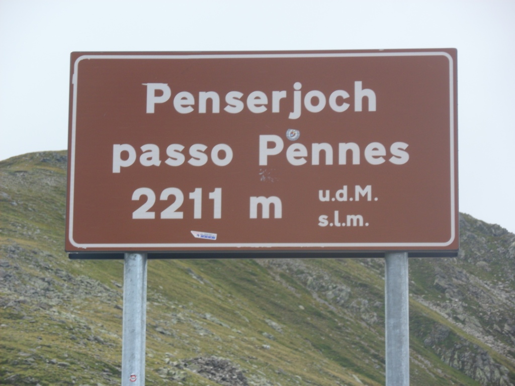
will work out better with the Passo di Pennes than in 1988.
day 1
day 2
day 3
day 4
day 5
day 6
day 7
day 8
day 9
day 10
day 11
day 12
day 14
day 15
day 16
day 17
start
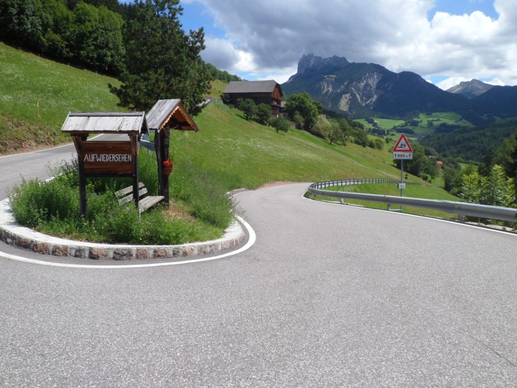
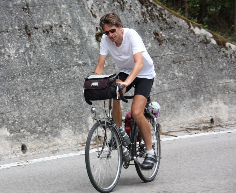
21-07-2012 BOLZANO → BOLZANO, distance 99 km, dķnivelķe 2000 m
What a poor place to have my birthday breakfast. On my own in a very
small dining room, small windows, no fresh things, no coffee
(well, half an hour later I learn from some other, Italian, guests how
the coffee machine works) – the contrast with Bormio couldn't be larger.
When I step out the front door I see a wet street and people with
umbrellas. Well, we'll see what happens. The route to the north is
easily found.
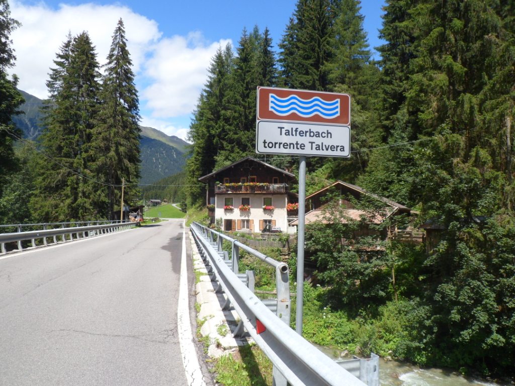
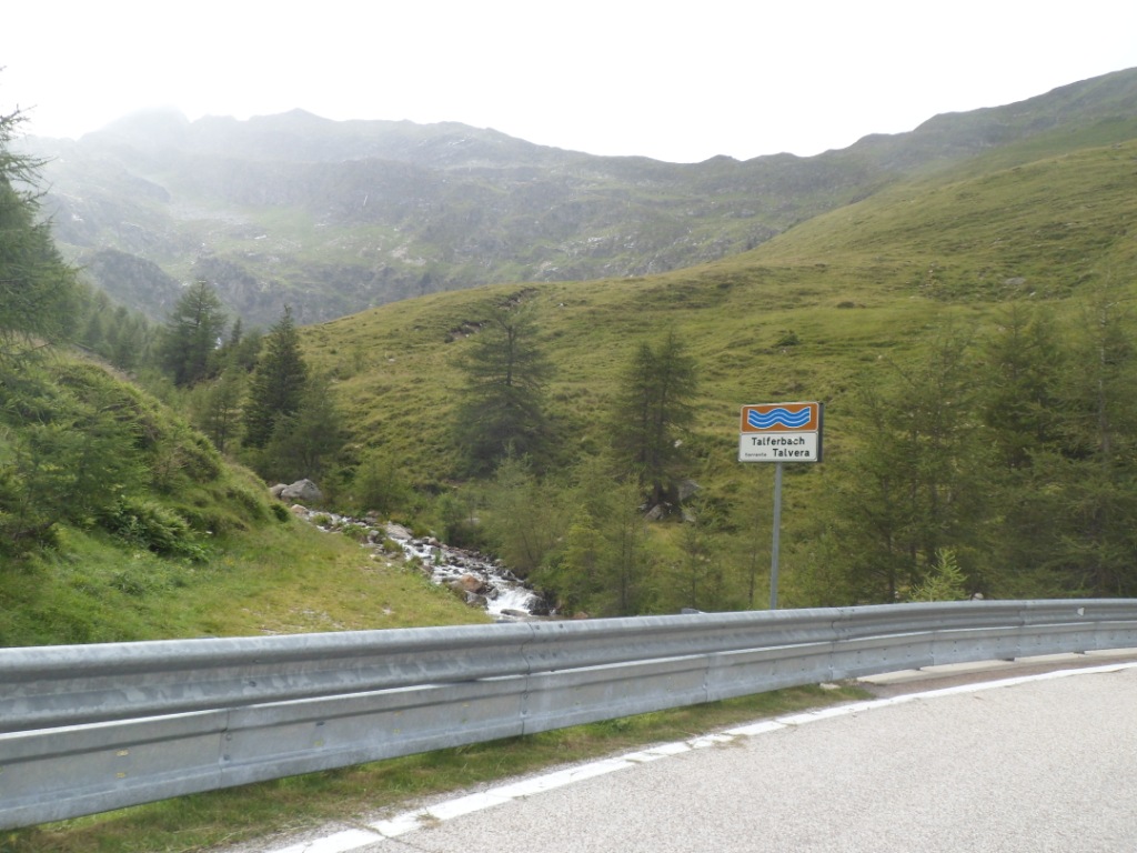
The first few kms it's a cycle path which almost passes by the backdoor
of the hotel, and follows the Torrente Tßlvera, a current I will follow
almost the whole climb (in fact, almost the whole day). In the
beginning there is a lot of agriculture (mostly viniculture) against the
steep mountain
sides. Further on, the valley is deep and narrow; the road is led
through many tunnels, 21 in all (one of which is forbidden for
cyclists).
Between tunnels 8 and 9 I try to call my Dad, whose birthday it is too,
but I only get my mum twice for ten seconds before the connection fails.
Because of the tunnels I don't perceive the rain so well, which changes
for the worse after the twenty-first. I still prefer to ride in T-shirt,
but against
the wind and the rain I get colder and colder. I had hoped to have
coffee at least 10 km further, but I'm glad when finally Sarentinos come
into view.
I wring out my
T-shirt and put on my track jacket, the only dry garment I have put in
my (small) pannier today.
The story of the Passo di Pennes; before the break
|
|
|
|
|
|
At first it feels warm in the Stube where I cause a wet bench and
a
pool of water on the floor, and a hot chocolate helps as well, but after
a while I feel chilly again. I text to my girlfriend Eveline that I
fear I will
again not reach the Passo di Pennes. In 1992 I wanted to make the same
tour, from Merano, in the opposite direction, but got stuck after 30 km
in St Leonard
im Passeier, where I spent six hours in a pizzeria, reading "Die
Klavierlehrerin", before I returned, demoralized,
and still in the rain, to Merano.
Across the street there is a women's clothes' shop, where I find one
T-shirt that reasonably fits. After two or three hours I have finished
my book (from
Fiesch), pay my bill and leave the restaurant for some 20 km downhill.
To my surprise (and joy) the sky has cleared a LOT. The Passo di Monte
Giovo
(also known as Jaufenpass) is out of the question, but let me see how
far I can get to the Passo di Pennes
(a.k.a. Penser Joch). Under a
blue sky adorned with white clouds the Austria-like valley is really
nice, and for a long while the grades are easy, in fact until the
village Pens.
And that's where the 'fun' starts. Shortly after Pens I read a sign
'1500m s.l.m.', and from then on it's harder work, 8% on average, with a
fierce wind
from the north. The clouds gain more and more area, and 7 km before the
pass it starts to rain. Okay, but now I will
'win'! I change into my wet T-shirt,
which after five minutes doesn't feel worse than when drenched in sweat.
The rain is not so terrible, and it's by far not the Mortirolo, so I
make it to the top.
The story of the Passo di Pennes; after the break
Where it's cold and windy, and where to my
surprise there is a restaurant where, moreover, they serve Kaiserschmarrn!
I let that be my treat – with a beer – for my birthday. For half an hour I don't think about the long (cold?) descent.
Well, it's not that cold; no more rain.
On the Passo di Pennes; and down again
|
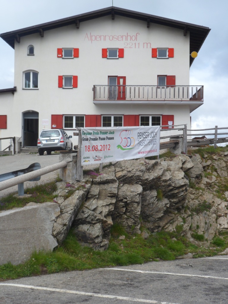
Pension Alpenrosenhof
|
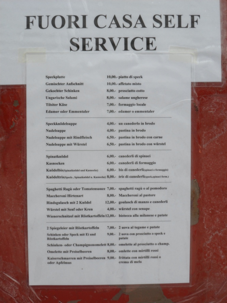
Kaiserschmarrn!
|
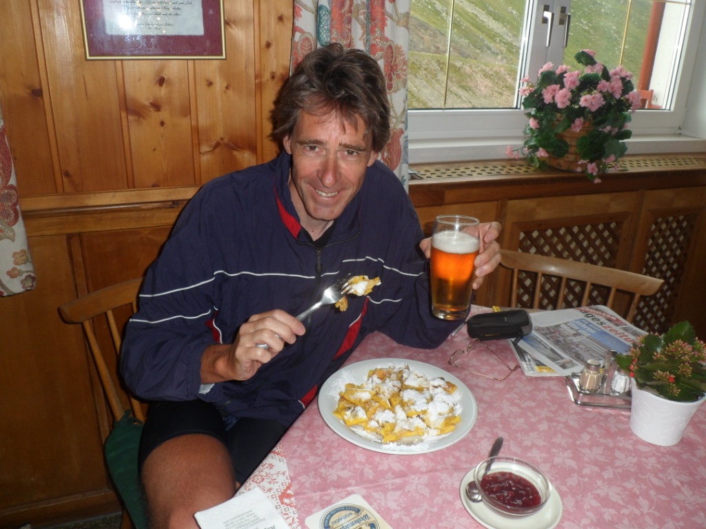
Kaiserschmarrn (und Bier) |
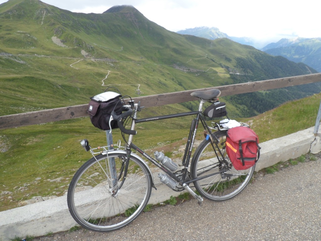
The other side |
1 km down
|
2 km down
|
Back along the Talferbach
|
Not much rain anymore |
The first part, with tail wind, is good for high speeds (at one moment I
observe 71.5 km/h), and in the absence of rain it's actually quite
nice.
At 4:20 I reached the top; between this glorious moment and the return
to the hotel, the Kaiserschmarrn and the
descent use up two hours and ten minutes.
I have dinner (pizza + ice-cream) on the terrace of Hotel
Dolomiti; the owner of the hotel may not be the friendliest person in Italy, he is a good cook!
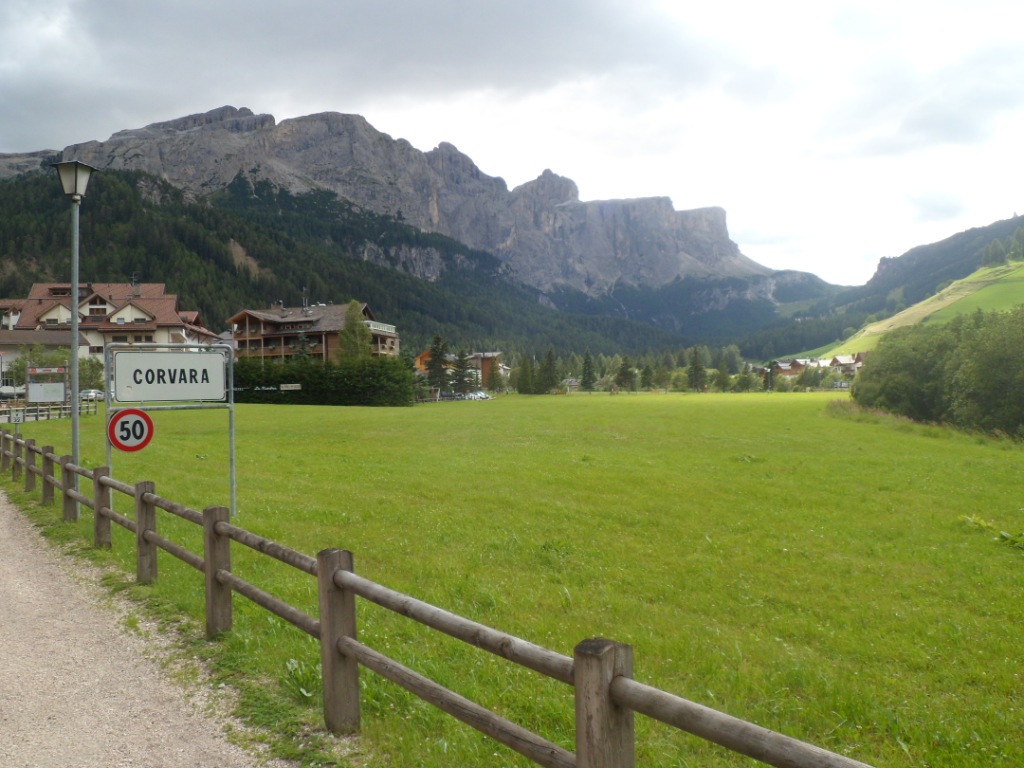
22-07-2012 BOLZANO → CORVARA, distance 95 km, dķnivelķe 2000 m
This morning breakfast is even more morose, since I am alone most of the
time. Luckily the weather has changed for the better. I quickly find
the right exit from
Bolzano. There are several options to follow the river Isarco. First I
choose the 'main road' (there is also a motorway), then I decide that
today
I have time enough to try the cycle track, so I retrace the first 500
meters. A very wise decision! Beside the Isarco river, the Valle Isarco
is traversed
by three main traffic lines, that are the motorway, the state road and
the railway line.
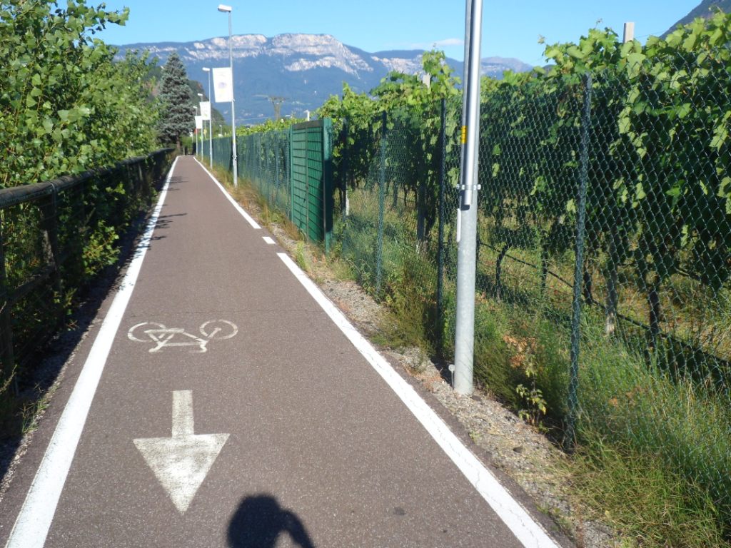
And a bicycle path, which stretches on the former railway track.
It's fun! Beautiful, quiet – apart from the many (Sunday) cyclists -
easy going (trains never go that steep) and it also offers shelter
against the wind
(a nordliche F÷hn again). At first I am just waiting till the
path will come to an abrupt end, but a 'local' informs me it continues
till Bressanone, so it is about as long as the route through
the Adige Valley.
The story of the cycling alternative in the Isarco Valley
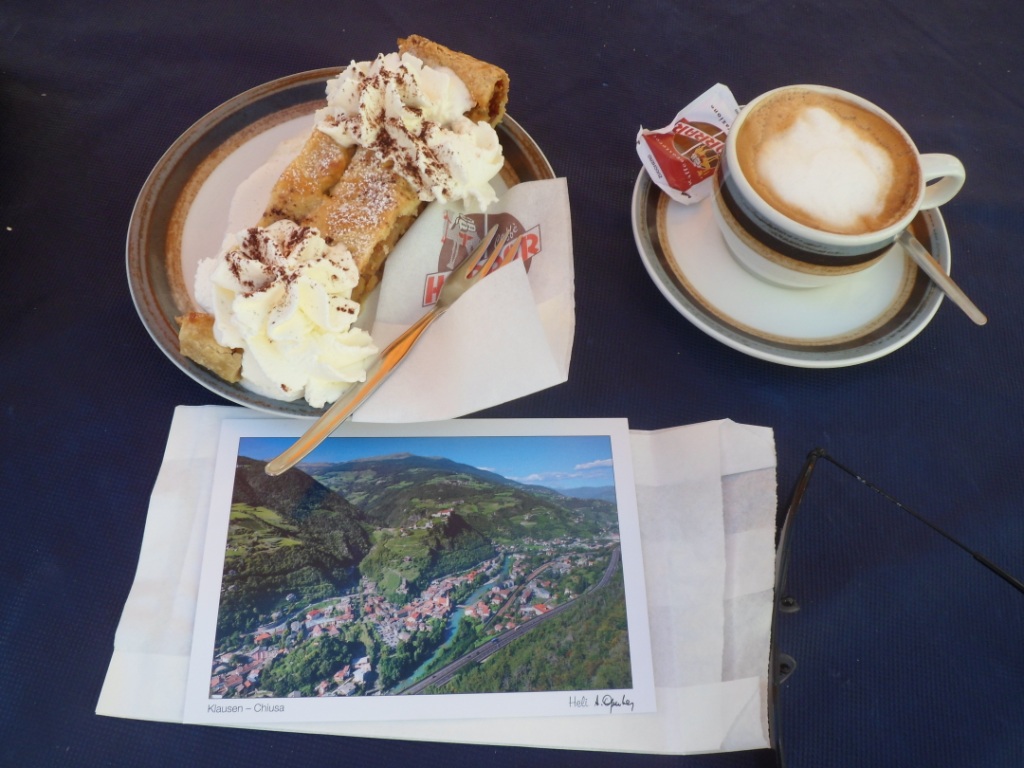
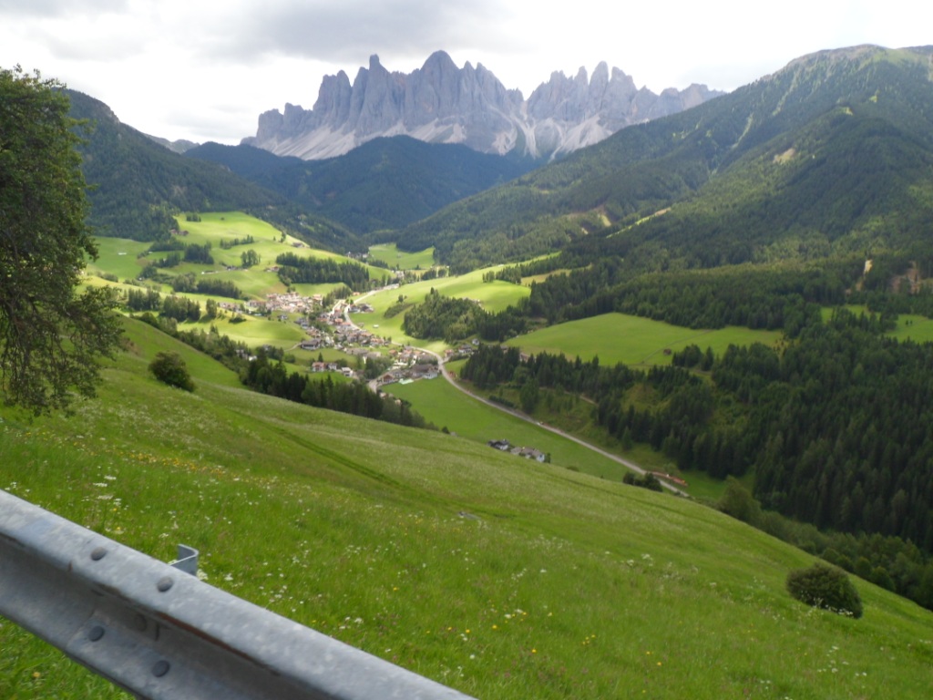
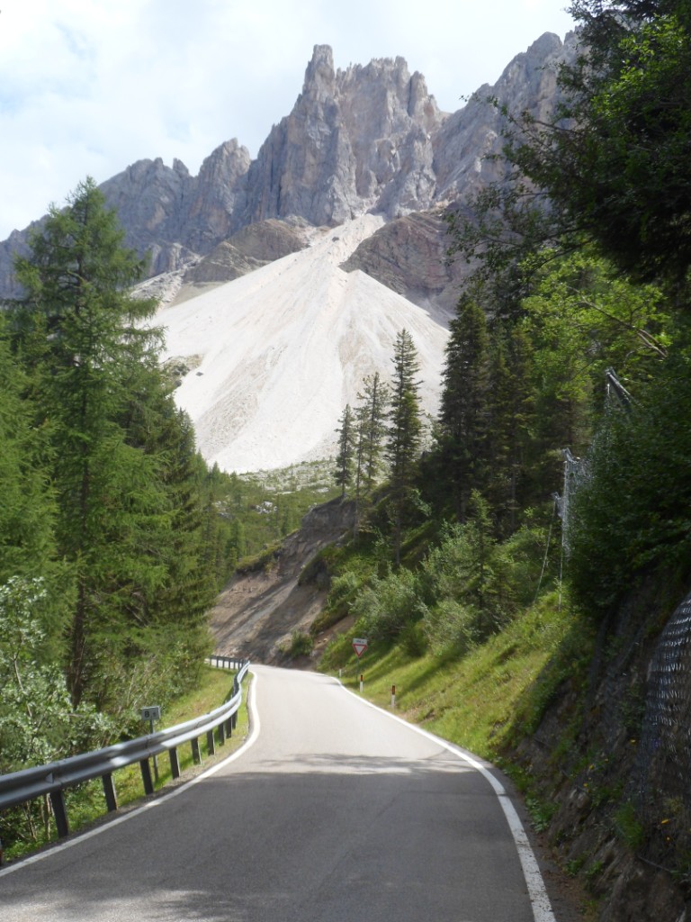
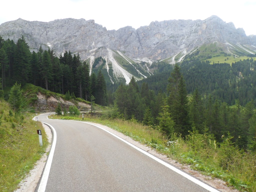
In Klausen I have a break with tasty pastry on a sunny plaza – it's so
nice that I forget the time ... Some 5 km further I miss the
turn to the
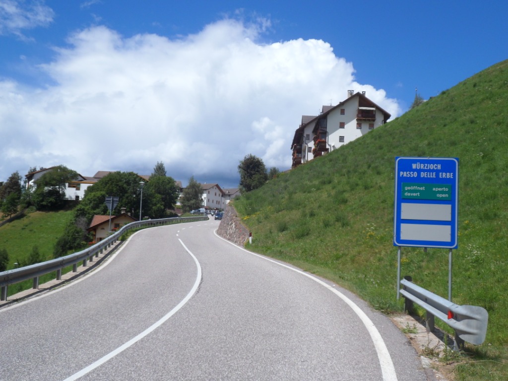
Passo delle Erbe, my doubts turn into certainty
at least a km too late. Today's 'main course' (in fact the only
‘course' on the menu) is quite a long/big/nice one.
Nice with respect to the scenery I ride through, and with respect to the
relative calmness of the road. I easily (and slowly) climb the first
600m and have a short break
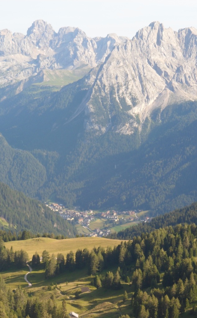
in San Pietro, from where I can see the first typical Dolomite peaks.
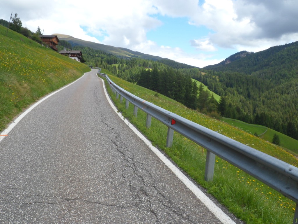
After San Pietro it's quite hard work for a while – the indication of a
steep section on the
map should be placed here, I guess – but I manage. It's a tiny road,
through alpine meadows interspersed with woods, and rocky mountains high
up. I get to the
junction with the direct road from Bressanone and am positively
surprised that the altitude is already 1750m! The next
5 km are very easy, there's even a descent (not
that I very much appreciate that: what goes down must go up), and after a
3 km of 7% it's 'in the pocket'.
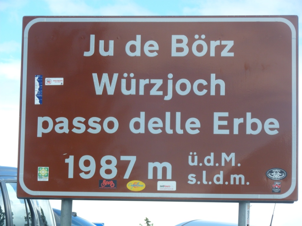
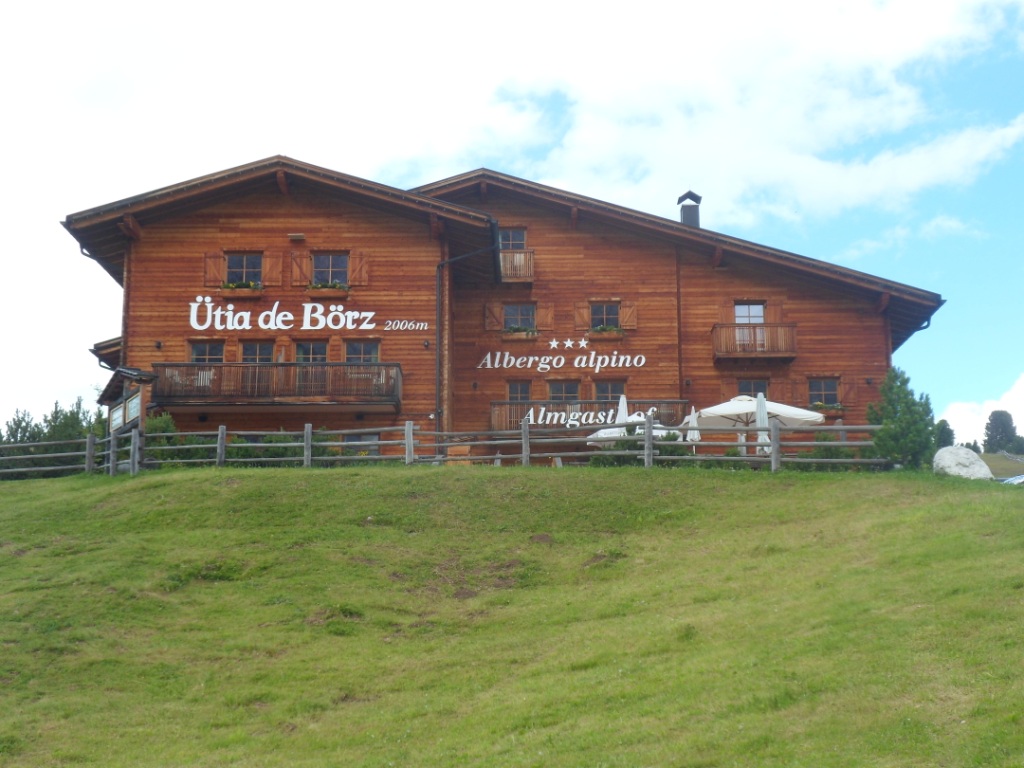
The story of the Passo delle Erbe
The col sign gives 'only' 1987m, so I turn left for
another 200 m (17m up ☺) to the W³rzjochhaus, to add another 'above
2000' to my list. It's crammed with cars, so I
take extra care at the beginning of the descent, a descent which is
interrupted by a 3 km climb for which I do need
to take of an extra layer of clothing! During the day I
have decided to deviate from my original plan to stay in Pedraces/Badia
(I don't know which is the official name),
but – with the long last stage in mind – continue till Corvara. The
S244 leading right into the
heart of the Dolomites is a very busy
road, as I could have foreseen. Also it goes up some 400m again from San
Martino. I pass several touristic towns – ample choice to find a place
to sleep, and find
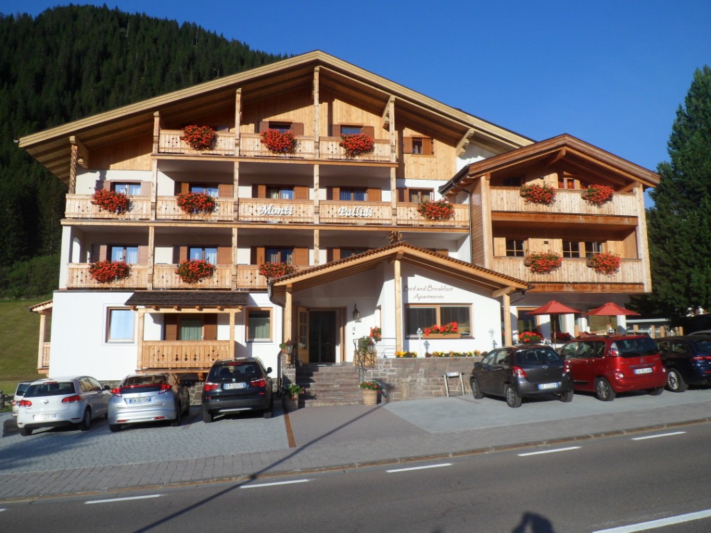
a very nice place to stay – 'bikers welcome' again – in Garni Monti
Pallidi.
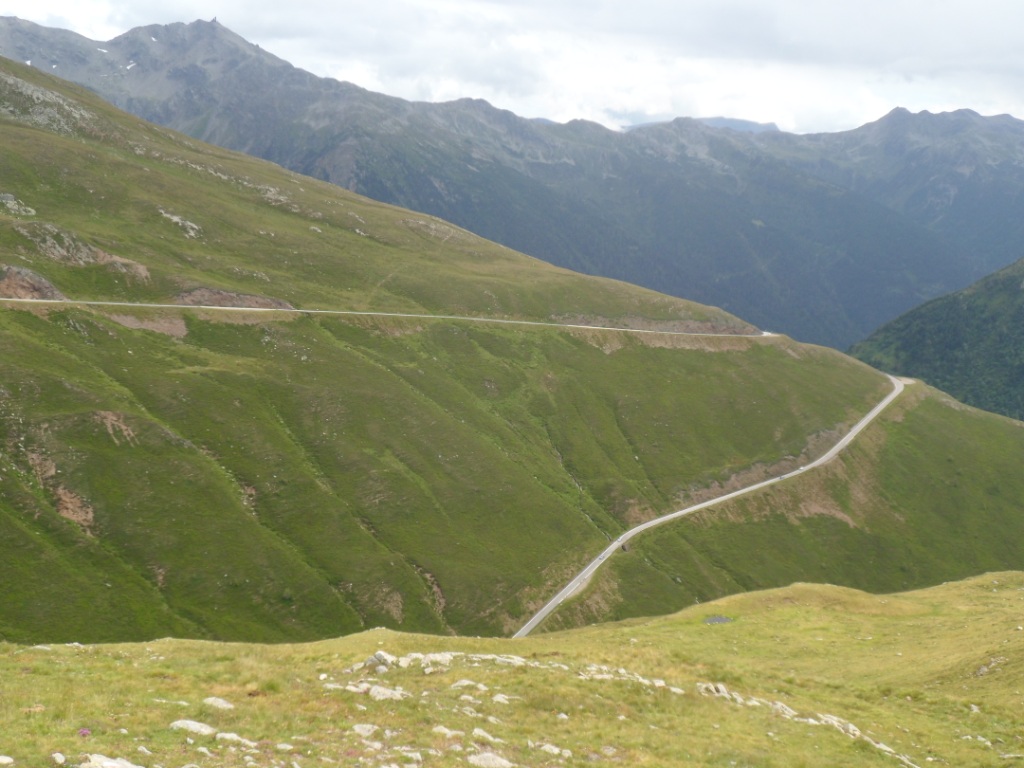
From the Passo di Erbe till Corvara
Into the heart of the Dolomites
|
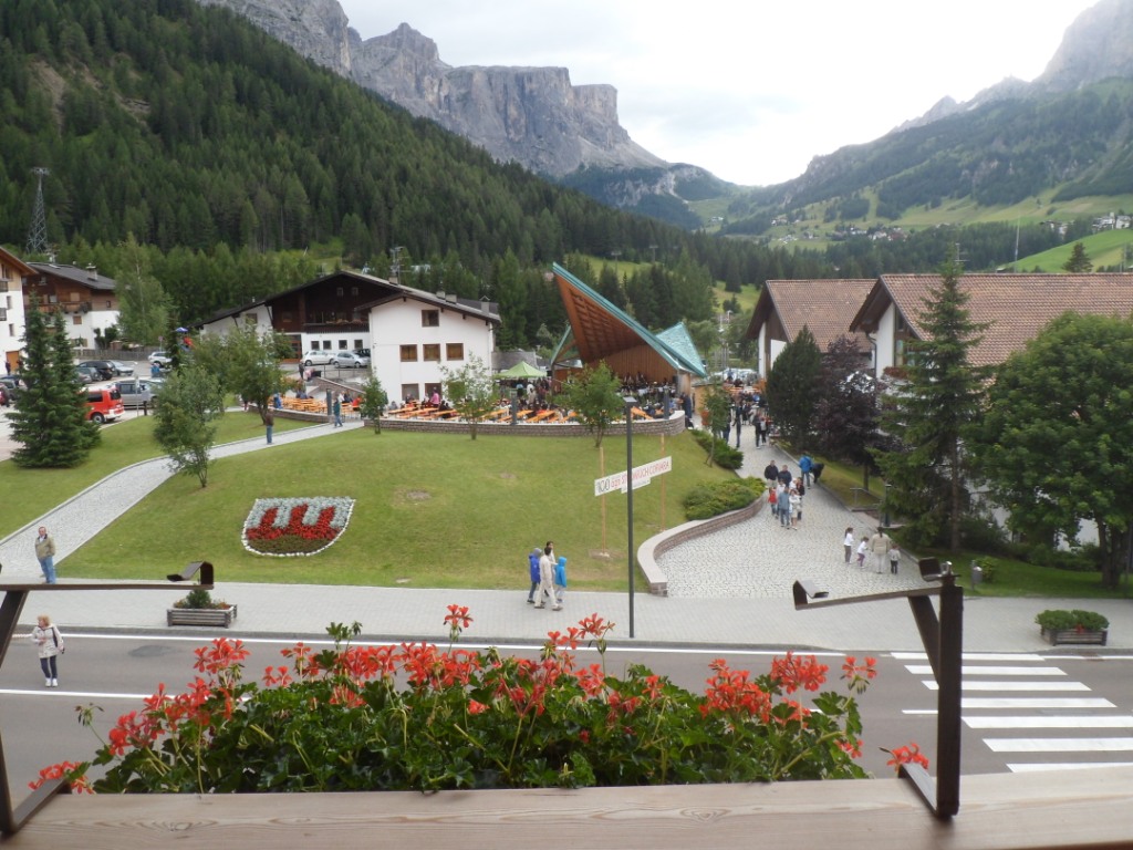
View from my room to the Gr÷dner Joch
|
A very friendly woman is a bit worried the bed might be too small for
me,
but it's okay. The room is very small, and a bit dark, but from my
balcony I have a perfect view to the Gr÷dner Joch in the west and the
rocky
mountain (the Sassongher?) in the north. I have a real gourmet five
course wild menu (for a reasonable price), and a chill walk back to my
'home'. I do some writing
in the lobby and have a chat with a German father and son, also touring
by bike (the boy is only fourteen years old, though he definitely looks
like he's sixteen
at least).
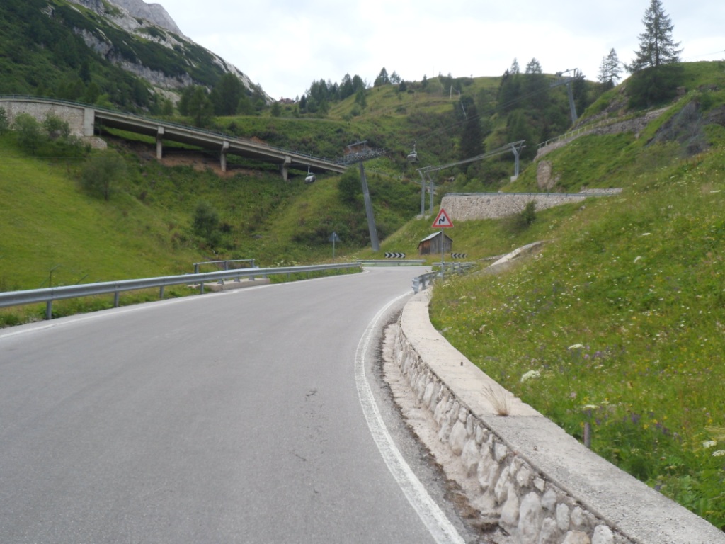
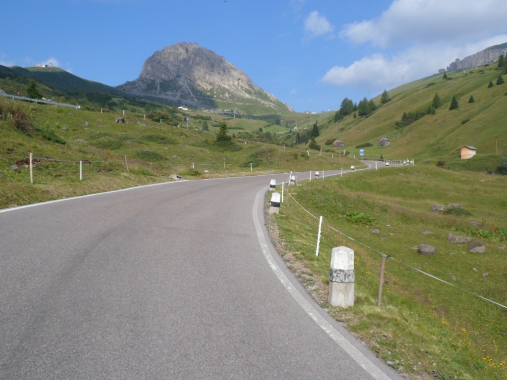
23-07-2012 CORVARA → CORVARA, distance 115 km, dķnivelķe 3700 m
With the condition at good as ever (since 2008) I can do 'anything I
want'. At home I had considered many possibilities, one including Plan
de Corones,
one including the "Drei Zinnen de Lavaredo", two 'Mortirolos'. Last
evening I decided to choose a more circular alternative with more
reasonable climbs,
and . . . with 'six' passages above 2000m (if one counts the Passo
Valparola and Passo di Falzarego as two). The breakfast buffet is not as
copious as in
Bormio, but I find everything I need: cereals, bread, fresh rolls, fruit
juice, coffee. It's six degrees centigrade when I pass the pharmacy on
the other side of
the road, which is a bit cold for the first kms downhill, but these are
only four or five, before I turn right
for the starter, the Passo Valparola, the
only new pass of today. It's a beautiful morning, the environment is gorgeous, the muscles are okay. Top!
| 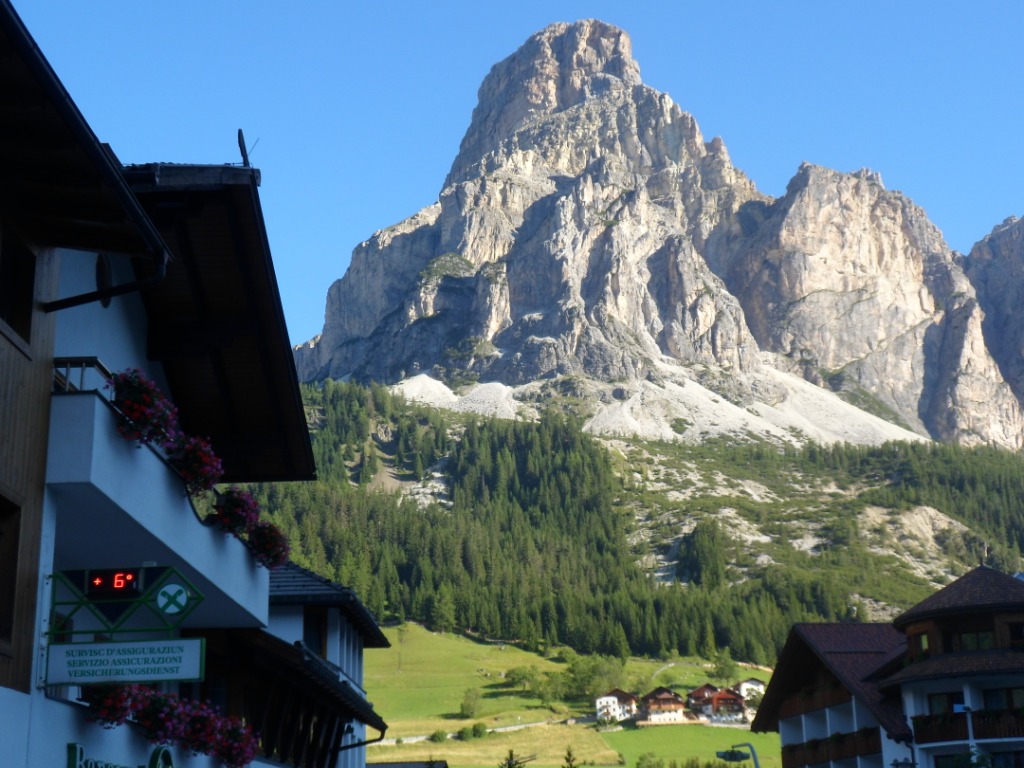
Cool morning! |
|
|
Starter of the day: Passo Valparola
|
And at the top I have enough energy to go on
directly for the second course. A quick descent, passing the Passo Falzarego
with a nice descent to the south (not my itinerary today), feeling/fearing my brakes getting worse,
even without luggage ... I get a glimpse of Cortina d'Ampezzo when I turn
right for the Passo di Giau. I remember the
great view up from the other side, and the beautiful evening colours on
the east side in 1992, and this year
I enjoy the nice scenery even more when I do it from the easier side. I
know I'm not a professional chamois on wheels, but I'm amazed about the
speed
with which I am overtaken by, I guess, an American couple; the girl is
even comfortably chatting along!
I again make several pictures while going up, especially around the
summit, with this very characteristic mountain on
the right.
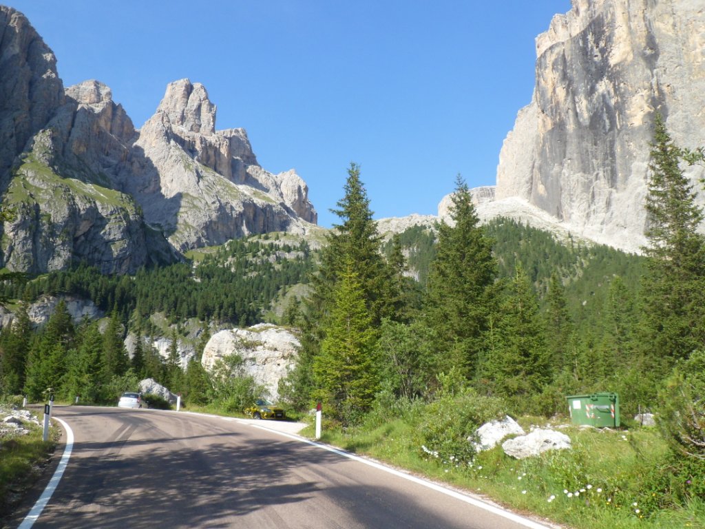
Descent from Valparola + second course: Passo di Giau
|
|
|
|
|
|
|
|
|
|
|
|
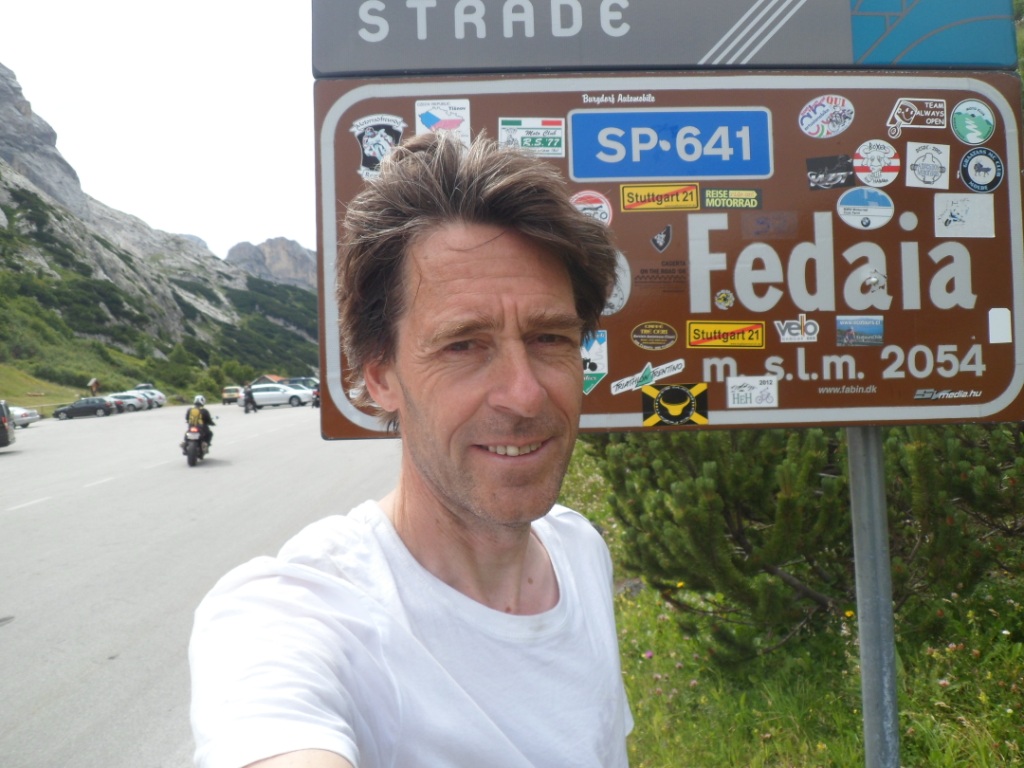
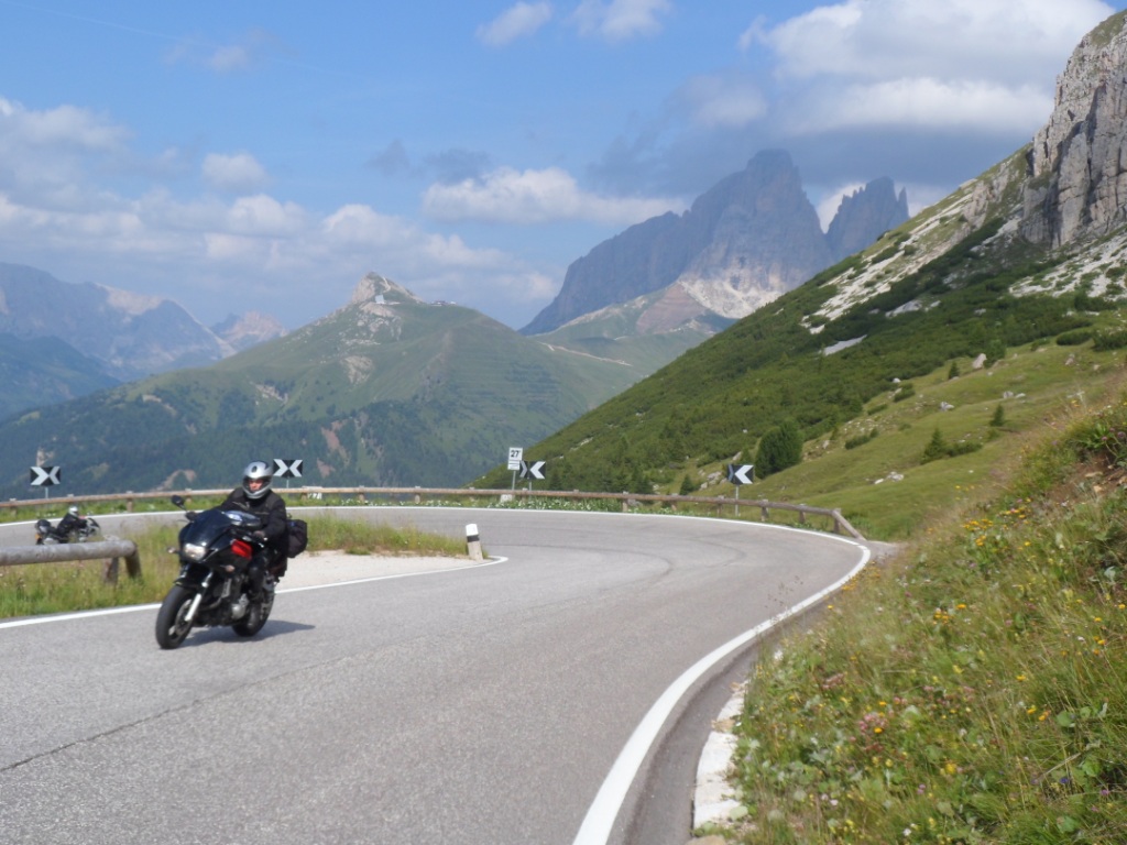
The pass, as well as the others today, is very popular under motorcyclists. At the Passo di Giau I don't need much time
before I dive down again. The valley to the west is quite narrow and straight; from very far I can look back/up
and still see the pass. Gorgeous descent; this side of the Giau I consider as one of the most beautiful of all. In Selva
I'm – not for the first time – the last customer in the Coop before lunch break. While riding around with my bag of
stuff, looking for a good place to sit, I spot a heavily loaded bike with, presumably, its owner. The owner has
already finished his lunch, but doesn't mind to keep me company for half an hour. He's from Vienna and has a lot of
cycling stories in store. He's wearing a T-shirt from the Dolomiten Marathon (harder stuff than the Marmotte!). Like
mine his next goal is the Passo di Fedaia, a
climb regarding to which at least two Italians I met along the way told
me: Phew! We
start off together, it's 3 km more downhill till Caprile, and ride up a
short while until it becomes clear that, with
the difference in weight we are carrying with us, today I'm definitely
faster than he is. So, after having exchanged names – his is
Reinhard – and make a few pictures of each other on the saddle, we say
goodbye. The climb has a slow start, but later
also a long, straight, steep section. I ride in a trance and use the
mantra 'the Mortirolo is much harder'.
This continues till a set of hairpin bends, where the grade wears off a
bit.
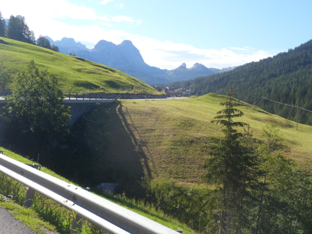
Between Passo di Giau and Passo di Fedaia
At the col sign I
wait ten minutes for my 'partner', and also to rest a bit, though I don't really expect him so short behind me.
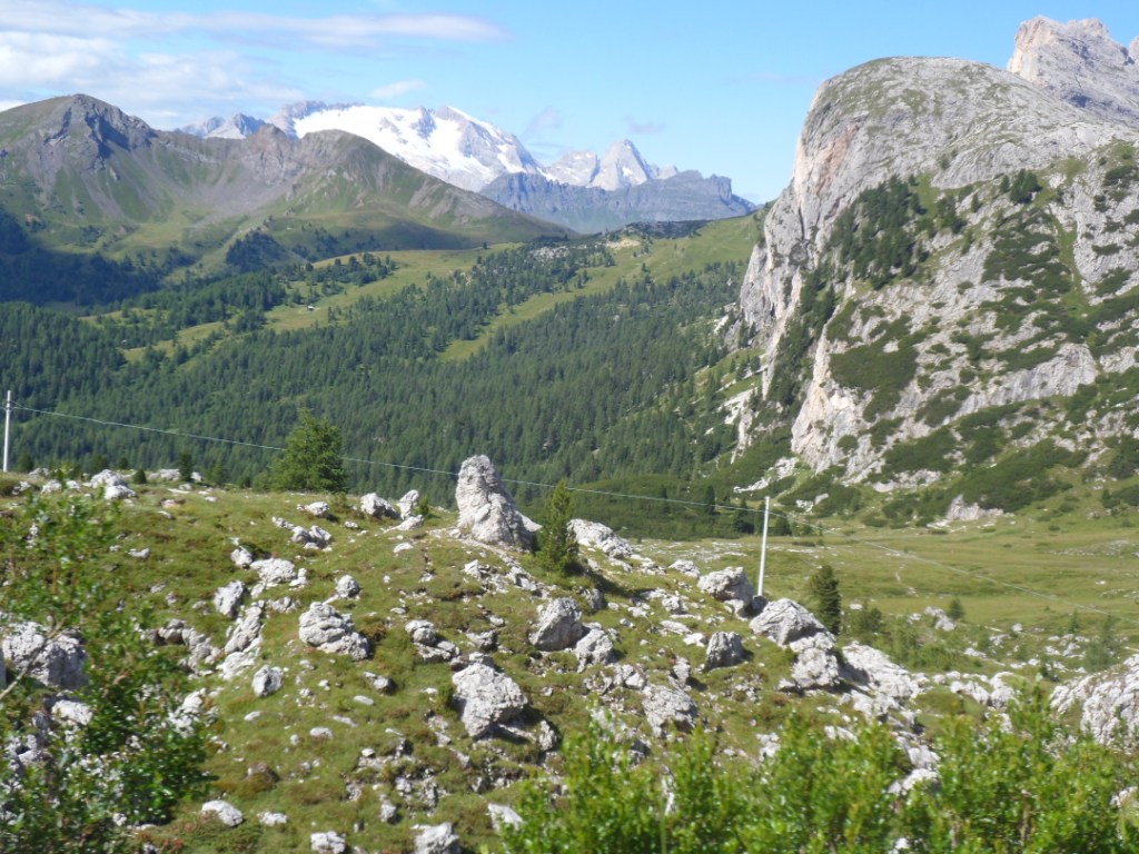
I do remember more or less the form of the Marmolada Gruppe, to the left/south, but I don't remember the long level
passage along the big lake, at the end of which is the col sign for the other side, and I remember nothing at all of
the descent.
Marmolada Gruppe |
|
|
|
In Canazei it's warm. I enter a rent-a-cycle shop hoping to find a new set of brake pads. I do, and the
man in the shop is also so friendly to fit them (for which he lies the Koga outside on the pavement). He doesn't want extra
money for that, but this I cannot accept; I'm so happy! Even though it's close to 4 p.m. and I have two climbs still in
store (2nd and 3rd category, I should guess) I have a coffee + Apfelstudl in ristorante 'Eine K÷nigin
unter den Bergen',
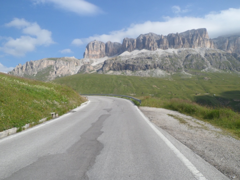
well, on its terrace. Canazei is warm and full of tourists, mostly by car, it seems. The road to the
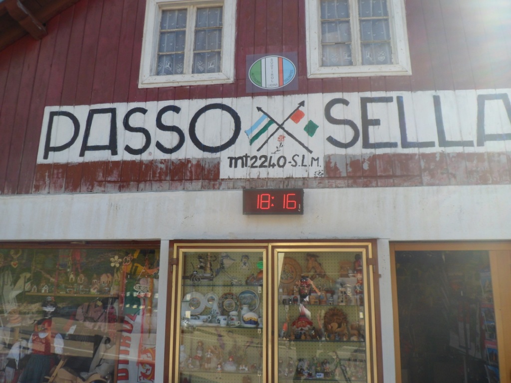
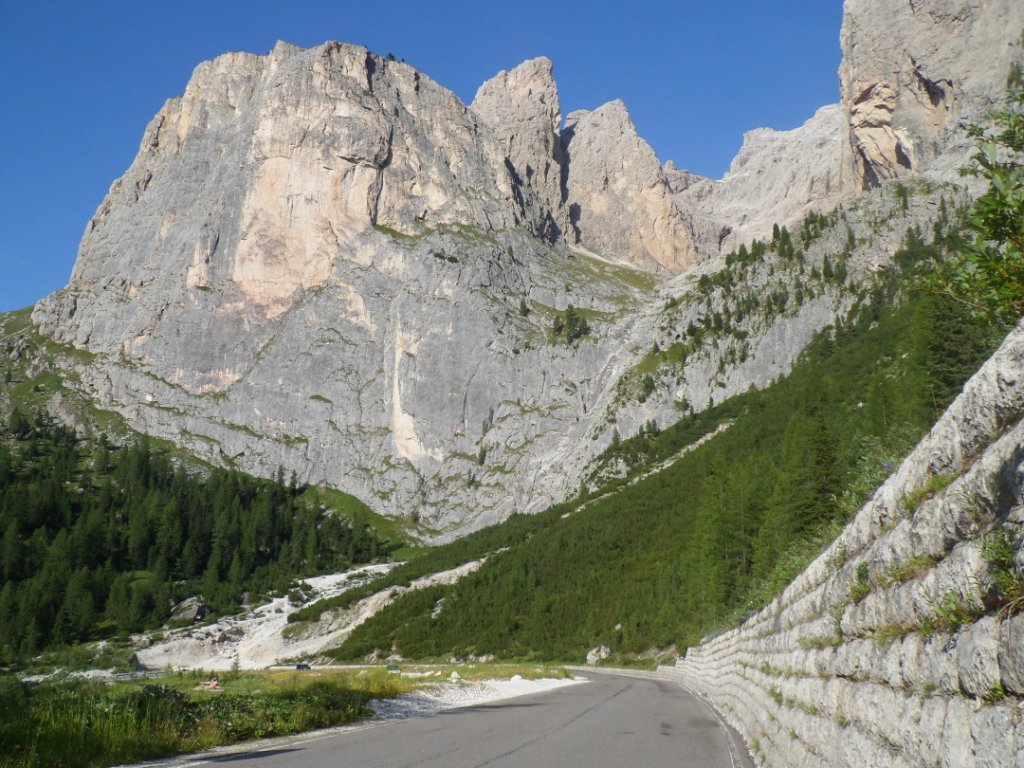
Passo di Sella/
Passo Pordoi is quite steep and very busy. After the junction it gets calmer – twice as calm, I should guess, and it
goes up at quite a pleasant, regular slope, between 6% and 9%. And what a gorgeous environment again, the whole time.
Sch÷n, sch÷n, wundersch÷n! During the last few hundred meters I look left for the breath-taking panorama, looking
down as far as Canazei. At 18:15 p.m. I reach this last but one pass. Also the three sharp mountains with the sun
going down behind them are enormous.
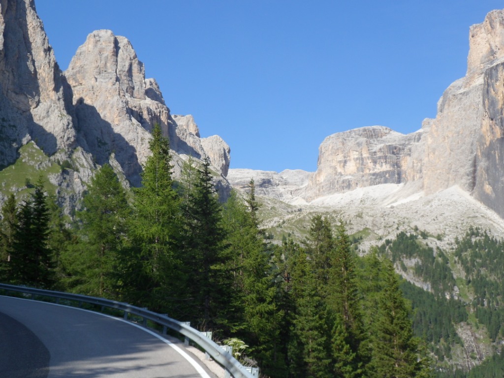
Wonderful environment of Passo di Sella
|
|
|
It will be a late arrival, and to make (almost) certain I will arrive before 8 p.m. I immediately
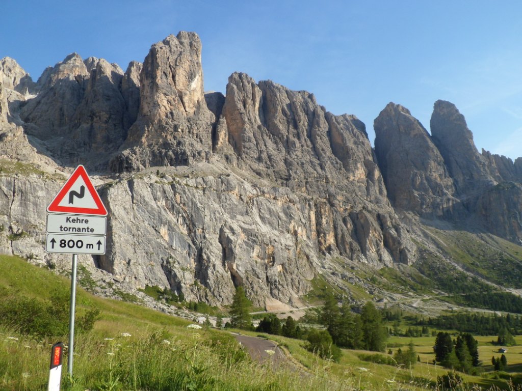
put on my helmet for a short, quick descent (with good brakes ☺ ). The Passo di Gardena
shouldn't be too much of a
problem – it's only 250m up, or so. Much of the difference in altitude is gained in the first 3km, which go
annoyingly slow. Follows a flat or even descending (which I find annoying too) part, and 3 more kms to go up. From the top a
nice view onto Corvara and the mountains behind it, and the valley with the serpentine road in between. I'm surprised to
see the time at the pharmacy close to the hotel, 19:15. Well, the distance was only 115 km ...
I have my last dinner in a ristorante that is well attended this Monday evening. I feel a bit lonely,
and, out of doors again, the search
for an ice-cream for dessert is not very successful. Corvara is not a typical Italian town, where between 9 and 12 p.m.
everyone is walking along the streets, with or without ice-cream. For one thing, even midsummer evenings are not that
warm.
Great day!
Gr÷dner Joch – up and down
|
Garni "Monti Pallidi" |
24-07-2012 CORVARA → LAGO CALDONAZZO, distance 140 km, dķnivelķe 2200 m
In the dining room I find an old aproned man with binoculars watching
the mountain slope in the west, spotting game,
he tells me. When I put the glasses before my eyes I spot nothing
living. I enjoy my last breakfast in Garni Monti Pallidi, settle
the bill ( € 70,-), get my bike from the garage and set off for the last
stage. It's not as cold as yesterday,
but I need an extra layer, even with a climb of six km to start with,
today a quiet and easy starter. The descent (from
the Passo Campolongo) offers
nice views over Arabba, the valley leading up to the Passo Pordoi, and the pointed rocks on the other side of this
wide valley. The climb to the pass just mentioned can be said to be twice as hard as the Campolongo – 640m up in
9.5 km.
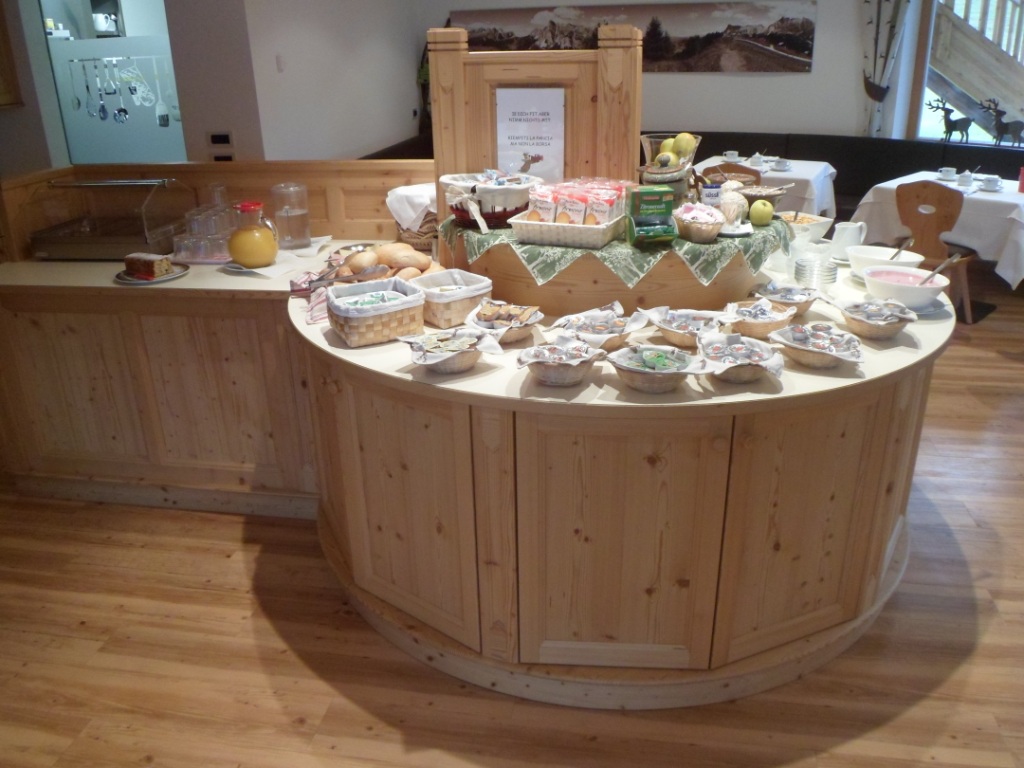
Breakfast in Garni Monti Pallidi
|
Another view from my room in Corvara
|
View over Arabba
|
Wide valley leading to Passo Pordoi
|
Great rocks around
|
Passo Pordoi
|
I think I remember there are 33 hairpin bends (a guy from Groningen told me in 1988) on the way to
the Passo Pordoi. The climb is very regular,
and the deepening of the views back helps psychologically. My first impression of where the pass is located
is contradicted as I get closer to it. Compared to what I've seen the last few days it's not very spectacular.
The west side is nicer. Very nice indeed.
|
|
|
|
|
Just below the 'Sella-junction' look who's cycling up, isn't that
Reinhard?! It is, we shake hands, exchange a few words – yes, the Fedaia is quite something! – make a few pictures
and continue our own
courses. In Canazei my intuition sends me into the wrong (Fedaia!) direction, possibly because of all the cars! I
follow what may be called the Dolomiten Haupstrasse – well halfway the road splits into a motorway and a secondary
road – till Predazzo, where I have an early lunch/late coffee break
with a huge piece of Apfelstrudl from the supermarket (and with some nice music coming from the church behind me).
I'm well on schedule to include the last new climb (and the 25th time of this tour that I cross the 2000m level),
the Passo Manghen. The 15 km or so from Predazzo (where I stayed two nights in 1992) and Cavalese (three nights in
1988, with bruised knee and shoulder after my worst fall ever, in the descent from the Passo di Mendola) are not as easy as
I had expected, and the clouds coming from the south do not offer a happy prospect. In Cavalese I have a cappu at the
ristorante where I licked my wounds 24 years ago, and get accurate route info. From Cavalese I descend to the
Torrente Avisio, with 800 m the lowest point in two days. From above I could already see the very black tarmac of the
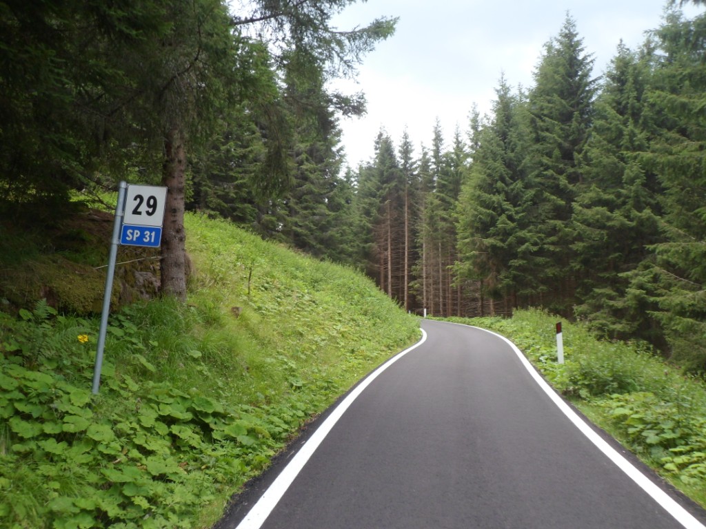
SP31 (Strada Provinciale) leading to the Passo Manghen.
'My' restaurant in Cavalese
|
Down there, right in the middle,
the start of the final climb
|
Long, small, (almost) straight road
|
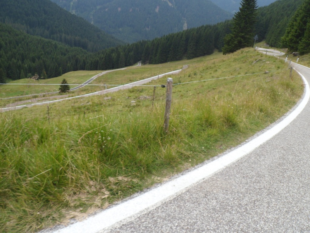
The first five km are absolutely flat and straight. This is not what I had expected! Most striking feature is that it
is so quiet, especially after the Sella Runde. I can hear the torrente on the right, I can hear the birds. (And when
a motorcycle approaches I can hear it coming from a long distance.) The km signs along the road follow each other
in a good pace. The pace slows down as the slope rises, but still there are hardly any bends, and I stay in the
woods. It's a good road to meditate! I don't make many photographs – they will be all much alike – but when I do
the automatic flash turns on: the sun has disappeared and the tall trees give much darkness. After a very long while
I finally get out of the woods, and I can see the road going up steeply in a few bends; it looks too steep for me, but after
each bend it's not as bad as it seemed before. So I struggle on; it is a long climb! It helps when 2 km before the
pass a German speaking cyclist encourages me (the heavily loaded one) and tells me it's only 1 km to go till the top.
So I
accomplish this last pass in one big stride. At the pass I'm photographed by one of three noisy Swiss (motorcyclists).
Finally getting out of the woods
|
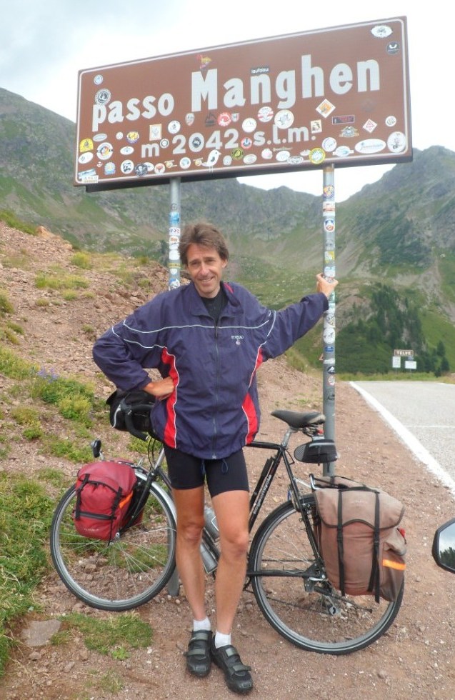
Happy man
|
And down again for the last time (15%)
|
Spectacular descent
|
Not a very happy man
|
View back to the pass
|
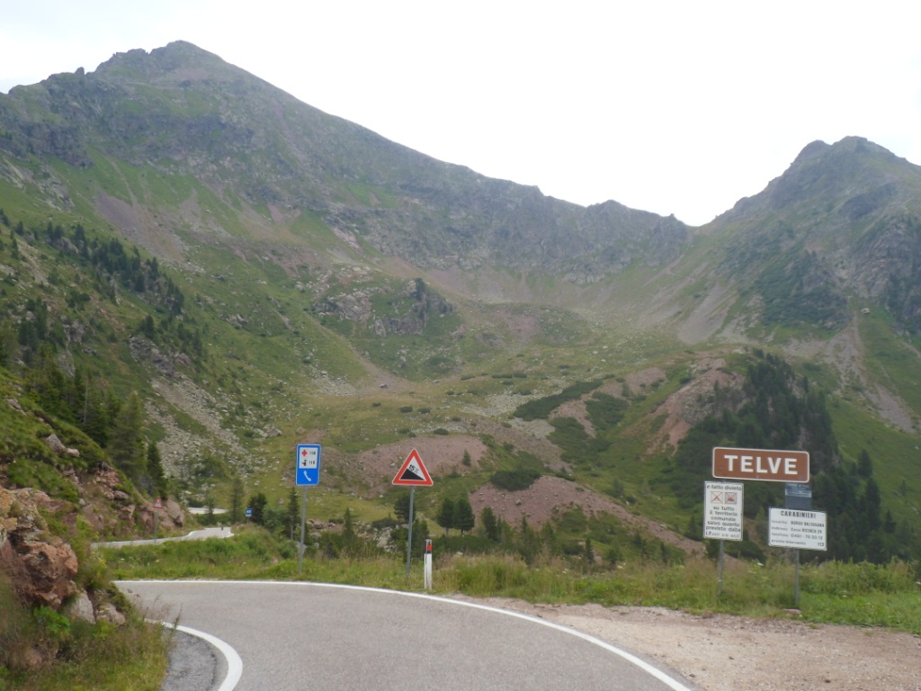
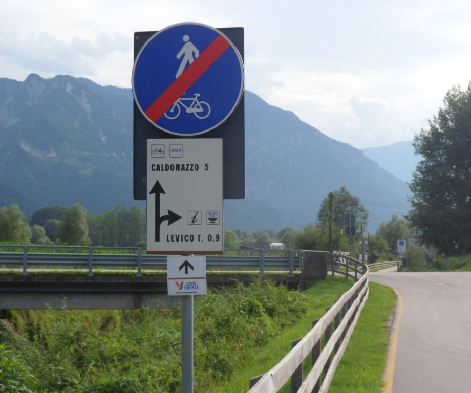
Rest another 48 km till my final destination, half of which is a descent to Borgo Valsugana. And what a descent!!
The south side of the Passo Manghen is MUCH more spectacular than the north. A glorious dessert of the final stage.
Alas, after 2 km it starts to rain, it stops, it starts again, HARD. For quite a while. It stops again, and the sun
returns, but speeding up on a wet road is not a good idea. Luckily I pass a restaurant, where I have a late lunch,
outside, on a bench, in the sun again! In Borgo, just before I get onto the Strada Statale 47 I notice another
bike route. The Italians did much good work for cyclists, these last twenty years!
I realize too late I should
have done some souvenir hunting in Borgo or should make a detour to Levico Terme.
The cycling alternative is nice: no cars, almost flat,
a bit boring though (I've become a spoiled child).
Last – sunny – stop
|
Cycle path, easily missed,
but not by me |
Almost there
|
Caldonazzo is coming closer and closer (and I don't want to make the detour to L.T.).
I arrive in Caldonazzo between 5:45 and 6:00 p.m. I hope to find a shop there, but the village is much smaller than I had
expected and there is only a toys shop and a (big) supermarket. I have to follow the west side of the lago for
another six or seven km. First I miss the cyclists' alternative, but the main road feels too much like a motor way, so
I quickly return (there's a fence between me and the cycle track which I cannot cross), for some relaxed last
five km along the Lago Caldonazzo till
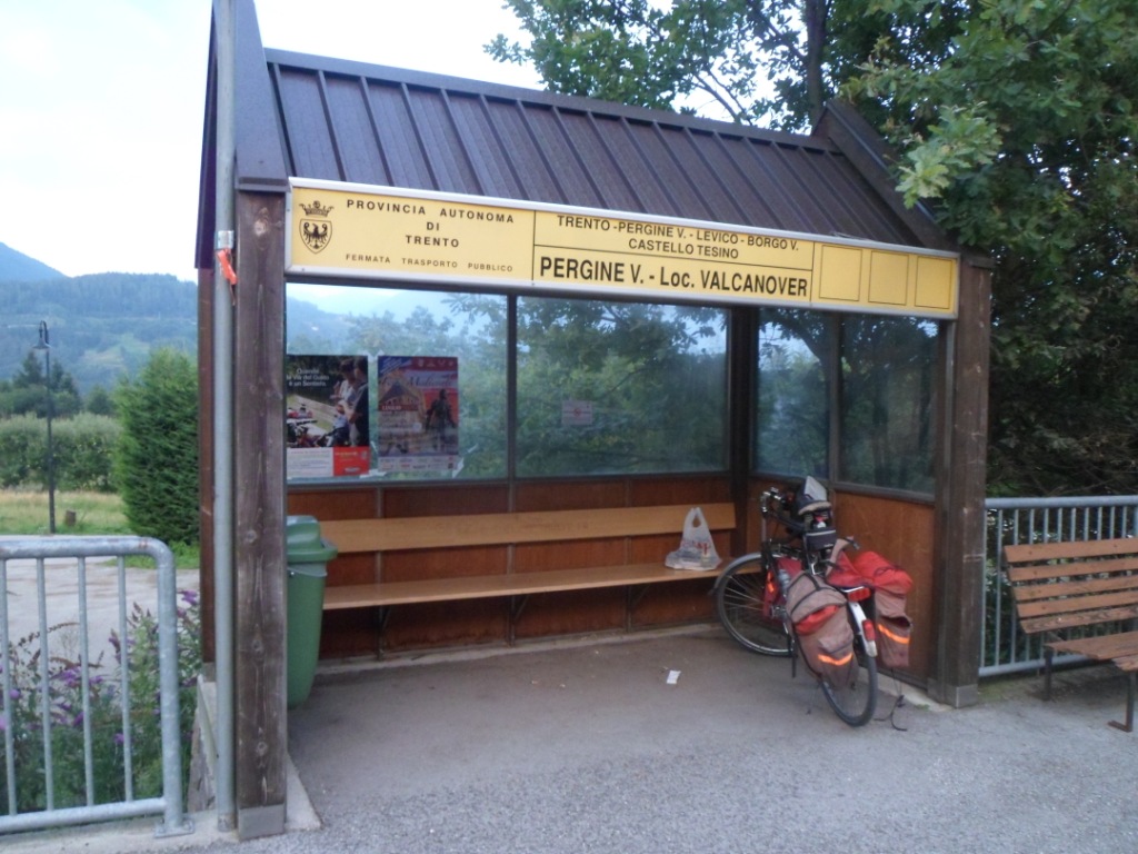
I’m definitely sure that I've found the bus stop where I'll be picked up at 9 p.m. I seem to be the only
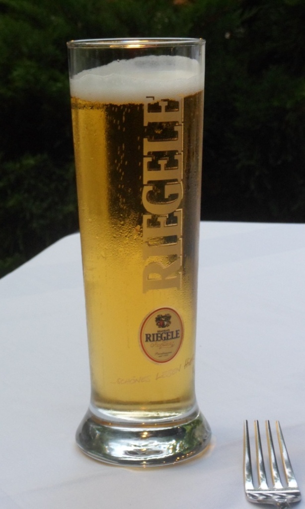
passenger. Time enough for a last Italian beer and a last Italian pizza. Right on time the bus arrives,
and at about the same time
one of the Cycletours 'personnel', whom I'd seen walking around (with his abundant rasta hair) in Hotel Funivia.
So far so good. And . . . . when will I be here again?
|