|
When around January it appeared I had to make
my own plans for the summer I automatically started looking at
my old maps of the Alps (the Michelin maps of Switzerland dating back to '85-'87)
and found there were still quite a few
interesting additions to make to my lists of cols and I wouldn't mind either
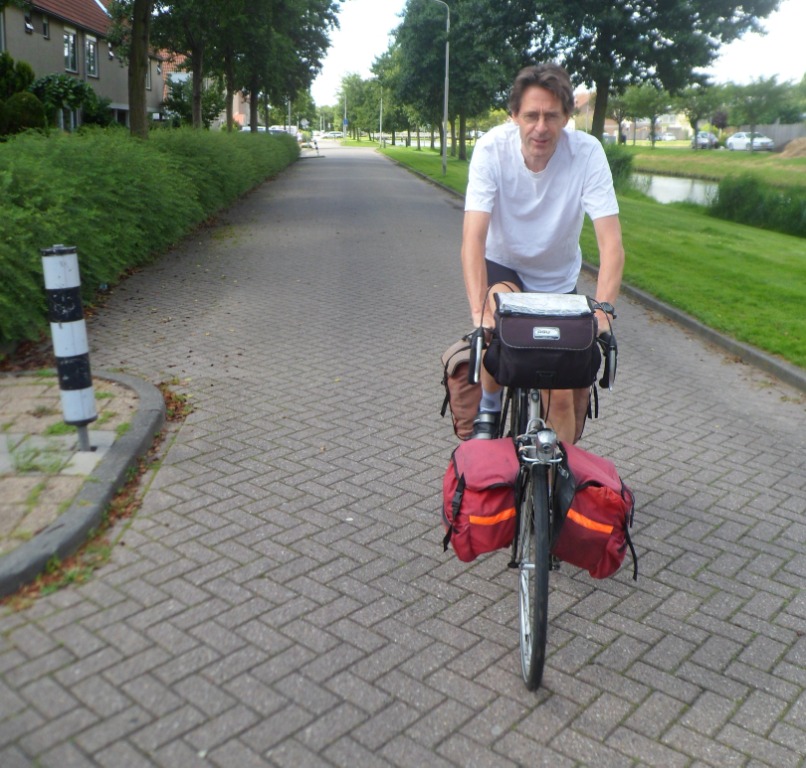
to revisit old places. Important decision to make: which bike to take ... my
old (1988) or new Koga (2009) ... the one which fitted me best,
or the one with all the modern facilities (swift gears, hub
dynamo, hydro brakes), but two kilos heavier, and with still
not the right 'sit'? I opted for the first, which required a
thorough restoration. A restoration that was worth every euro I
put into it (thanks Jan!).
07-07-2012 NOOTDORP → UTRECHT . . . .
Enya makes some farewell pictures – two years
ago she accompanied me to the Cévennes – around noon, and I
have a rather uneventful 60 km ride to Utrecht. There’s only a
5 km detour because the bridge at Waddinxveen still isn’t
fixed, and I have to wait quite a while at the open
‘twin-bridge’ in Boskoop. A few hundred meters later I almost
bump into a boy who bumped onto a traffic pole, probably due to
his not being able to text a message while riding a bike. In
Utrecht I have enough time to do some shopping and when I
arrive at the Jaarbeurs parking place shortly before 4 p.m.,
there’s no sign yet of any co-passengers. They do arrive arrive
around 4:30, but not in large numbers. The bus is early too,
but unfortunately we have to wait for two more people. It’s
the same in Eindhoven, where a very experienced Cycletours
customer ‘knows’ that the bus is always late. Well, not today,
and indeed I hope that the bus will arrive at my destination
Bourg d’Oisans at least one hour before schedule. We do win
some time due to the small group (among which four guides) and
the happy circumstance that on Saturday the A2 to Maastricht is
by far not as busy as on a Friday.
 08-07-2102 . . . . → LE BOURG D'OISANS
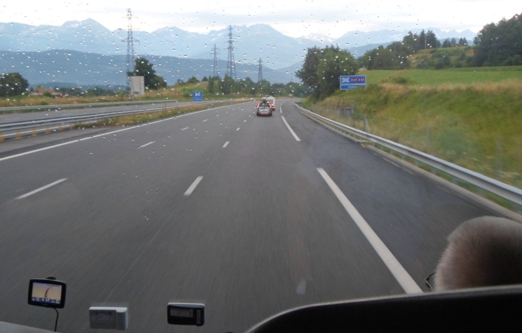
I wake up early – in fact, I hardly sleep (alas, the old ‘sleeping buses’ are not on the road anymore) – and notice
immediately that the wipers are making havoc on the front screen. The cloud is completely blocked by a thick cover
of clouds when we reach Sévrier, at the Lac d'Annecy, about 6:30 a.m., which is good! However, I fear this will
undoubtedly be the first time I'll have to start a Tour de France in the rain. To anyone's surprise it isn't
raining when we get from the bus. We leave more than half the group on a wet, deserted parking place in the middle
of nowhere (where is the welcoming team? The Cycletours escorts for Bourg d'Oisans are a bit worried.
Probably sound asleep in their tents!) Anyway, no more rain till Bourg d'Oisans, and even some patches of blue sky
when we reach this destination around 9 a.m. Well on time! I wonder how the two very young chaps with their light
racing bikes and full camping equipment (even a table!) will get everything to the campground, and I guess that
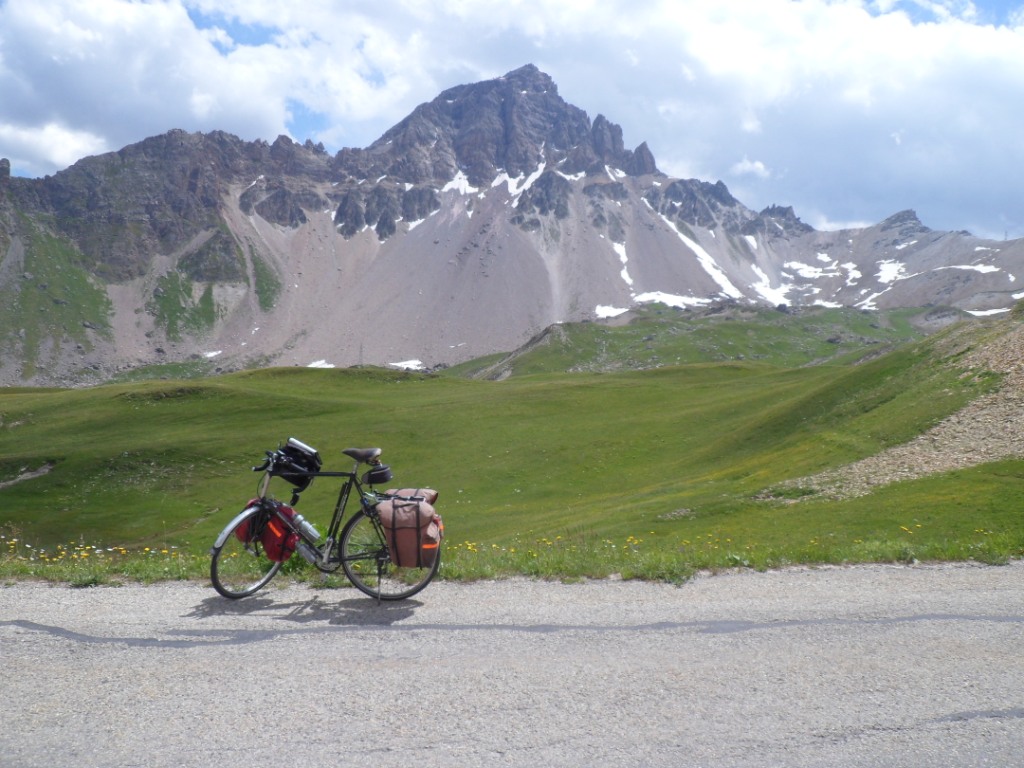
the Cycletours guys will lend a hand (i.e. a place in their van), but that is none of my problems. I hang the four
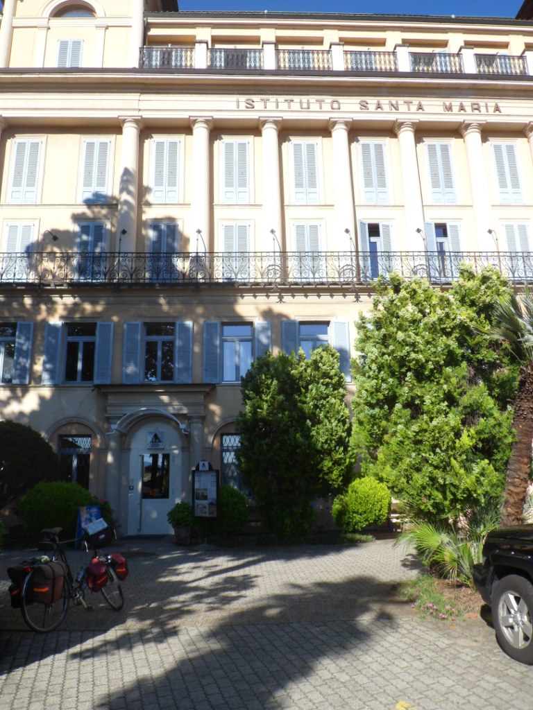
panniers to my good old Koga bike and set off in search of the gîte 'La Marmotte de la Meije' in the
hameau of Le Vert. That appears to be the old 'Le Paradis' recently taken over by younger people.
Breakfast is just at its end, it seems, when I arrive. I'm warmly welcomed, put most of my stuff in a corner and
am ready for the first
stage!
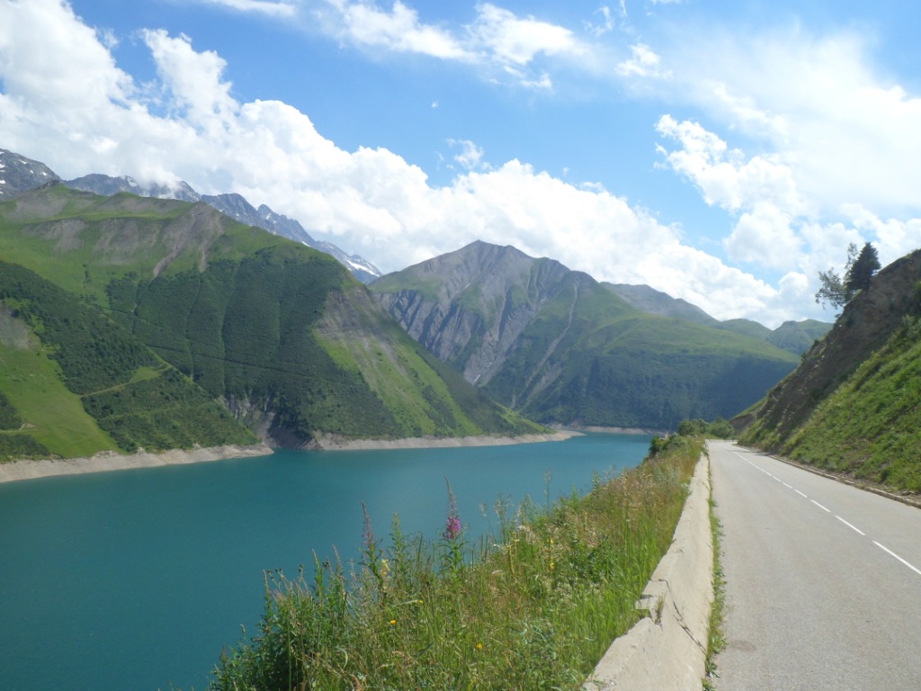
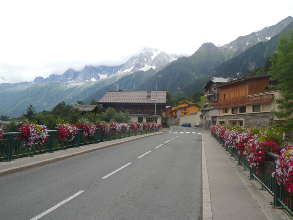
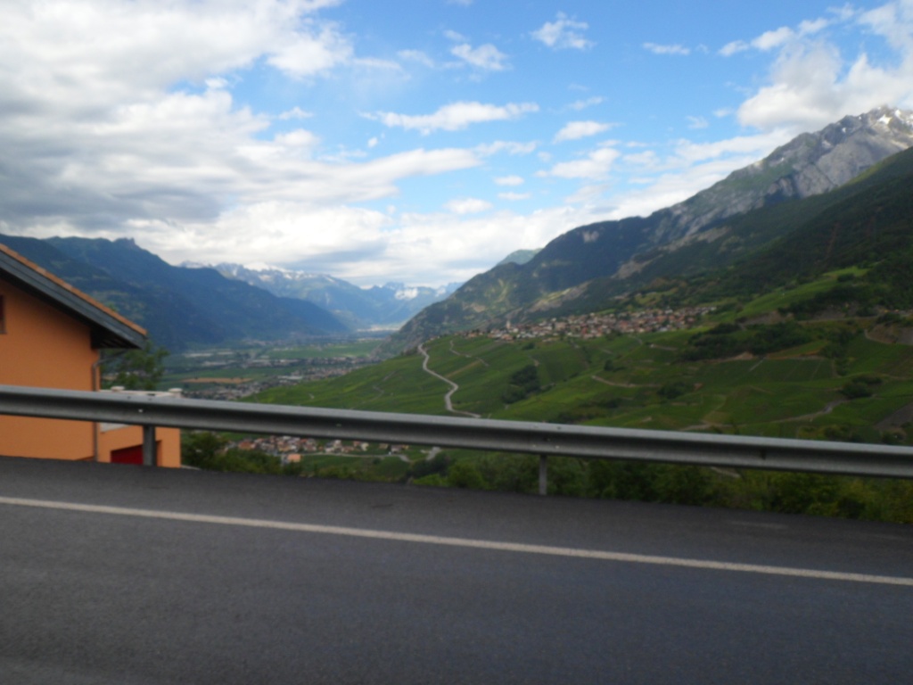
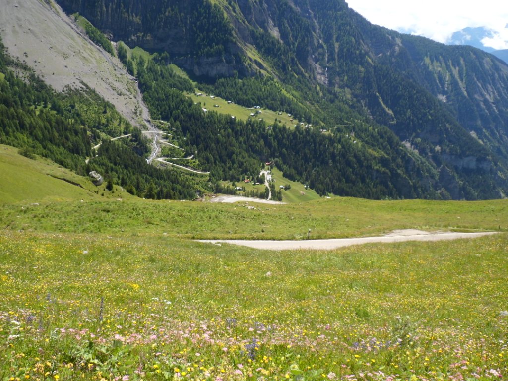
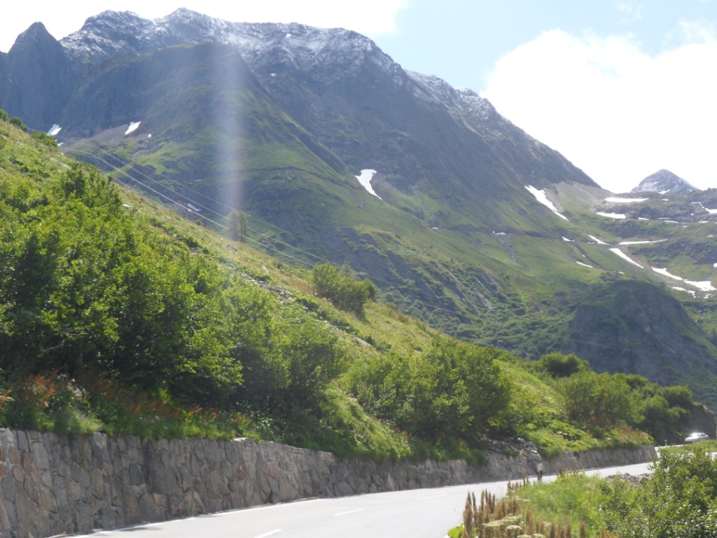
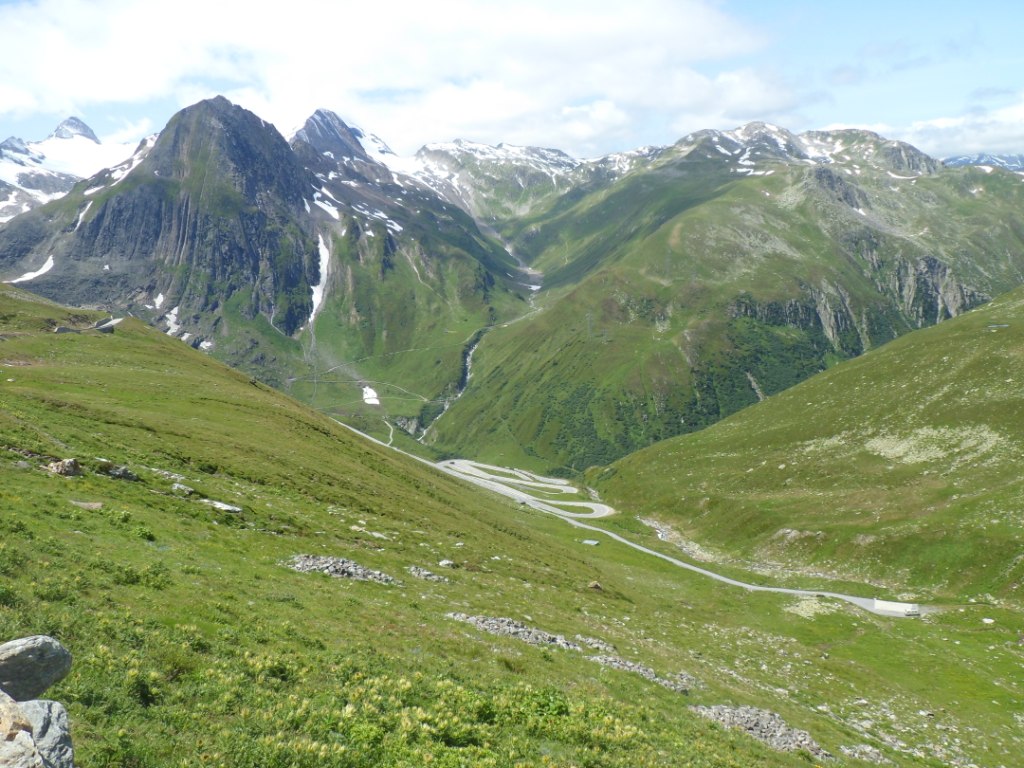
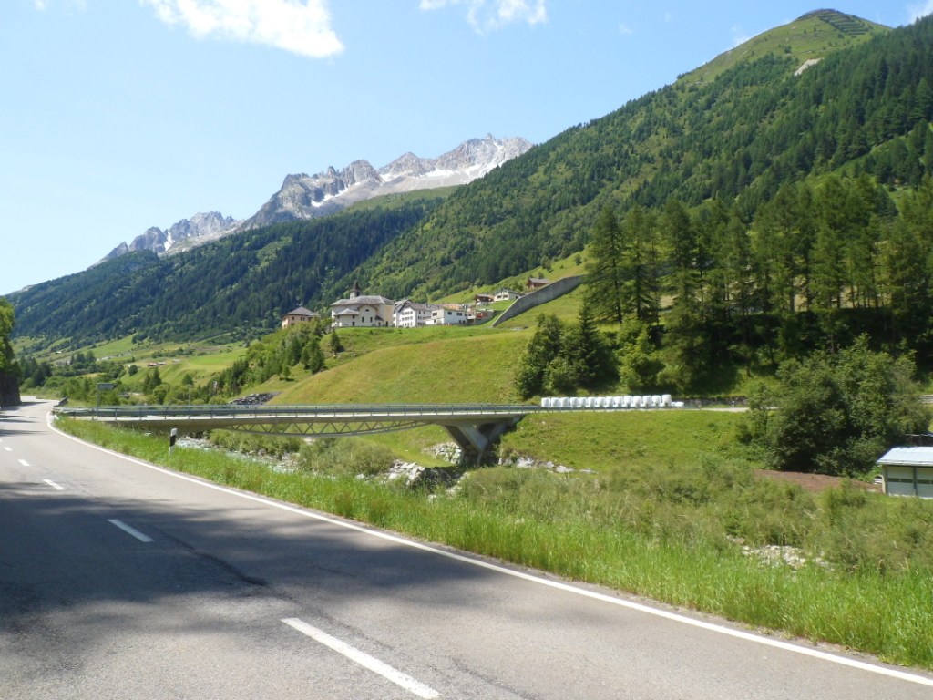
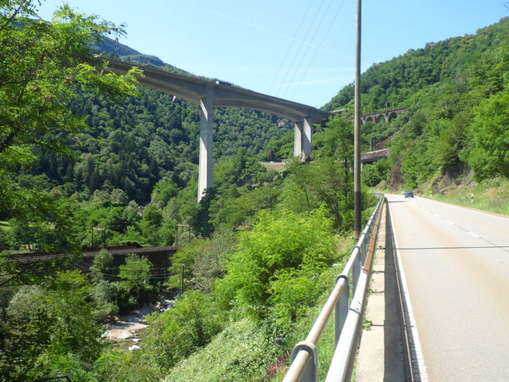
BOURG D'OISANS → BOURG D'OISANS, distance 120 km, dénivelée 2450 m
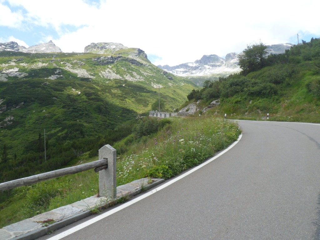
Blue is definitely taking over above when I ride back to Le Bourg, the
sun breaks through!, while my attention is already attracted by the road
along the
wall of rock towering above Le Vert – tomorrow's pičce de résistance!
The road to Séchilienne is busy, but with a favorable wind and a
difference
in altitude of about -400 m during 35 km I make it quickly to my first
coffee. Well, coffee, the café I think I remember from earlier
occasions
is no longer there; I can only go back to the boulangerie for an instant coffee. This and a croissant I consume at the central fontaine,
where I am
joined for a short while by four 'Kiwi's' – two nice couples in black –
just started from Grenoble this morning, and on their way to Alpe d'Huez
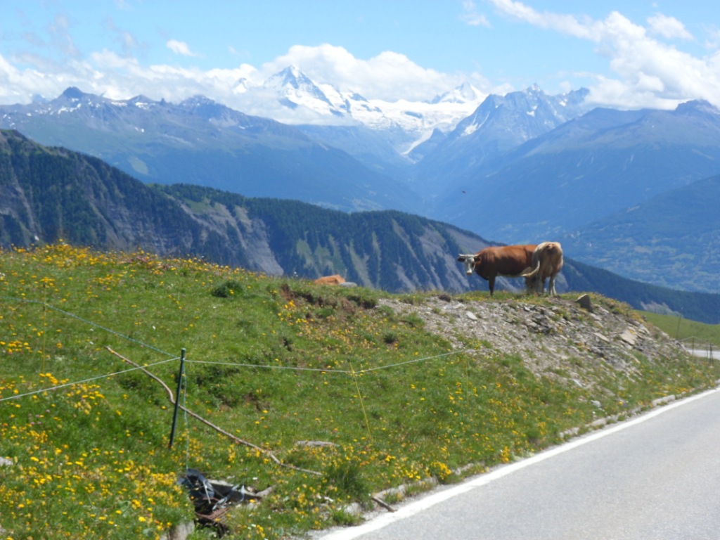
(today) and the Col du Galibier (tomorrow).
Not that my plans are not challenging, but during the first three étapes I will carry light luggage. Whereas they ... ouff! The weather is getting nicer and nicer when I
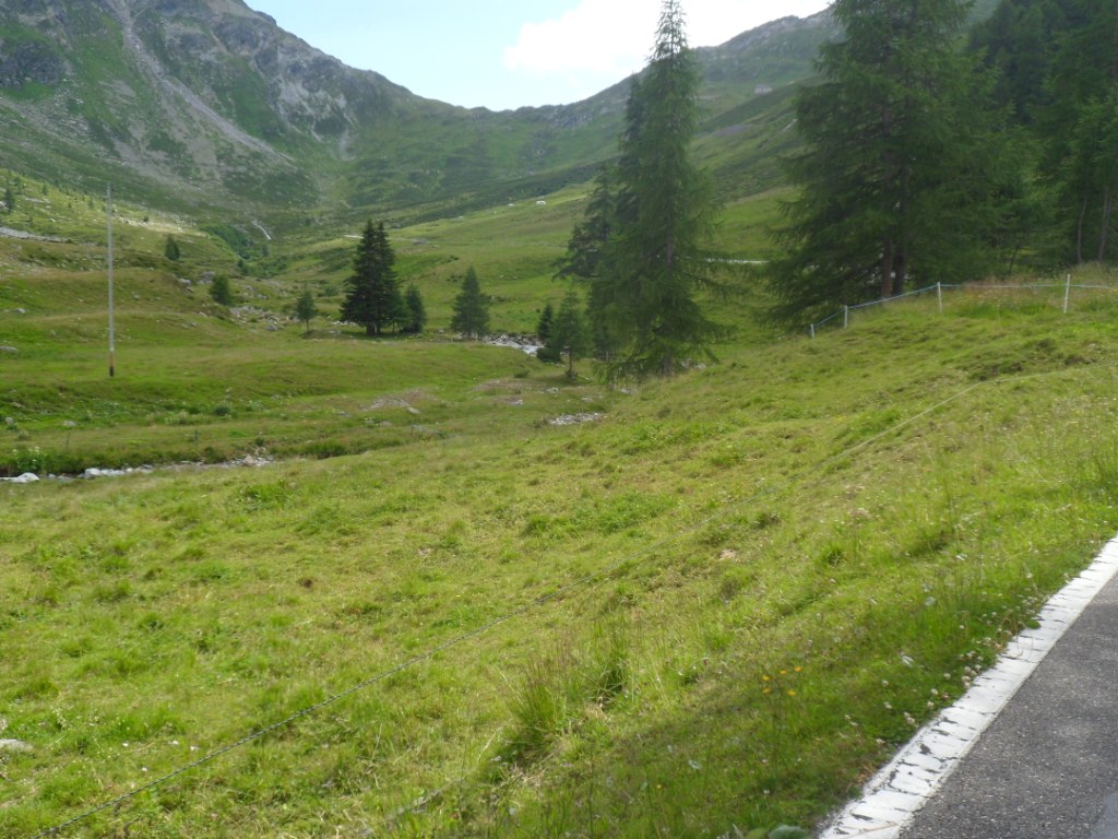
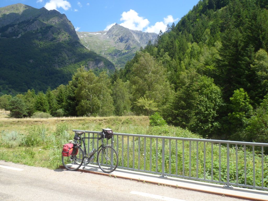
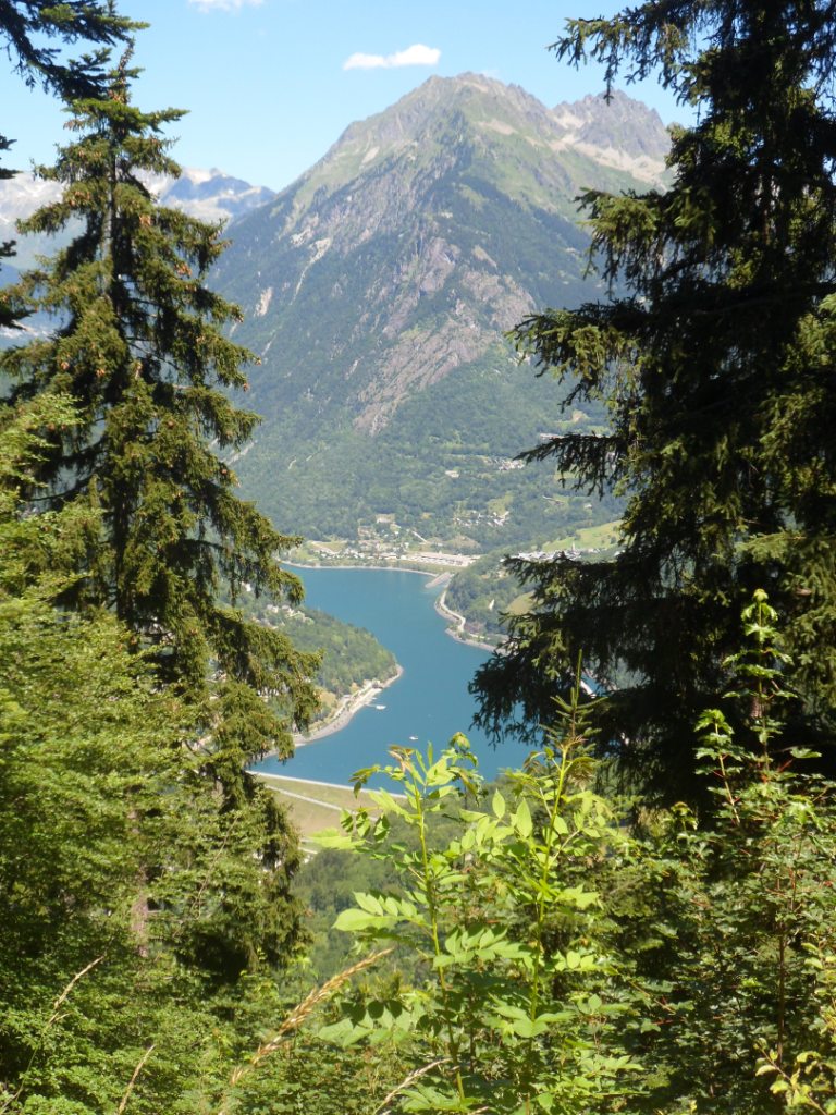
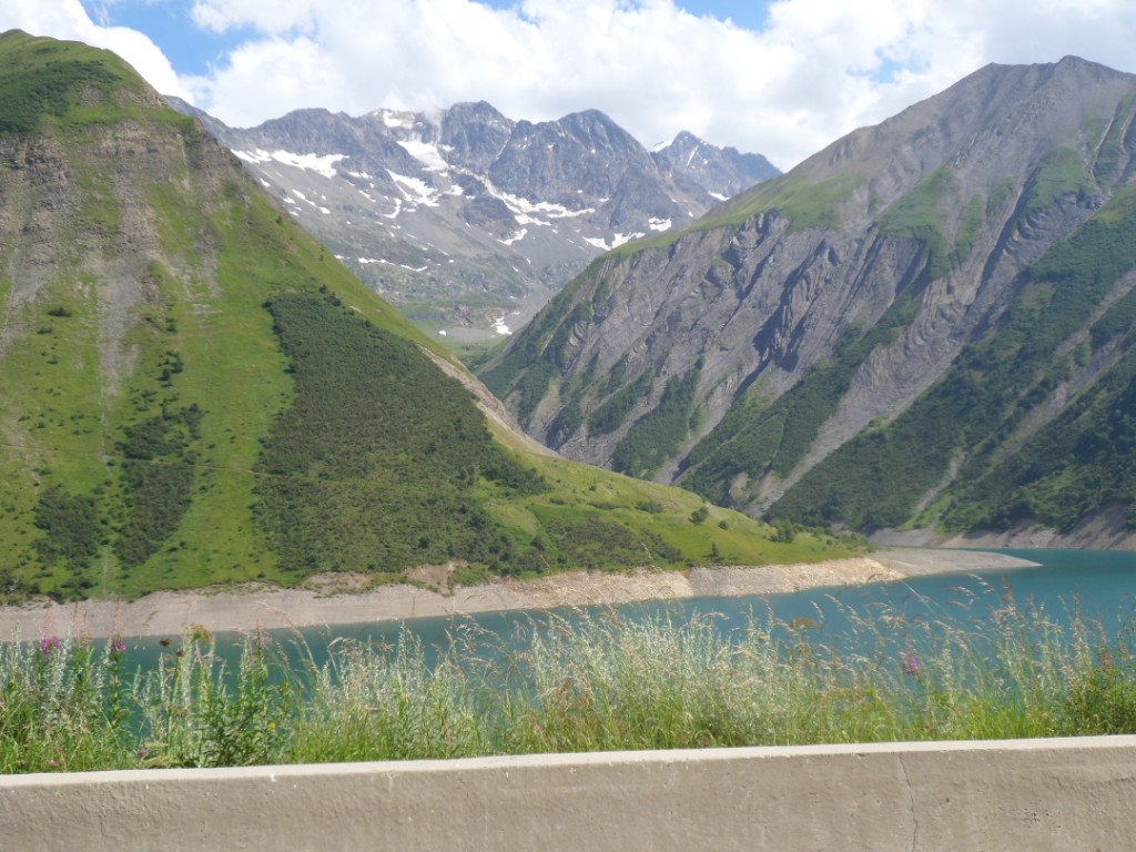
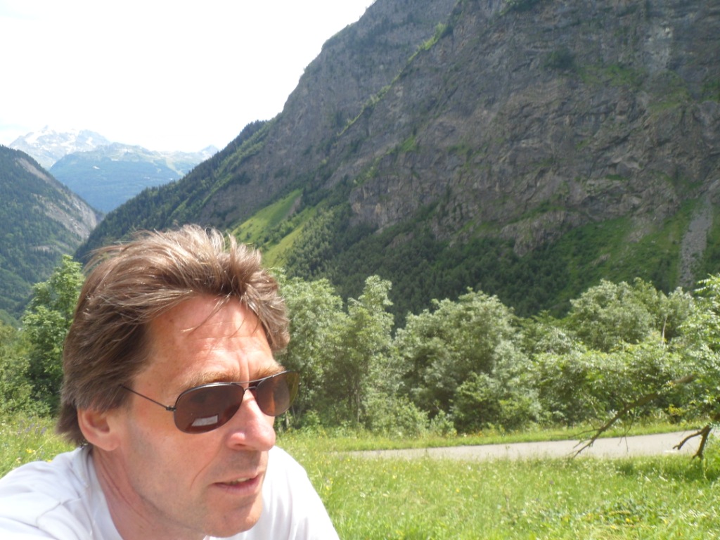
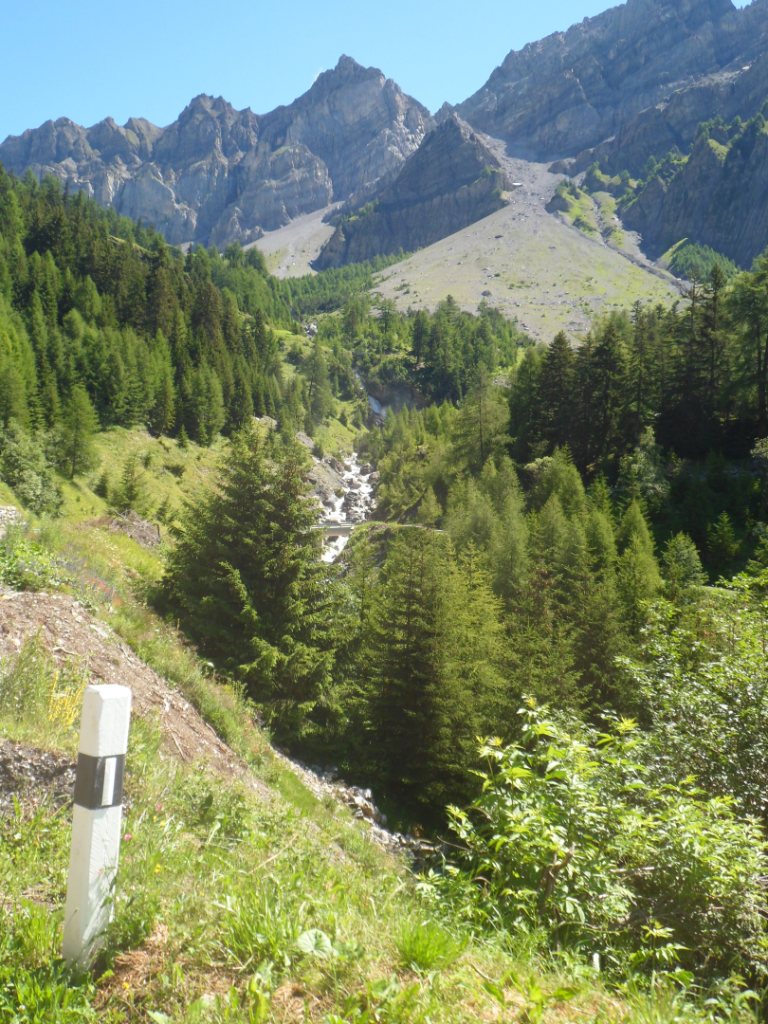
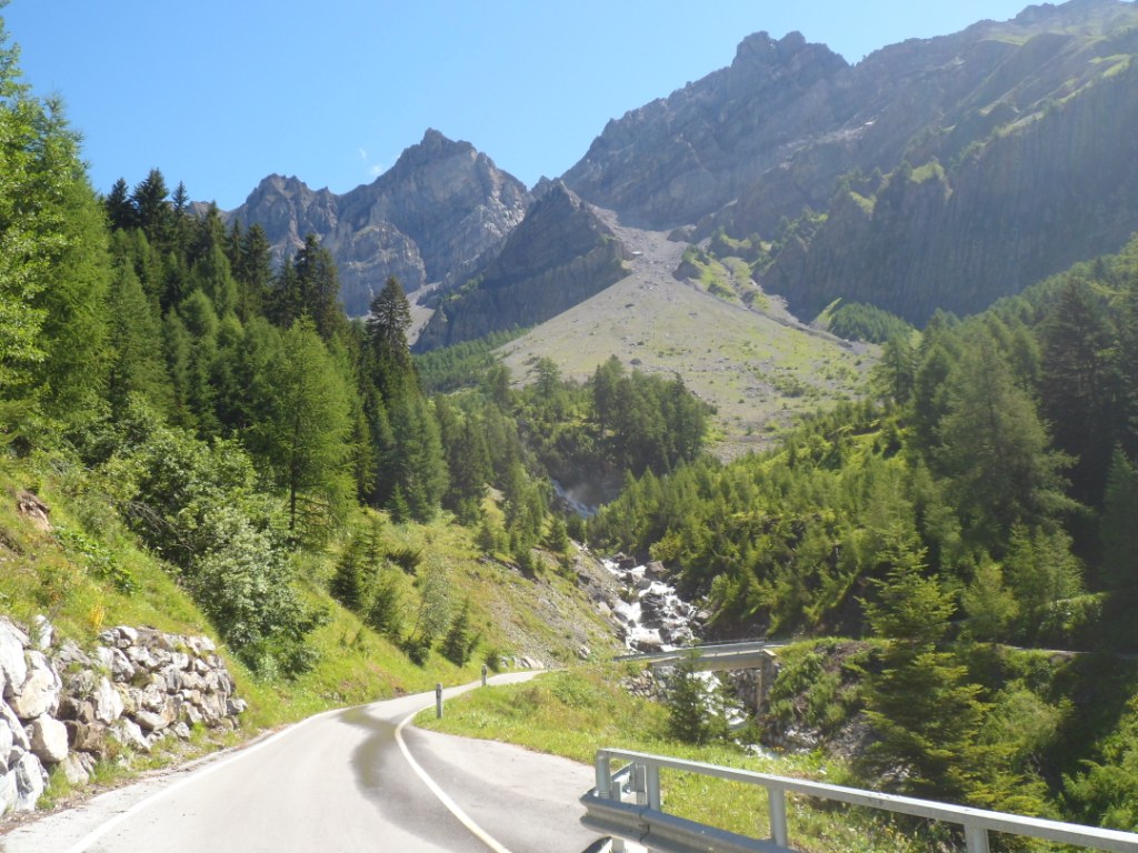
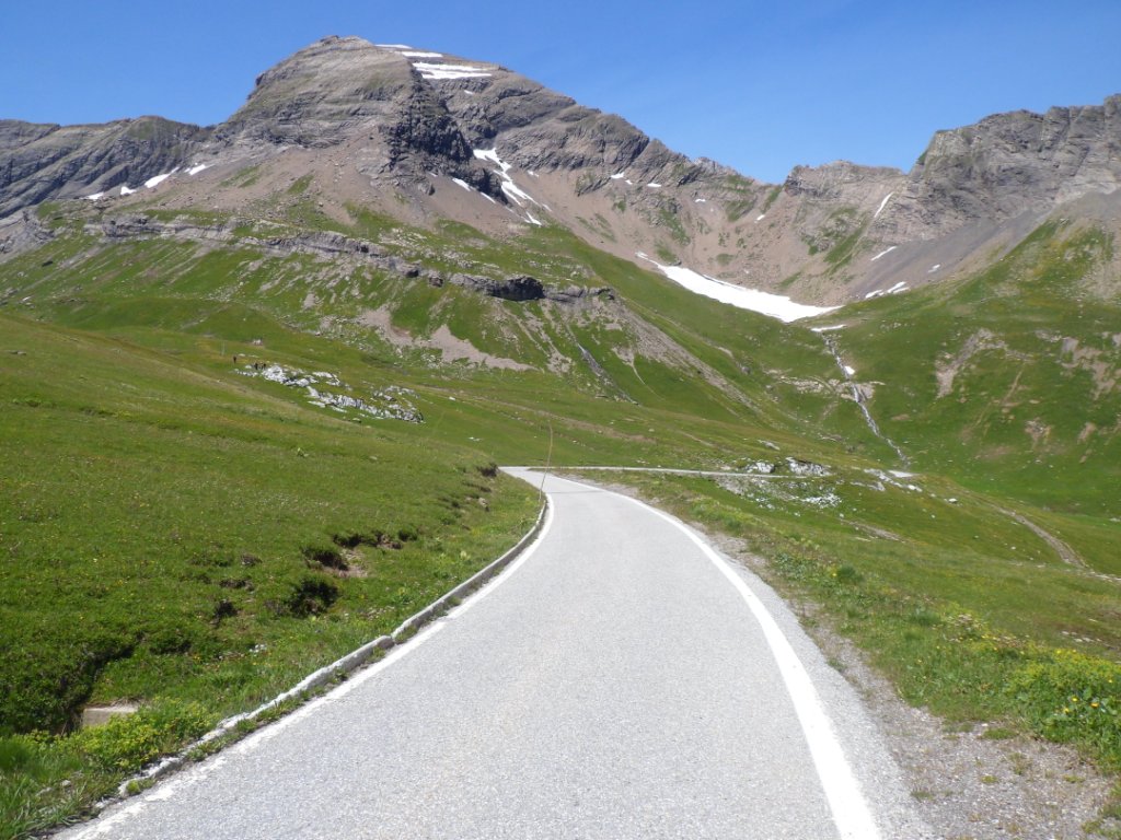
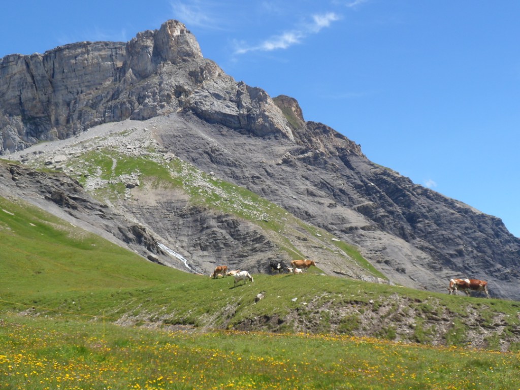
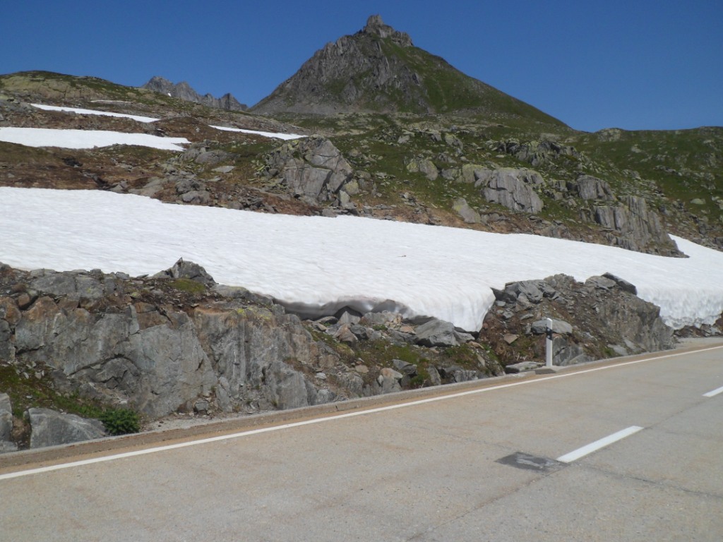
cross the river Romanche for the first starter, the Col de Morte. This is a very regular climb, gaining about 1000 meters in altitude, and it offers
no problems. At the summit I have a short break, take a picture and a banana, and leave my gloves on the bench (not on
purpose). The views during the (irregular) descent,
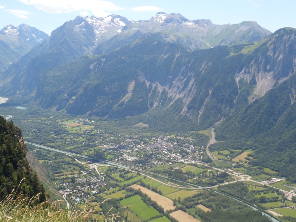
e.g. to the Mont Aiguille standing out high above La Mure, to the Col de Malissol and to the Obiou (I guess), are nice.
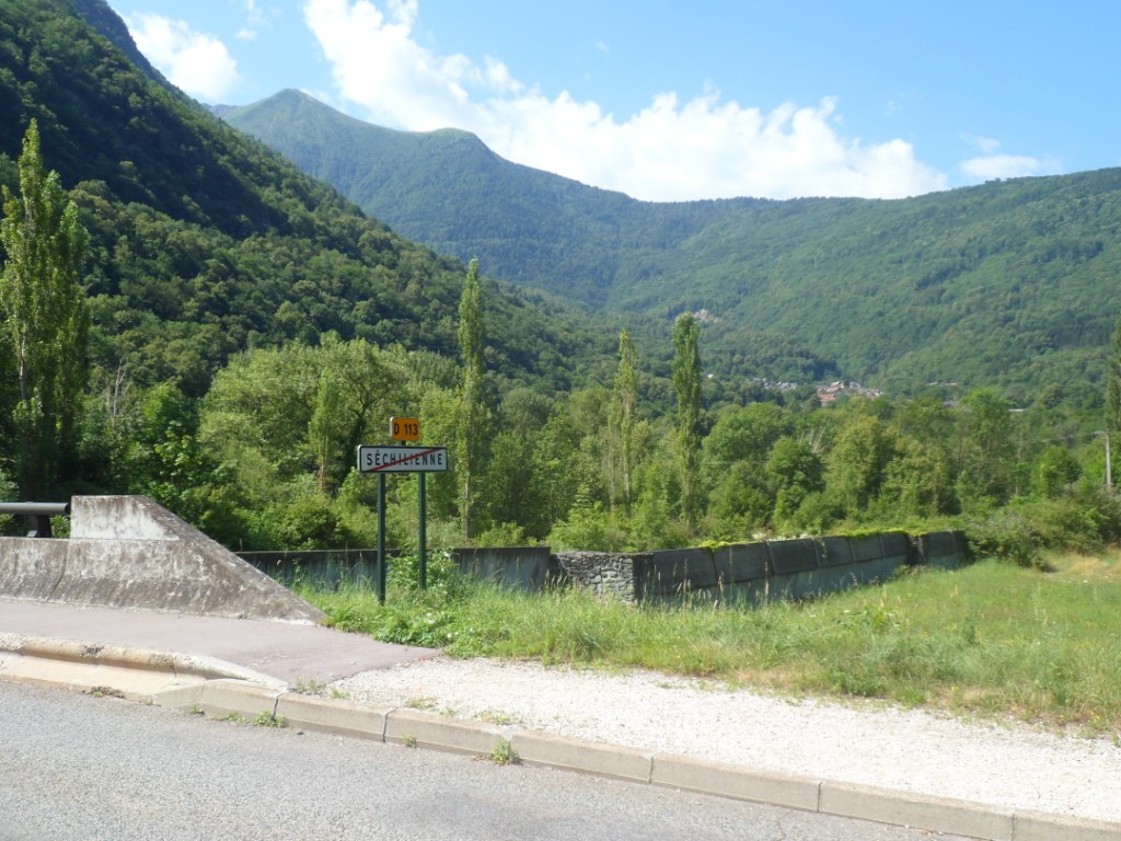
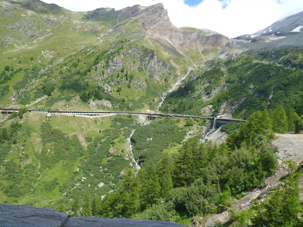
Just after Séchilienne
|
|
Descent from Col de Morte
|
View to Col de Malissol
|
|
View over La Mure
|
At about the lowest point, in Valbonnais, I have a break and a coke (and
a newspaper)
in the same restaurant – I guess – as two years ago with Enya, at the end of our
twelve days trip from Nîmes to Le Bourg d'Oisans.
Like then it is a quite warm afternoon. Also like in 2010 I 'do' the Col d'Ornon with rear wind and rear sun and without a shirt (and indeed get sun burnt as before).
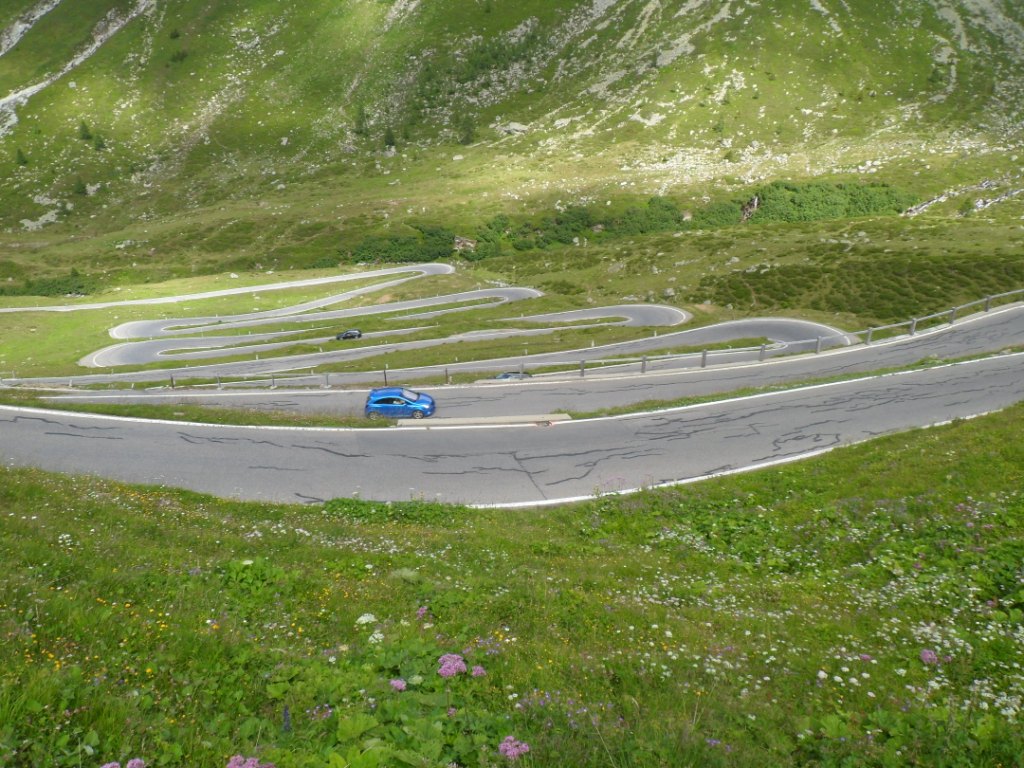
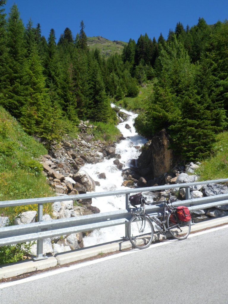
It will be an early arrival, until I decide to include the climb to Oulles, which starts about 1.5 km before La Paute. I'd noticed it in 2010 as an
'interesting' road, with some ten hairpin bends going up steeply. It's a rude climb of 6 km going up some 600 m.
I get quickly overheated and out of breath.
Around pôteau kilometrique 2 it is clear I won't make it in one
'jump', feeling my blood pulsating in the arteries in my neck. With
pain (and sweat) I make
it a km further (so I've gained 290 m in altitude already), and there
take a long break on the tarmac, in the shade. I suppose I don't look
too well as
two cyclists who come up ask me whether
I am okay. Well, sort of, everything is under control. From there I
ride at an even lower speed, even so I catch up with the
female half of the passers-by, and make it to the 'village' (seven
houses or so) without a second break.
Start of climb to Col d'Ornon
|
|
Descent from Col d'Ornon
|
The point of no(!) return |
Oulles 'accomplished' |
|
View back to Oulles |
That's good, even though I do for the time being
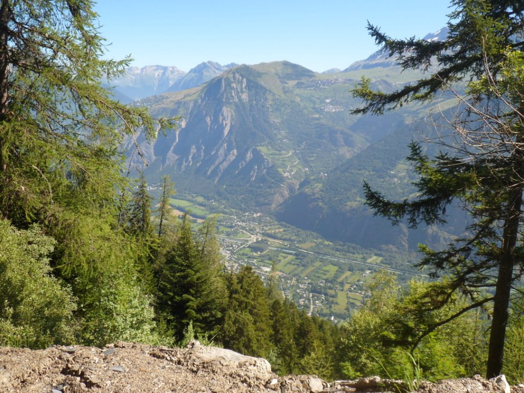
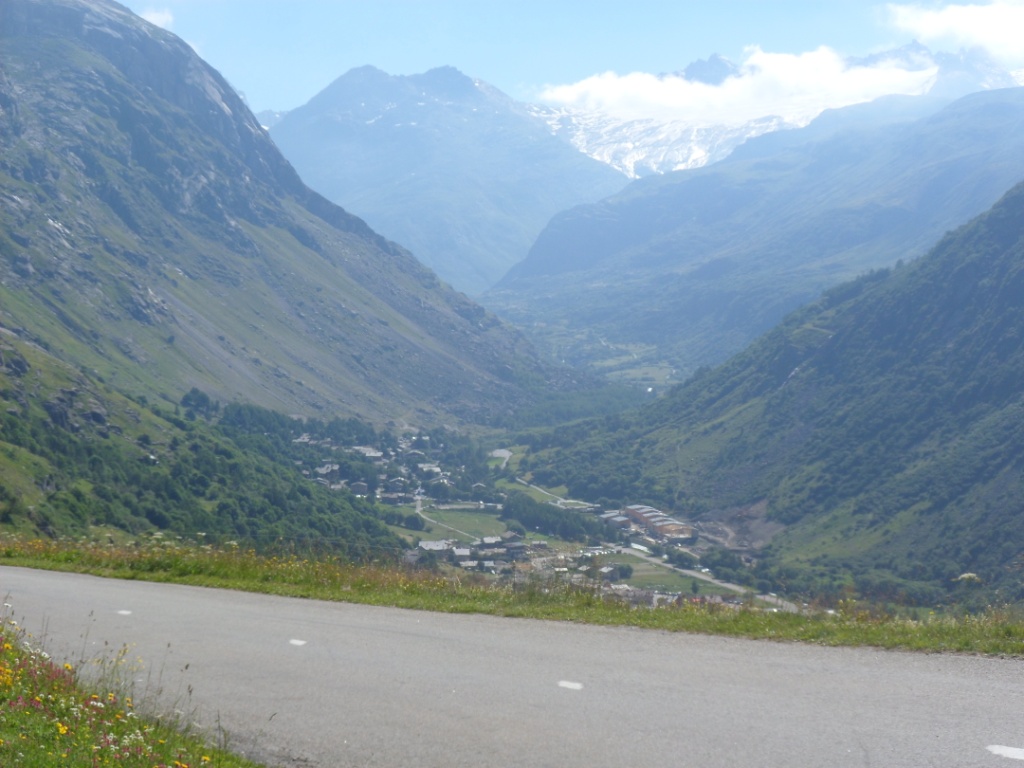
not want to think about the Passo Mortirolo .... After a quick descent with views up to Villard Reculaz and Alpe d'Huez,
two mountain villages I hope to visit tomorrow, and a short even part, I arrive in warm Bourg d'Oisans.
After some shopping at the local Casino (and sweet yoghurt on the pavement
across the street – in the shade) I arrive at the gîte around 6:30 p.m. Time for a shower and a
half hour on my bed for three nights. Dinner is under the lime tree
(and not a
platan, as I wrongly remembered). I share the table with eight British
cyclists who on Saturday (= yesterday) did the Marmotte, and a older
French randonneur
ŕ pied who must feel rather alien in his own country with so many
English around; I do act as an interpreter. I'm in bed before 9:30 and
asleep before 10.
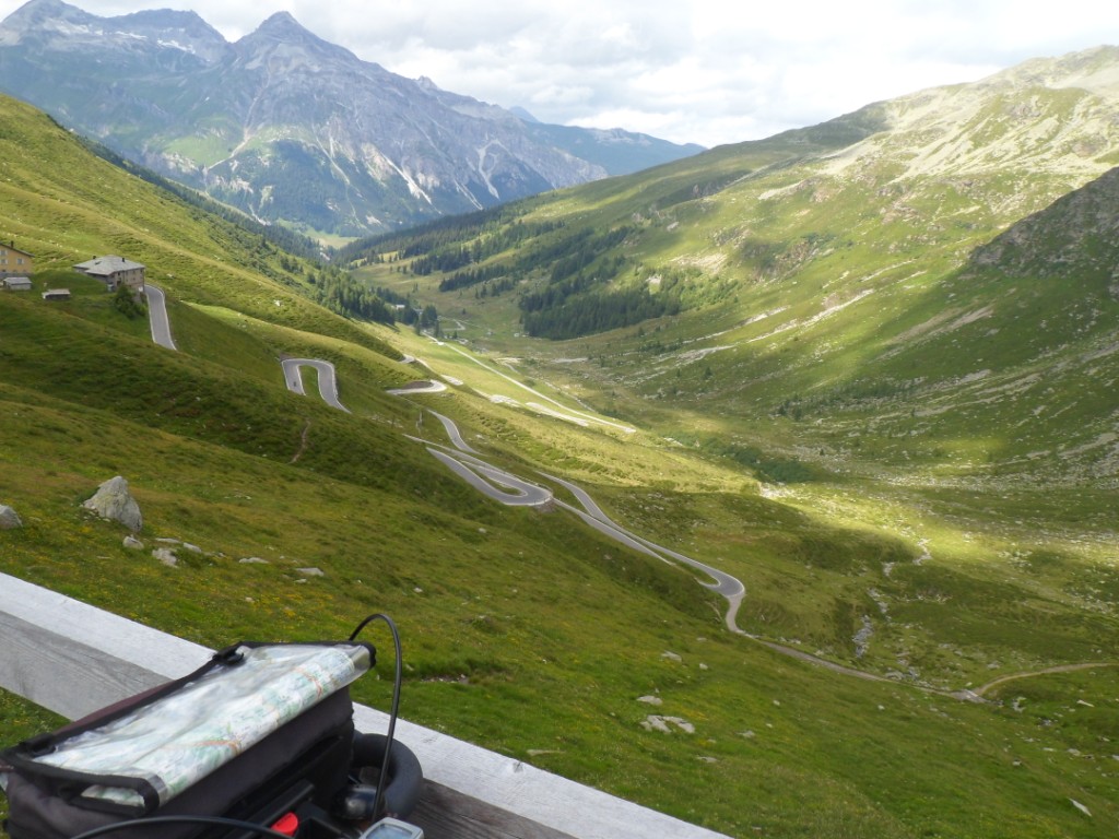
09-07-2012 LE BOURG D'OISANS → LE BOURG D'OISANS, distance 105 km, dénivelée 2650 m
I have breakfast at 8 with the last two British guys and the Frenchman;
the others have left early.
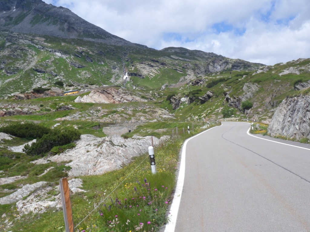
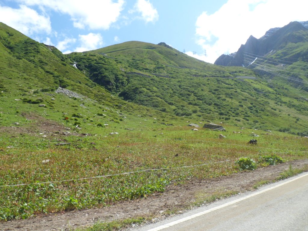
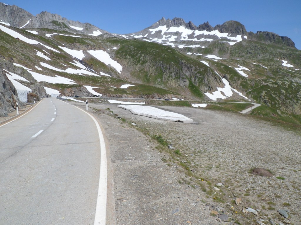
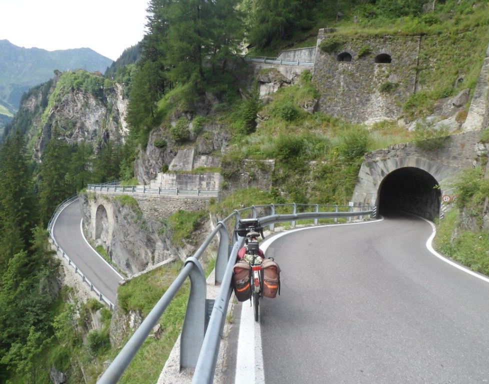
Clear blue sky!! The 'climb of the day' starts already after 2.5 km. A
sign next to the road warns me of the four unlit tunnels; as did one of
the English
already (they did it by car and promised nice views). So it will also be
a test for my new front light (part of the renovation of the Koga ;-).
The first tunnel has a short part which is pitch
dark and my front light fails (!) the test; for the rest the tunnels are
okay. The gradient is high all the time (8.5 to 10% – so not the Mortirolo
yet) but
it is
quite doable, also because I make a few photo stops, as here already the
views over the Vallée d'Oisans are very nice.
Road to Col de Solude (from the garden of the gîte)
|
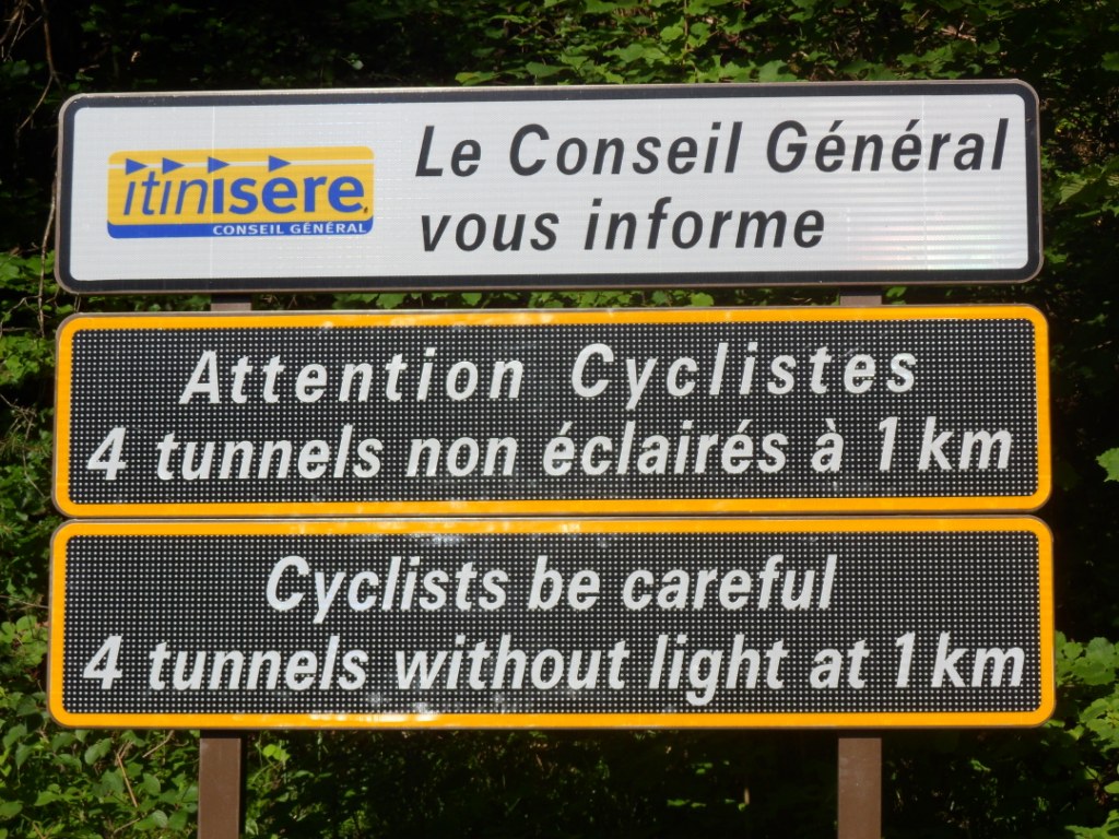
'The' warning
|
| 
'The' road, with nice views
|
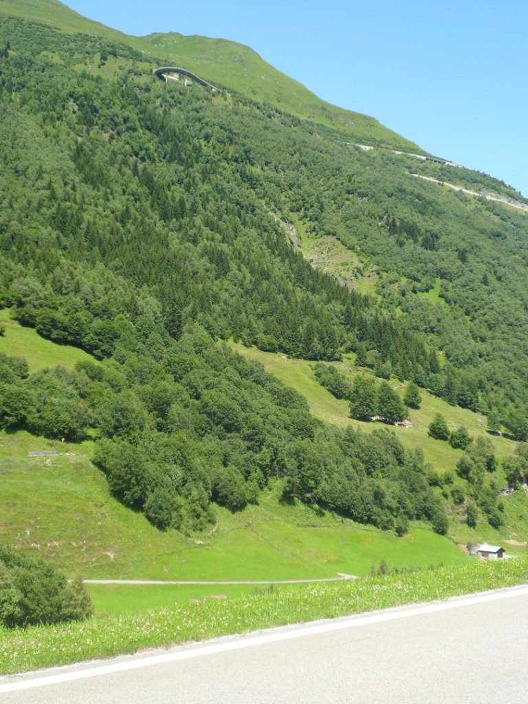
After Villard Notre Dame, the endpoint
of the steep part, the road goes up another 1.5 km, and becomes a gravel
road. It keeps going up and down for a while, there are also camions
around (are
they paving the whole stretch?) and halfway on this upper part I stop
to take in the incredibly nice panorama (and capture it in .jpg format).
At the highest point
(Col de Solude) the road becomes well-paved
again, and the
descent is magnificent, and is continued by the last part of the descent
from the Col d'Ornon, with the by now
well-known view up to the road to Oulles.
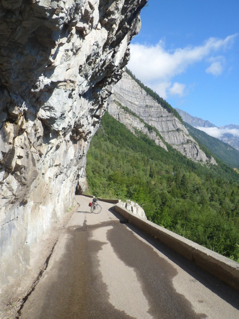
In the afternoon I will 'attack' Alpe d'Huez from the west, but first I
have lunch break in the garden next to the tourist office of Allemont.
In the shade!
The afternoon climb starts with two hairpin bends to come level with the
Lac du Verney, and then a climb of some
nine km of about 7% to Villard Reculas. Nice
views again over the Vallée d'Oisans; I can clearly see the Col de
Solude on the other side, and the first half of
the 'royal' road to l'Alpe d'Huez below.
Same road |
|
Bourg d'Oisans (and l'Alpe d'Huez) seen from around Col de Solude |
Lac du Verney |
|
Bourg d'Oisans seen from Villard Reculas |
After a short descent I come onto this main road, busy with cars and cyclists, of whom for a change I do pass a
few. After a short break at a small
supermarchée in l'Alpe d'Huez
I follow the signs and a few instructions of locals to find the right
way out of this crazy mountain village to the Col de Sarennes. How
quiet
this road is in comparison; it goes up and down for 5 km or so, and then
at the end – with a strong tail wind – I have to go up another 250 m in
3 km.
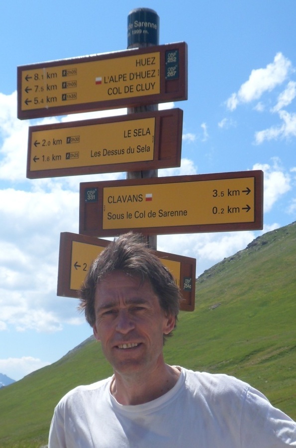
At the col, just under 2000 m |
|
Descent from Col de Sarennes |
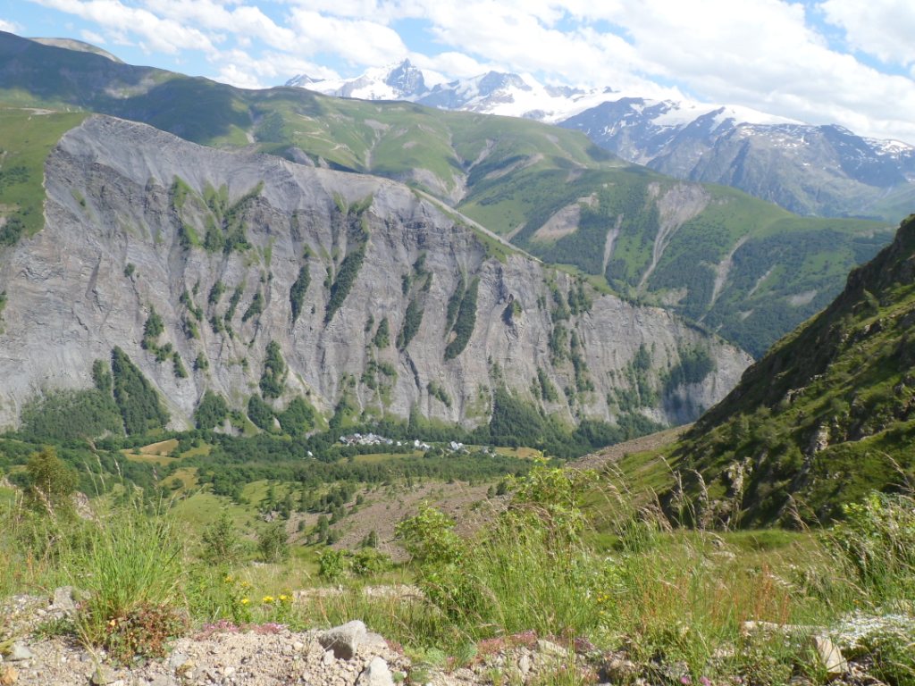
On the other side I find a great panorama again, deep down and far, far
away on this clear day;
I guess I can see the massive of the Meije over there. The climb from
that side looks a lot harder than from the
Alpe d'Huez side.
It doesn't take much time – just a lot of braking – to get to the
Barrage du Chambon. From there another steep km down and at
Freney-en-Oisans I leave the D1091
(I can't get used to these long codes for the roads) for a short break
to have a rest, a drink, and regain energy for the climb to
Auris-en-Oisans to make it a full
Tour d'Oisans. However, during the first (steep) km up I decide it is
better to skip that part, and just take
the easy road (the busy D1091) and have an early arrival 'home';
and an hour of reading on one of the sun beds in the sunny garden of "La
Marmotte de la Meije". Well, before I turn left into Le
Bourg I decide to 'do' the first two bends to l'Alpe d'Huez. On the way
down I set the highest speed of the
trip so far (and about the highest of the whole trip, as far as I have
seen it), i.e. 70 km/h.
I have time for a Leffe but prefer the garden of the gîte. I share the garden/dinner table with a motor couple, my age, from the Haute-Savoie.
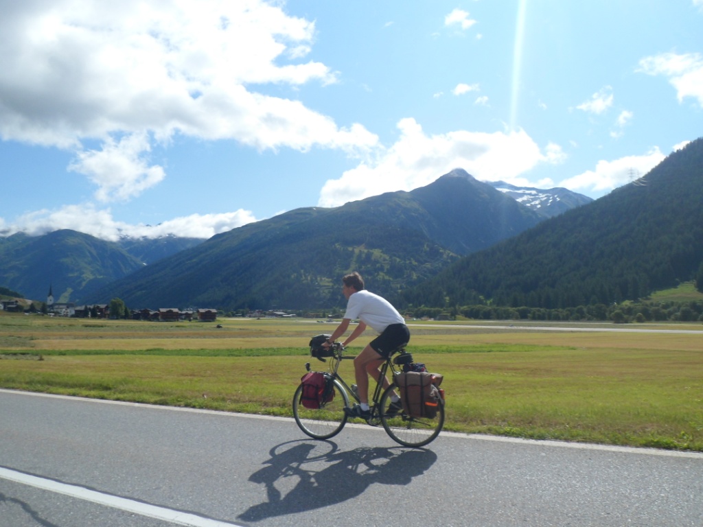
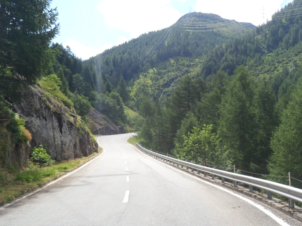
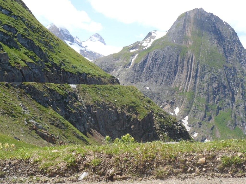
10-07-2012 LE BOURG D'OISANS → LE BOURG D'OISANS, distance 114 km, dénivelée 2900 m
The morning is partly cloudy.
This will be the last day to 'test' myself sans bagage, and of
course enjoy the gorgeous scenery around Le
Bourg d'Oisans. The real (and new) test comes first and is called Col du
Sabot and is ranked the hardest but two on my to-do-list for these
seventeen days.
First an easy hour to Verney to warm up. Turning right at the end of the
Lac du Verney (onto the Chemin du
Col du Sabot ;-) it goes up steeply to La
Villette, 2 km after Vaujany. This part
I've done before, in 1999; then I didn't continue, partly because someone told me the condition of the road was very
bad. This time I take a short rest before trying this second (larger) half with an average of 9% (and no peaks
much higher). It is hard, but I do not get out of breath and make it to the top
without a foot on the ground. From the pass a footpath goes up a little further and leads to a spot with VERY nice
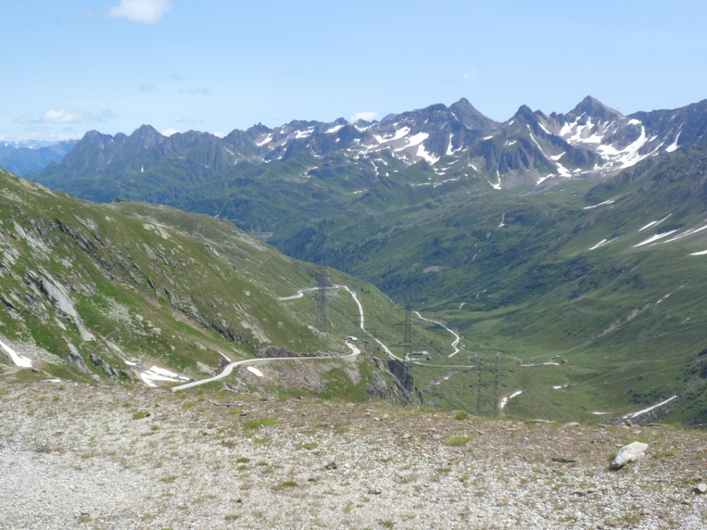
views back to the Oisans valley and down to the Lac and Barrage de Grand Maison, and even onto the Col du Glandon!
View from Col du Sabot to the north (Glandon, a.o)
|
|
View from Col du Sabot to the south
|
Descent from Col du Sabot |
The descent is mostly tiring for my hands. In Vaujany I cannot find a
boulangerie and in Le Villette not a single restaurant. I dare take a seat at a picnic table at one of the
huge chalets on the shore (beautifully located
indeed). Oops, the owner gets out; fortunately it isn't a Frenchman (for some French people propriété privée
is a big thing), so I can stay where I am.
I promise myself a sandwich or something – I have almost run out of food
– in Le Rivier d'Allemont, right after the steepest part of the second
climb of the
day, to the 'good old' Col de la Croix-de-Fer.
In fact, this part is not even as steep as the average grade of the
Sabot! I guess I choose the wrong restaurant,
they have only one kind of sandwich – rather a poor kind – but they have
cold coca cola, and don't overcharge me for it. The rest, irregular as
it is,
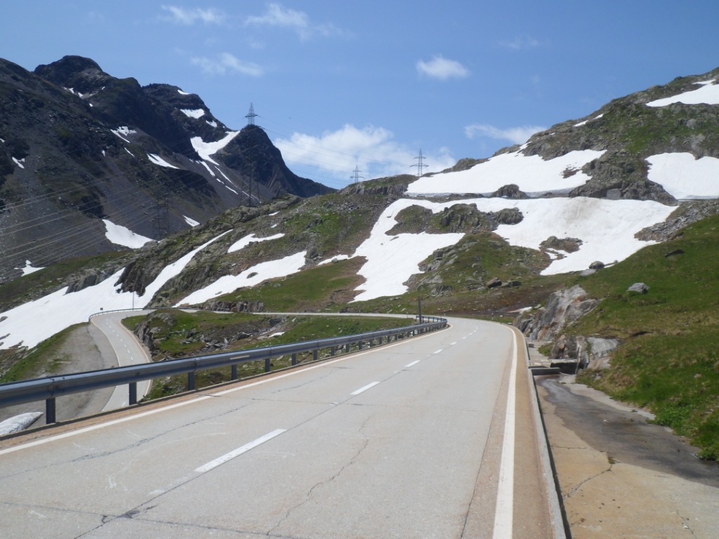
I know it quite well and I thoroughly enjoy it. Between the Glandon and
the Croix-de-Fer the roadside is crammed with British cars and (mostly)
motor homes
and caravans:
the next day the Tour will pass over this road (and two English,
Wiggins and Froome, are leading the classement général). Also a lot of cyclists there!
I make a few pictures of the other (i.e. east) side – indeed copies of earlier years – and on the way back/down I make the small sidestep
to the Col du Glandon, where they are also making
preparations for the oncoming Tour.
View from Croix-de-Fer
|
|
View over Lac de Grand-Maison
|
Another view over Lac de Grand-Maison
|
|
Me before the Barrage de Grand-Maison
|
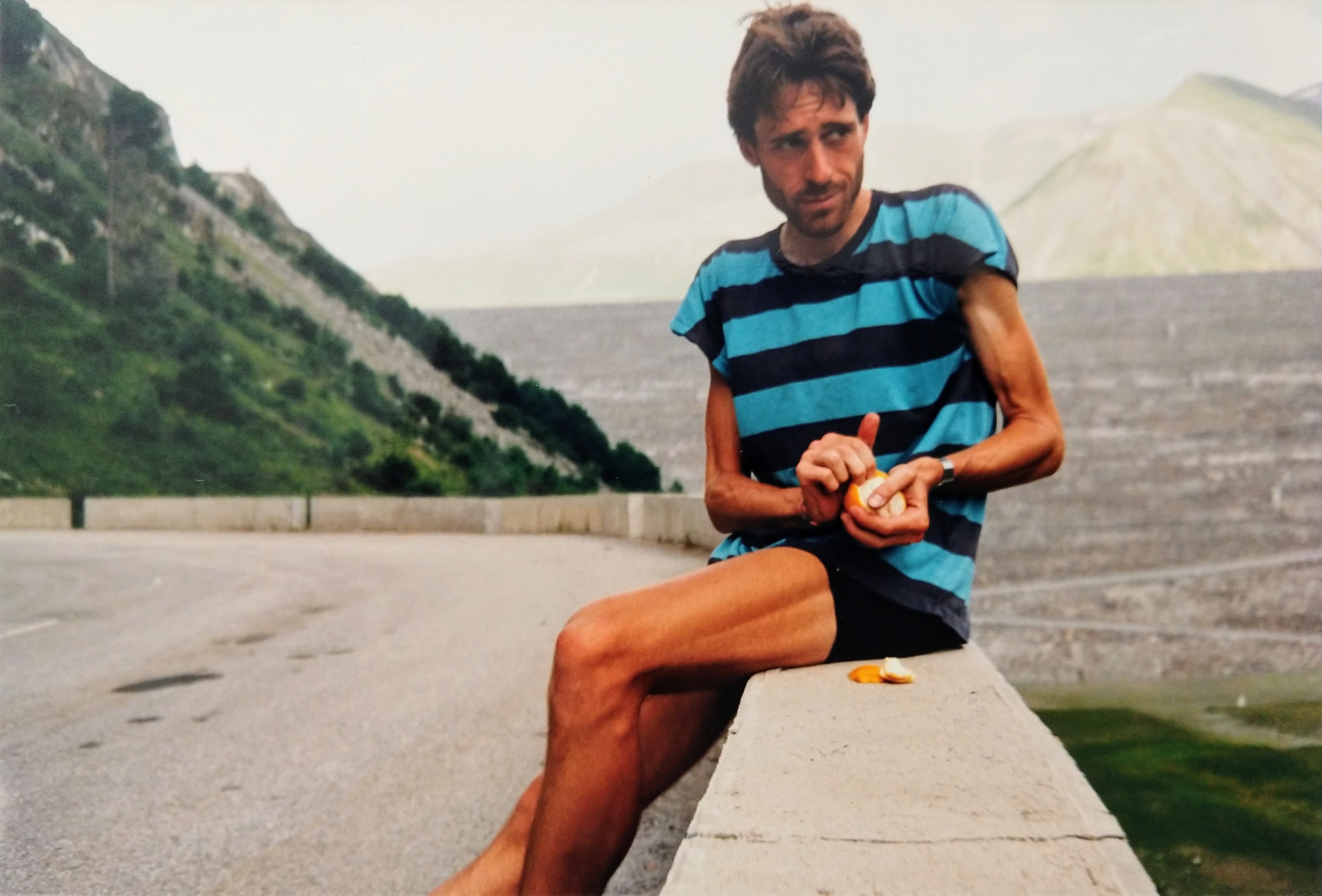
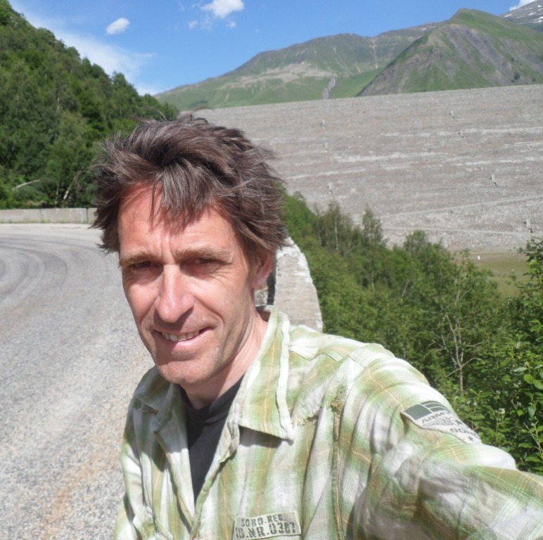
26 (!) years earlier ....
|
And then the nice descent for the umpteenth (sixth?) time, along the
lake, a déjŕ-vu picture of myself with the
dam in the background, into the forest, around the collapsed mountain,
and the steep, almost straight part down to the lower lake. Nice!
From Allemont back to the Romanche I have to struggle against a strong
head wind, which much to my surprise becomes a tail wind after I have
turned left at
Rochetaillée. Time enough for a Leffe in a café in Le Bourg, and still
time for forty pages of my catchy ladies novel. Owing to the wind (and
thunderstorms
later) dinner is inside tonight, and we are with seven people, six of which French,
which makes it much harder for this Dutchman to follow the conversation. Before I go to
sleep I ask for an
earlier breakfast because of the rather demanding stage tomorrow.
Notwithstanding the thunderstorms I sleep – again – really well.
11-07-2012 LE BOURG D'OISANS → LANSLEBOURG, distance 128 km, dénivelée 2700 m
Alas, the owner of the gîte isn't there at the appointed time;
luckily he arrives not much later.
It has however been a very nice place to stay three nights.
The weather forecast is good, but in the morning clouds fill the valley.
After seven flat kms the road starts getting up after Le Clapier and I
gain some 250
meters till the Barrage du Champion. Along the lake the road is almost
even, the clouds clear away, the road is much quieter than I had feared,
the scenery is
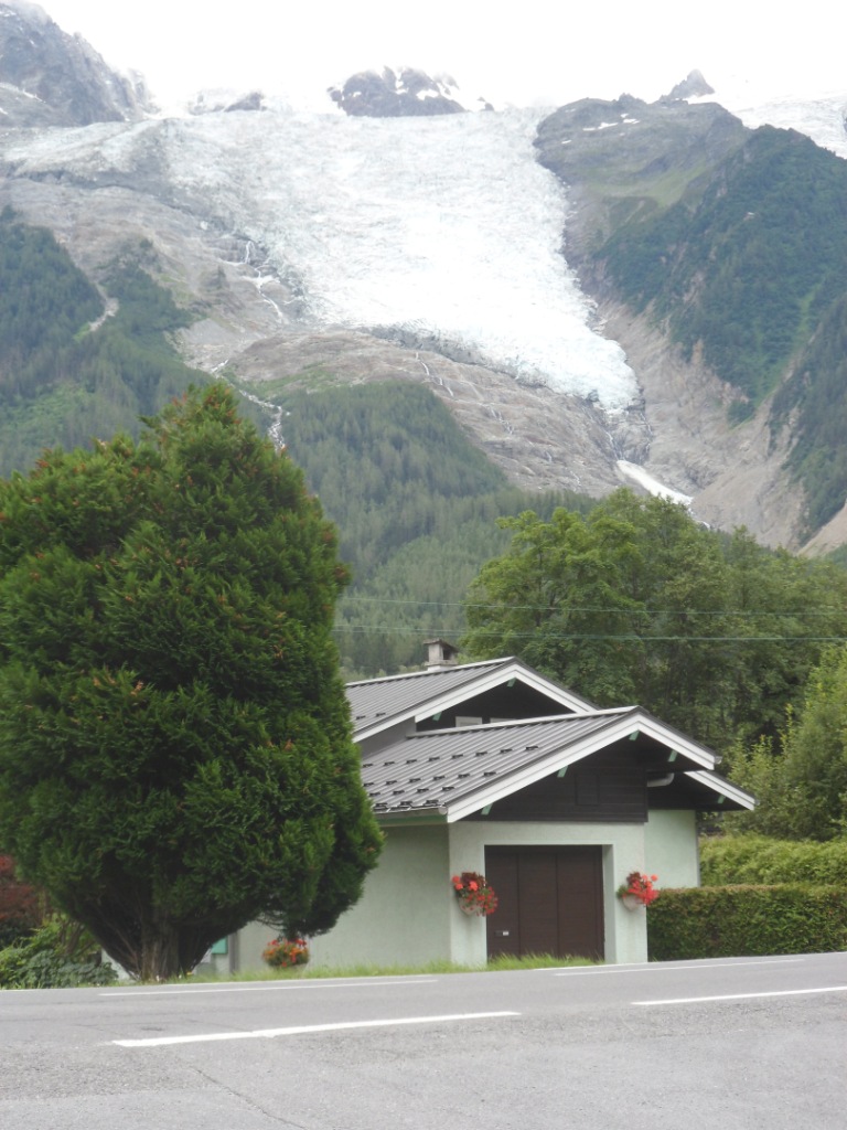
gorgeous; what a nice, sunny morning! In La Grave I buy a headlamp for
the tunnel on the road to the Col du Sanetsch; the views up to the
Meijer glacier in the
south are spectacular; the slope remains easy going all the time till
the Col du
Lautaret.
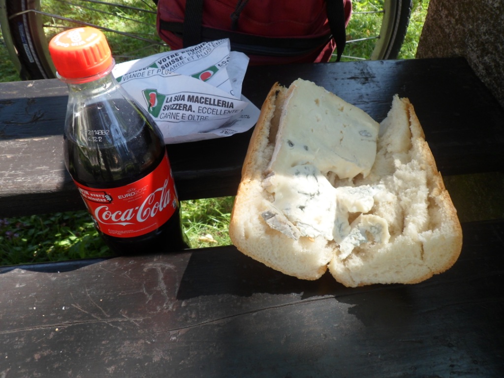
Time for a (windy) break, with coffee and bread and cheese.
Misty morning (and heavily loaded bike)
|
|
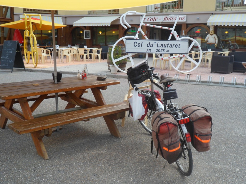
At the Col du Lautaret
|
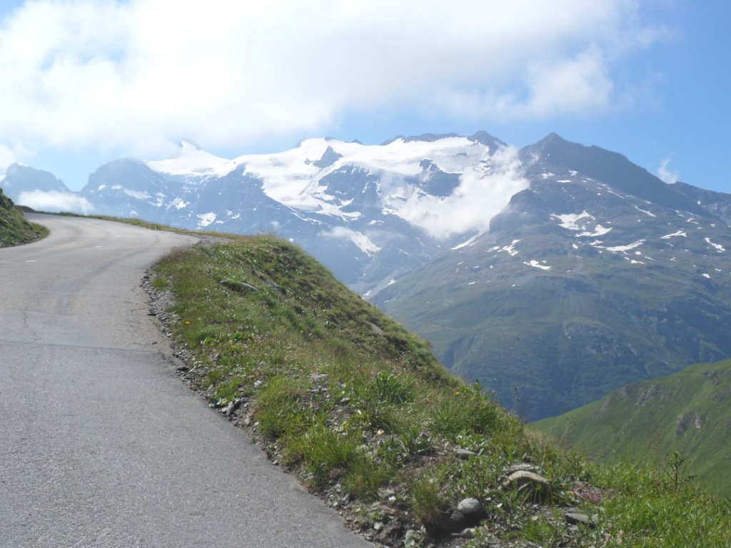
Clear view onto the Meije glacier (slight abuse of chronological order) |
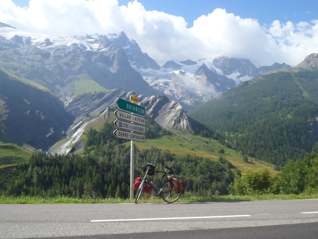
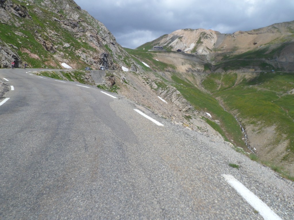
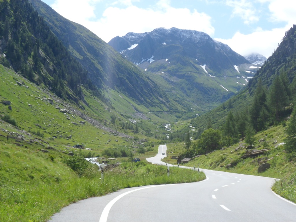
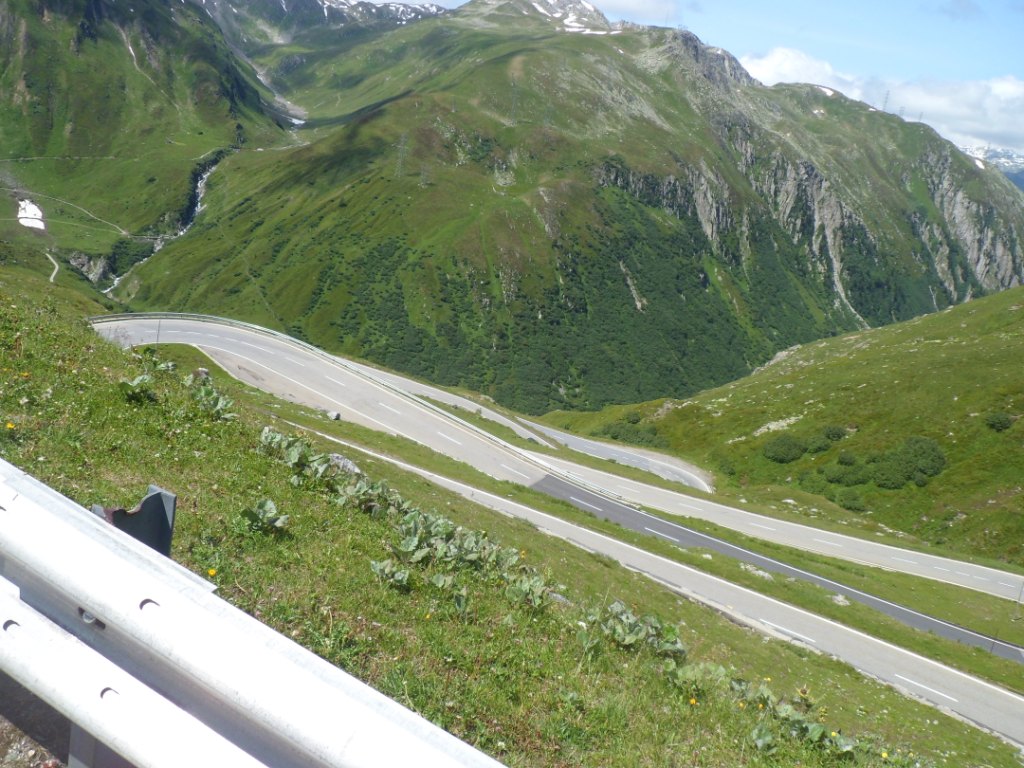
Next the steepest phase to the Galibier, but apart from the last km –
when I'm at the end of a 40 km climb – not very difficult – I start
making pictures
while cycling (at less than 10 km/h). With the top in view, that last
km is also easily managed. On the pass I have a chat with a Dutch ('Alpe
d'HuZes') girl waiting
for a friend (possibly also her father; when he arrives I remember having
started from the Lautaret shortly after him). During the descent a few
(more) pictures
(the first since 1996, before digital photography) of the great
environment – not so many, because now I do have to
stop (brake!) to make them.
In Valloire it is warm, and so are the few climbing kms to the Col du
Télégraphe. The descent from this pass,
through the pine forest, is not very spectacular, but fun nevertheless,
rather easy going,
since most curves are smooth. I can already see the straight A43 going
east along the Arc.
Not far from the Col du Galibier
|
|
Not long after the Col du Galibier
|
A little further down
|
|
Hairpins around Plan Lachat
|
Descent from Col du Télégraphe
(deep down: St.-Michel-de-M.) |
|
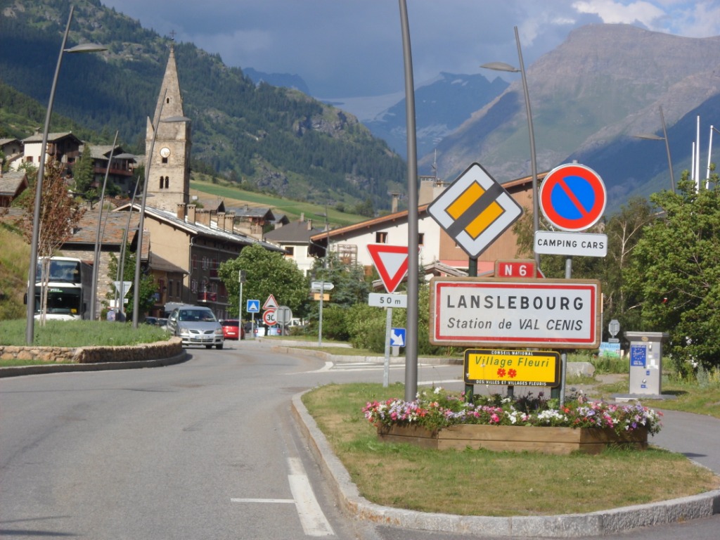
'Good-old' Lanslebourg
|
In St.Maurice-de-Maurienne I'm back on the level of Le Bourg d'Oisans
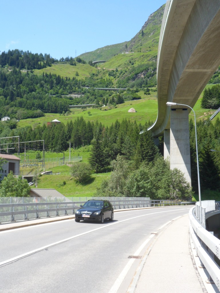
and have to go up almost 700 meters again. With a look at the time I decide to postpone the next ravitaillement till Modane. Now that the A43 is open (since
some time between 1996 and 2012), the (old) D-road is not quite so bad anymore.
|
It is warm though, today, and the
countdown till Modane stops one village
earlier, when I spot an intermarchée of some sort.
I devour the
newly purchased eatables and drinkables on a
little warm place/playground in Fourneaux.
After Modane the scenery becomes nicer (most traffic has disappeared
into the Tunnel du Fréjus), and the road goes up a little steeper for a
while.
Also I
fear I'll need my raincoat for the first time, but the short shower
right after Termignon, during the second steeper part, is just
refreshing on this warm
afternoon.
The last – down going – kilometers till the 'good old' youth hostel in
Lanslebourg (I stayed there in '86,
'87, '89, '94, '96 and 2001) the sky
already clears again. It feels like being in Lanslebourg for the first
time; I cannot remember anything!
The only thing I remember about the location of
the youth hostel is that you could clearly hear the Arc – but that is
not much help. It appears that the youth hostel
lies more in Lanslevillard than in Lanslebourg, not far from the start
of the climb to the Mont-Cénis.
Well, when I finally get there (after asking directions three times!)
something comes back. Like in Le Vert the
staff is not the same as it used to be, but the old mčre et pčre aubergiste drop by for an apéritif. It's a shame there are so few guests. Dinner is great:
chicken curry and tart aux ... pommes (I think). I share a four-bedded room with a German (a former politician for the communist party) and an Italian
(who only speaks Italian, and of whom I only get to see the head).
|
|
|  |
|
12-07-2012 LANSLEBOURG → MOLLIESOULAZ, distance 133 km, dénivelée 2900 m
Today another test – almost every day is a test! – with two climbs of more than 1000 m up.
At breakfast (alas, as late as 8 o'clock; in former years I would have
been better prepared better and have made my own!) I'm joined by the friendly 'politician',
who hasn't had many holidays during his career, always on the road to win new souls, and who now is doing a bit of cycling
on his e-bike. Today he wants to see the Tour de France pass by. When I leave the youth hostel (for the last time ever?)
the mountains are in the clouds, but the road is already in the
sun, and during the first hours it will only get better. Right from Lanslevillard I meet the first climb of some six
km to a (not 'the') Col de la Madeleine. Everything
looks perfect, which I try to capture in two pictures from the 'top'.
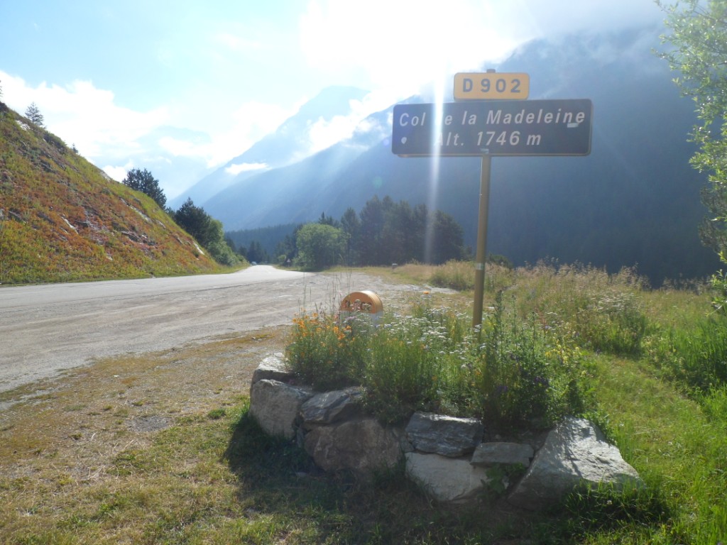
'A' Col de la Madeleine |
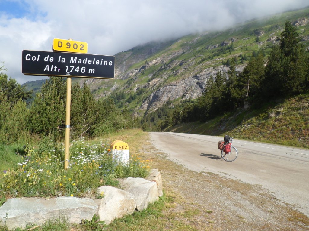
Same spot, looking backwards |
Follows an even stretch till Bonneval-sur-Arc with
during the last kms a nice view high up to the
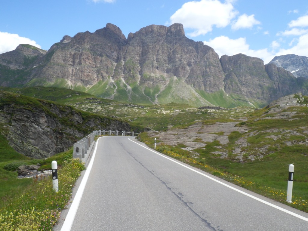
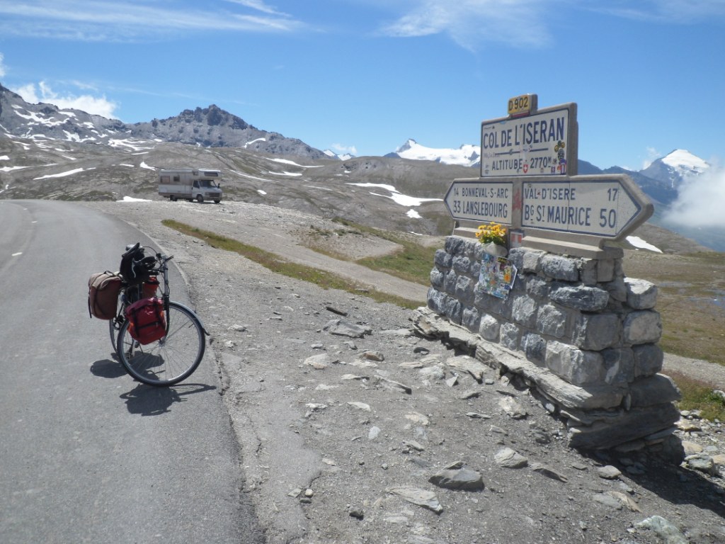
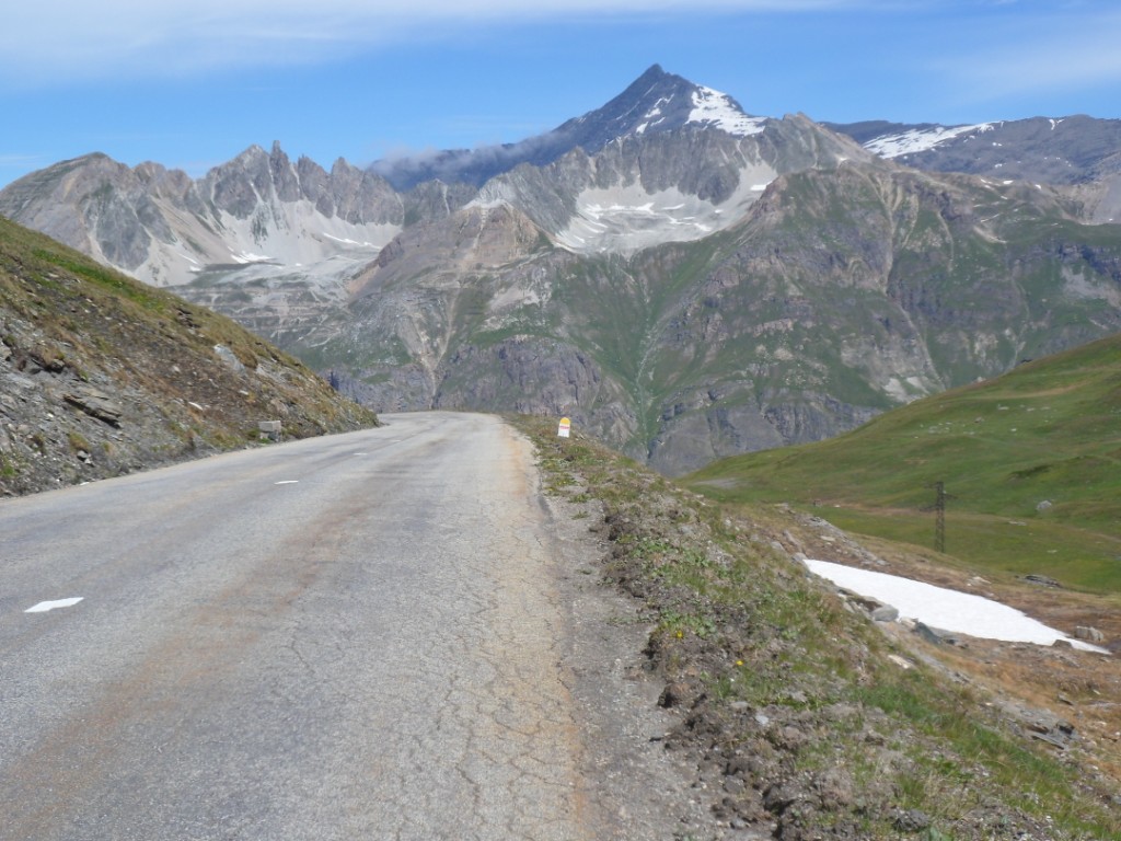
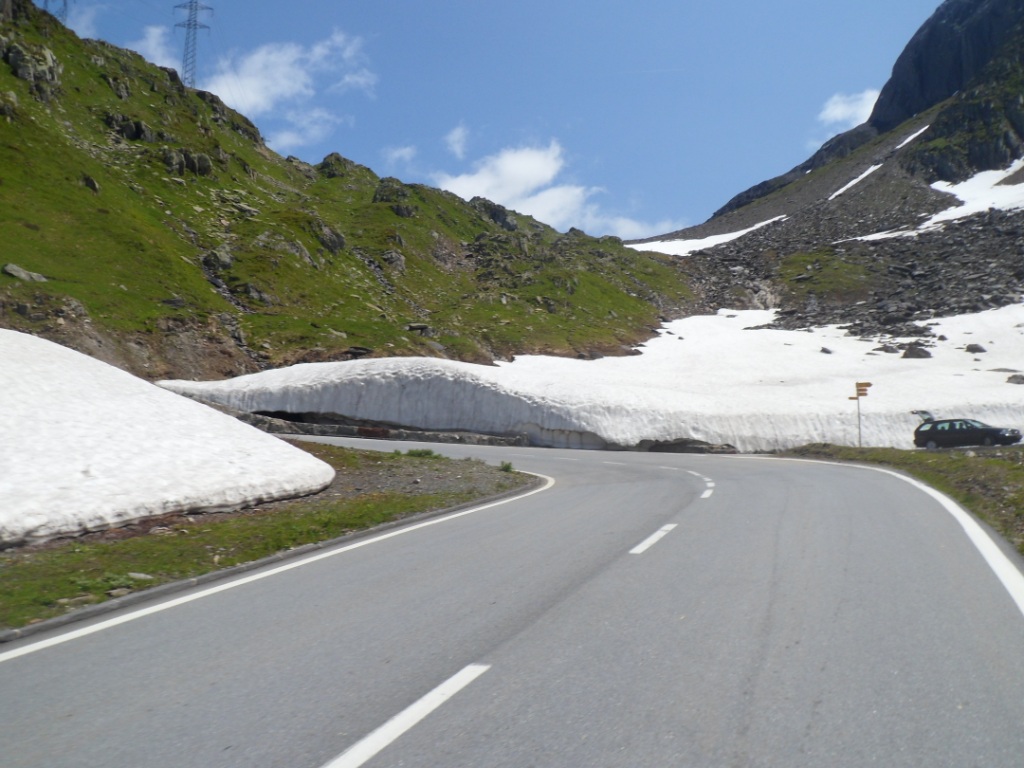
first hairpin bend. A little before Bonneval the countdown to the Col de l'Iséran starts: 13 km (alt: 1795 m).
At the first hairpin bend I take a last short stop to take in the nice views and a few photographs. From there I
creep up slowly – more slowly than before – enjoying the beautiful environment and finally
after a last (steepest) km of 10% reach the top.
Around de Col de l'Iséran
Beautiful morning; rather quiet road
|
The Arc on the way to Bonneval
|
Panorama over Bonneval
|
Not long before the Col de l'Iséran
|
Le toit de cet expédition
|
Shortly after the Col de l'Iséran
|
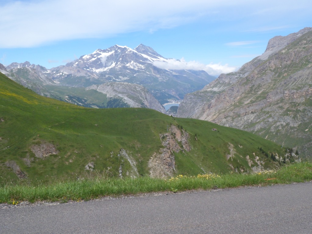
View down onto Lac de Chévril |
About the same view zoomed in onto Val d'Isere |
I put on two extra layers, as there is quite a cool wind up there, and in the refuge/shop have a coke.
During the descent I am amazed to see so many quite young oncoming cyclists.
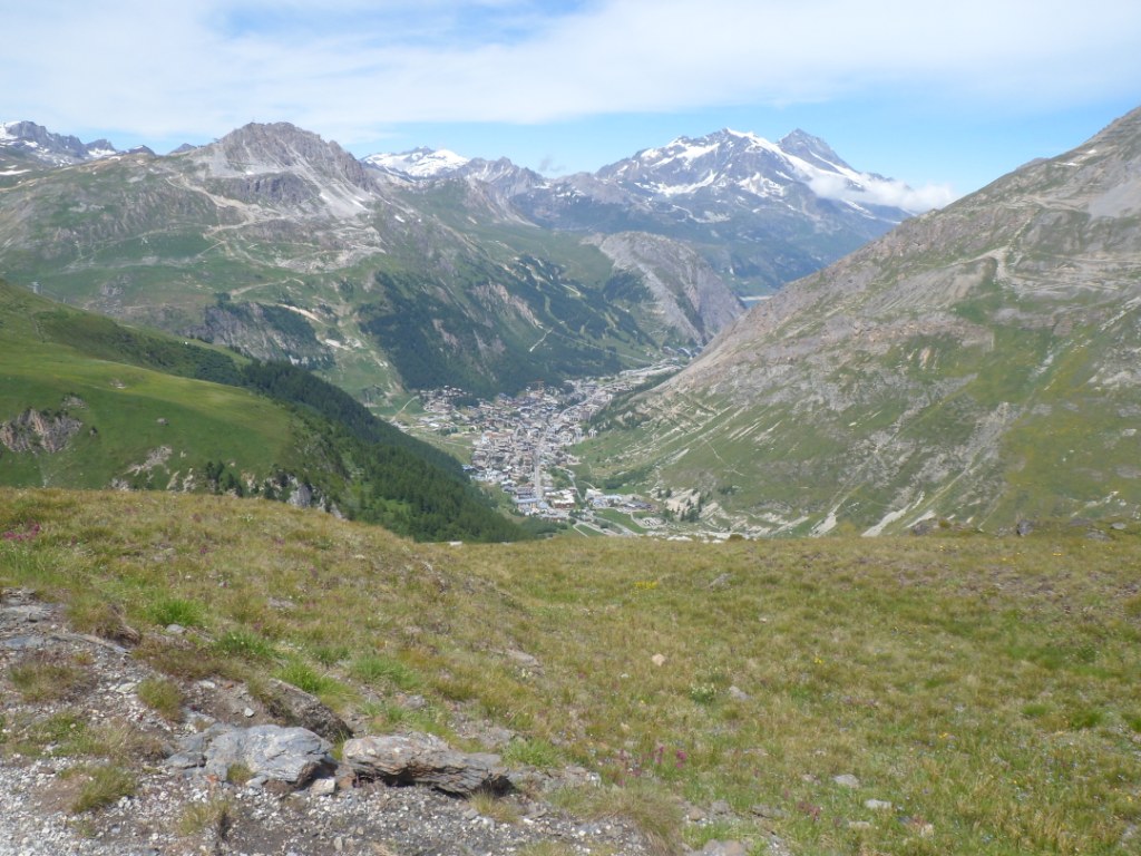
Val d'Isčre as it first comes into view is nice, but when I get there I find it's not my
favorite town. However, I'm the last customer before lunch break in a Casino supermarchée and have lunch
on a sunny pelouse, so today I'm quite happy there. Warmed up I descend further
through the many (ouch!) tunnels along the lake (Lac de Chévril), and descend deeper and faster to
Ste-Foy-en-Tarentaise, to Séez and – hardly down anymore – to busy/warm Bourg
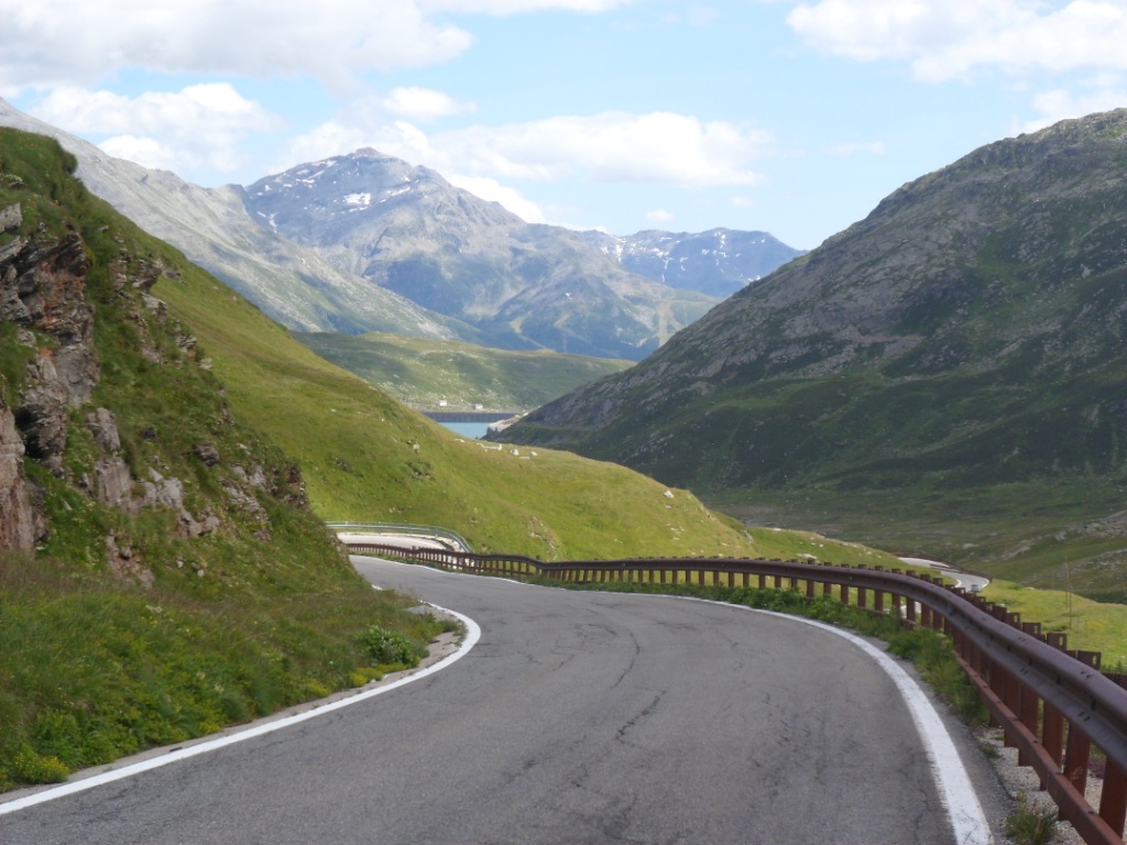
Saint-Maurice. After I've found the right track to the Cormet de Roselend I have my
water bottle filled in a restaurant and fill me up with the remainder of
the purchases from Val d'Isčre. From here to the pass: 19 km. The start is easy, 4-7 %, then a first steeper part with many lacets (not nice in the descent,
as I remember). I ride up in high spirits; I do feel at home here! The road flattens off, there's a nice view to
the right into the Vallée des Glaciers,
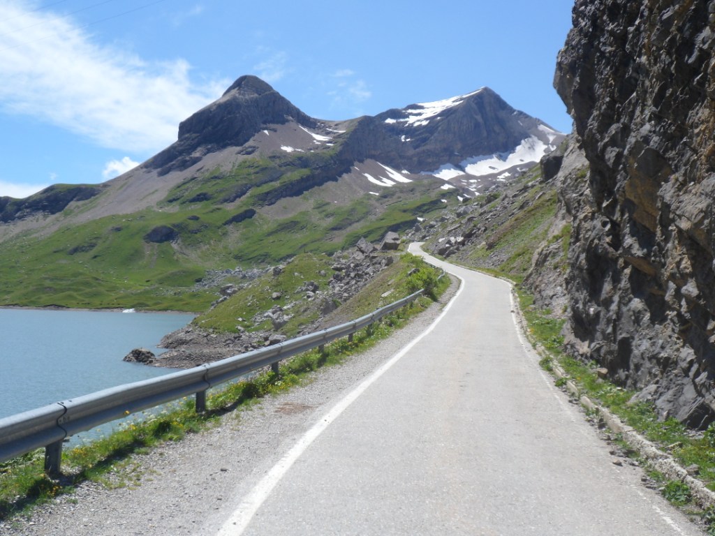
the road gets steeper and the wind also makes it hard work to get to the pass, for the tenth time ever!
Self portrait while riding
|
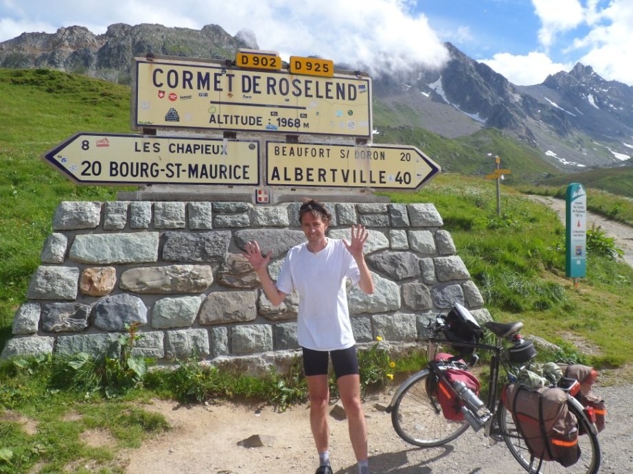
Back 'home'
|
Shortly after Cormet de Roselend |
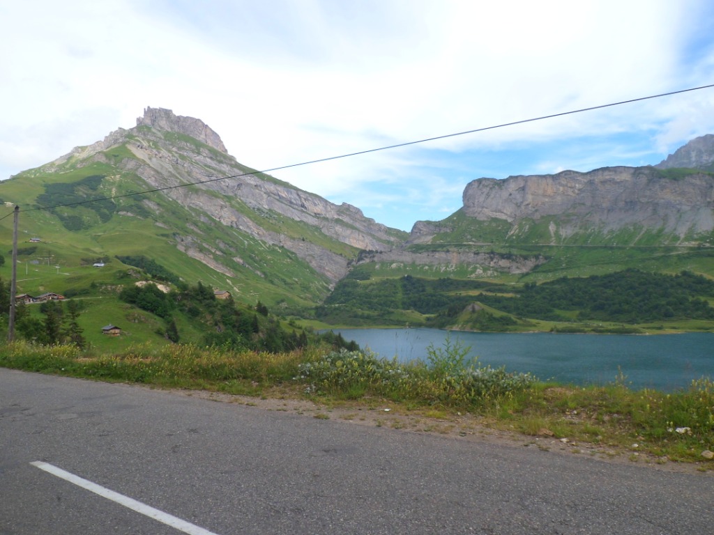
Lac de Roselend again |
Not much time to celebrate this 'historic' event –
also there's neither shop nor restaurant around – but the descent to
Beaufort-sur-Doron is quite a treat too! It would be nice to go around
the whole lake
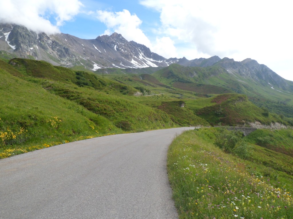
once – walking that should be, I guess. From the Col du Méraillet it is a
delicious ride, good bends, good road surface, no villages, perfect!
I had hoped to be in Beaufort at six (due to the late start), and I
arrive half an hour before schedule.
|
So I have time for a beer! What rests is 9 km
slightly downhill along the Doron, and 5 km up to Molliesoullaz.
Quite severely up, and also a bit longer as the gîte appears to be situated above the village.
However, today's
distance ends up exactly as I measured it using Google maps at home.
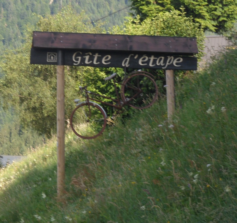
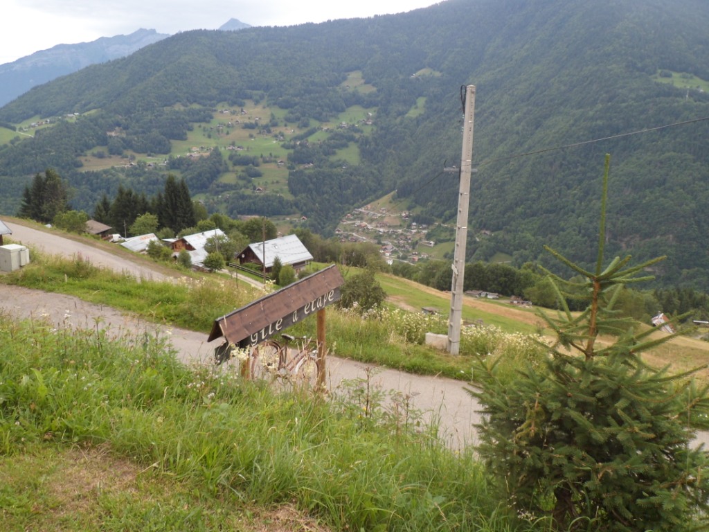
I have quite had it when eventually I reach the (hanging bicycle) sign of the gîte
(and don't miss on the right/north a nice view onto the Mont Blanc!). Albeit the
bicycle sign the gîte is quite full with randonneurs ŕ pied, I'm the only one of a different species.
Dinner is quite lively, apart from the young lady
whom I end up face to face with – but it seems that she is suffering from a severe sore throat.
The dormitory is quite lively as well. I'm not bothered by
the sounds of sleeping people and sleep wonderfully myself.
I'm not the only one who goes to bed early; eleven or so others join me.
|
|  |
|
13-07-2012 MOLLIESOULAZ → SION, distance 157 km, dénivelée 1900 m
|
 |
Today the longest stage of the whole trip, and the only one without a 'first category' climb.
I start together with the couple that will take the sick girl to a doctor. The Mont Blanc is hidden in/behind the
clouds. For six km we stay close, and as at the junction with the D925 they
hesitate which direction to take, I overtake them and turn left, and then right after 2 km to start the appetizer of
the day,
the (small) Col de la Forclaz. A short, steep, nice climb, a little rain, and a steep descent over a tiny road through
the woods. This day I have feared because of the large sections over busy roads,
mainly around Chamonix (I vaguely remember some trouble there, very vaguely, as I was there only once,
in 1986.) The D1212 is not a nice road indeed; it is busy, and it also seems going up all the time –
and I have such a long distance to cover still! Indeed,
it's about 700 meters up from Ugine to Mégčve, where I have a stop on the pavement in front of a supermarchée,
and because of that miss most of the (little)
rain today. Follows a descent to St.-Gervais-les-Bains, which I had
first hoped to reach via the Col du Joly, before people talked me out of
that.
|
The (first)
glacier of the Mont-Blanc I set my eyes on is rather gray, but then, it
is also rather a gray morning. First I take a wrong turn, and then,
following the signs for Chamonix I'm led to a highway with a 'no cycling' sign – I've missed the
inconspicuous sign for the cyclists' alternative, an alternative that
holds some unexpected (and unwanted!) extra work: first I have to climb to Servoz,
and when – halfway between St.-Gervais
and Chamonix – I get down to the N205 I have to
cross it and go (severely) up again to Vaudagne. I curse the mayors of St.-Gervais
and Chamonix (compose an angry letter to them
in my head).
Descent from Col de la Forclaz |
End of the fun |
Chamonix and one of the glaciers above |
When I finally reach Chamonix and a good-looking restaurant (well, the
plates look good – and from the terrace
there's also a nice view onto another glacier) the kitchen is already
closed. Further on there are many alternatives from which I don't choose
the quick one
(Turkish pizza) but the one with the soft chairs (and the tandoori
chicken menu of the day).
It's past three when I mount my bike again; at least half an hour
behind my (worst) schedule, with 70 km to go to Sion, and the
Col de la Forclaz in between. Well, that one is not so hard (the
elevation gain is only 500 m). The first
phase, till the Col des Montets offers hardly any difficulty; the wind also helps.
When, after the Swiss boundary, the road turns south-east I have to work
harder, especially the last 2 km to the ('big') Col de la Forclaz. I don't consult my watch, do make a self-portrait with the col sign, and speed
down. What a descent! In '86 from Martigny
I remember it was quite an exercise - that was the étape till La Clusaz where a met my cycling mate Art (who alas couldn't arrange to fly over from
Minnesota to join me): long straight stretches, steep!, especially the final part through the Rhône vineyards.
Rushing down I set my highest speed of the trip: 72 km/h (at least!).
Another glacier |
View onto Martigny |
In Martigny
a church clock tells me it is (only) 5:30 p.m. I am very lucky with the
wind too, or rather, with the gale,
coming from the west. Halfway I have my first
encounter with a Swiss: an apricot seller at a fruit stall. He doesn't
want to sell me less than one kilogram; how stupid! The Swiss are really
not my friends!
(Of course I only mean some of the Swiss I've met during two or three
holidays!) After this trying day even with this favorable storm the
last 30 km take me
75 minutes to get to the youth hostel, which is rather easily found,
next to the railway station. I have made the bookings for
my four nights in Switzerland (all in youth hostels) from
home (as I didn't want to get confronted with sky high hotel prices). It
looks like I have a room of my own, but after
I have done some shopping and have made me some
dinner in the quite busy salle de séjour – which borders on a garden – the other three beds are occupied as well by two small children and their Dad (Mum
and one or more children are in another room, I learn later). There is an opportunity to go onto the Internet, but why should I.
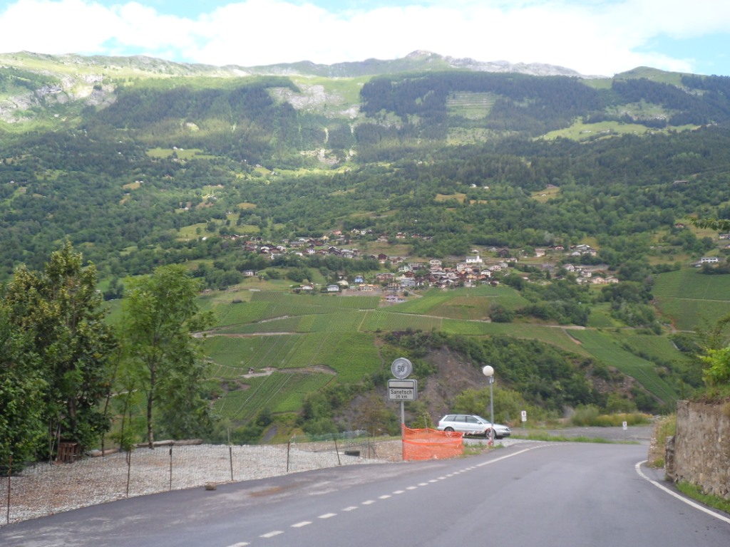
14-07-2012 SION → SION, distance 70 km, dénivelée 2000 m
Last evening + last night it rained; this morning it still has the
tendency to rain. The program for today is overloaded, with two hors catégorie climbs.
I decide I'll try the Col du Sanetsch, the
higher of the two (with 1750m up the hardest
classified after the Mortirolo), or, in fact, just see how far I can
come.
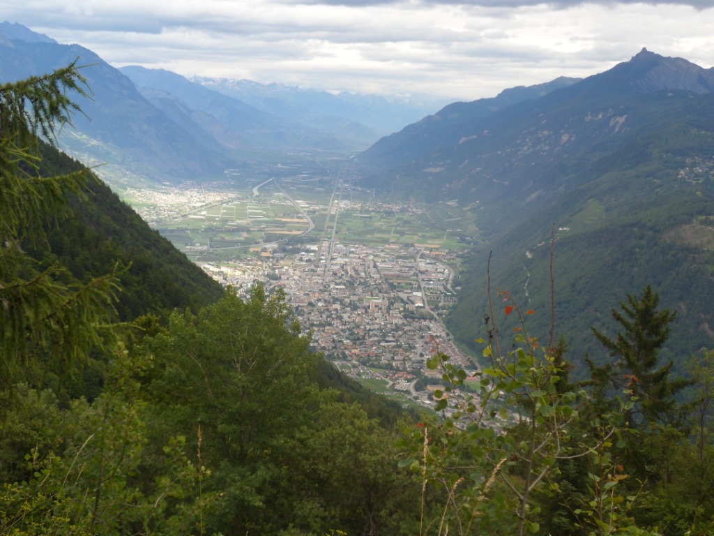
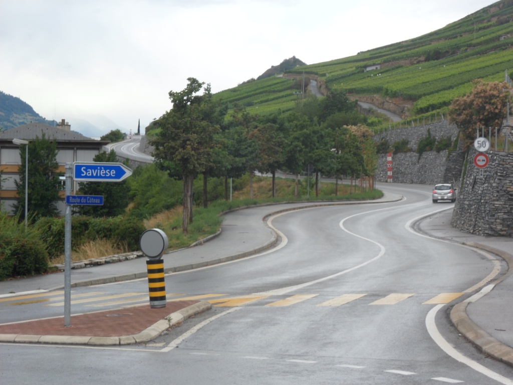
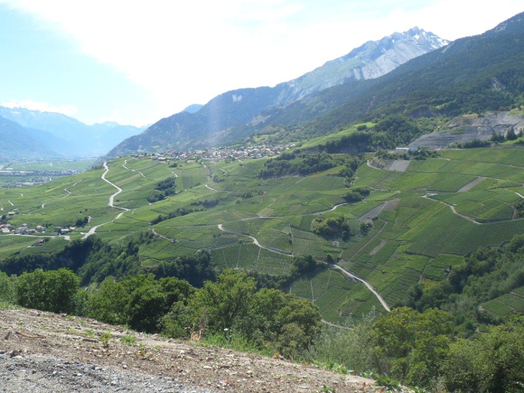
Looking back I can say this is one of the nicest days. The road is
still wet when I try to find the right way out of Sion, i.e. the road to
Savičse. This road looks a bit like the descent to Martigny: the slopes
surrounding
the Rhône valley are quite steep, and below a certain altitude they are
filled with vinyeards. The road to Savičse goes up like 6-7% I should
guess. The road
is still wet and in fact I'm amazed I stay dry during the first hour;
the clouds do seem to break open though. I pass several villages, none
of which is
called Savičse.
|
The start |
|
The sky clears! |
| 
Still 'only' 26 (?) km to the top |
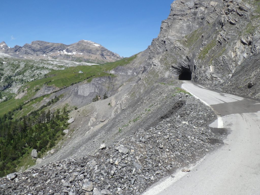
In Chandolin I choose the Route du
Belvédčre because that's the one that goes up most. Wrong idea, a bit
stupid also, since the other road is called
Route du Sanetsch, and to my surprise
– I'm not that well informed – it starts with a descent. It goes down until a
tunnel – not the one for which I bought the head light – and then the
long climb starts – (another) 20 km with an
average of about 7.5%. – It starts off quite rude! No risk of rain anymore,
time is on my side too. It's hard work but it's absolutely fun! Michelin indicates
there's a stretch of 15%, which I get by without stops (nor photographs). I pass several
colourful restaurants and every now and then a bus stop – the Swiss Postbus system
is amazing.
When I get above the trees there's a part with cascades on all
sides, and I get higher and higher (without taking any drugs!). When I take a rest two hikers ask me
about the route they have to take; how would I know? The environment gets
empty and
rude, for THE tunnel I put on my head light – afterwards it wasn't
really that necessary – and I can't stop making photos.
What a great road!
Rough ride up |
|
Shortly before the 15% part |
First cascade from afar
|
|
Another cascade from nearby
|
GLORIOUS ride up!
|
|
During a short break
|
|
|
|
'The' tunnel |
|
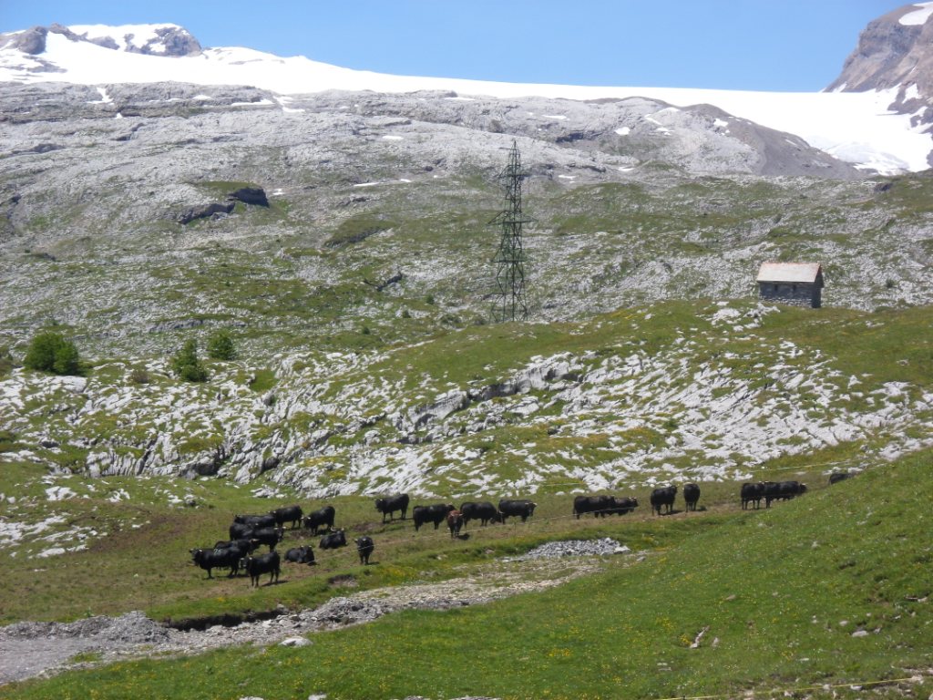
The cows are black, the end is near |
And finally I reach the highest point. The col sign is the bus stop.
Having skipped the other climb, I have decided I will continue till the Lac de Sénin, 4 km further (and 200 m lower);
time is on my side today.
Between the col and the lake |
At the lake |
Between the lake and the col |
So the way back starts with another climb. And then a dazzling long
descent with terrific views. I come across the two hikers of the way up
and they inform
me that the white peaks I see clearly in the south (on the other side of
the Rhone valley) – of which I have taken several pictures, one with a
Postbus in front, another one with a Swiss cow –
are the ''Dame Blanche'' and the Matterhorn. One of the guys is from
Savičse; how come he didn't know his way? (Back 'home' I see on the map
that it is the Dent Blanche.☺)
One of the tunnels
|
EXHILARATING |
|
Dent Blanche + Matterhorn
|
DESCENT |
FROM COL DU SANETSCH |
After the cascades I quit making pictures,
but of course keep taking in the gorgeous scenery. The Rhône valley with
its vineyards comes into view, Sion, the road to the Barrage de Grande
Dixence (the other challenge for today, now still on my
to-climb-list ☹). Not before I'm back in room 23 do I have a look at the time: 4:30
p.m. My original plan had been way too ambitious. I discover that
after my gloves (Col de Morte), hair gel (Bourg d'Oisans) I have also lost my
red T-shirt (probably in Lanslebourg). I have a late lunch in the
garden, walk over to a woman whom I saw arriving on her bike, but no, she'd
rather relax (with her iPhone or other device – and she's not the only
one that is claimed by his or her electronic device whatever. So sad!). I call my
youngest daughter who will be off for two weeks of youth camps, and I am
under the spell
of my book. Coming back in room 23 – to lie down with a book – I notice
it is crammed with three heavily
loaded Scottish mountaineers, just descended from the environment of the
Matterhorn – bad weather
in the morning – and flying home tomorrow. They seem nice,
so I try to invite myself for dinner with them, to which they agree.
Dinner is nice indeed, with very varied live music, easy conversation
and incredibly
expensive pizzas. Afterwards on the way back a beer in a pub – it's
their last night (and I suppose they haven't seen many pubs during their
stay high up).
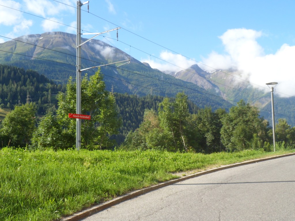
15-07-2012 SION → FIESCH, distance 125 km, dénivelée 1750 m
|
The good weather is back, I notice when I have an early breakfast (no signs of the Scots).
This is supposed to be an easy stage, with only one climb, which I
hope to do 'without luggage', so maybe there'll be time for a swim in the youth hostel/Ferienzentrum.
However, I know, never underestimate an étape!
The wind/storm is the same as two days ago, with which I am very fortunate indeed.
I fear another crazy detour when I have to get off the main road, but that
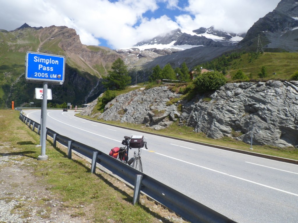
is only for two km or so, and obviously because of a tunnel. The 56 km till Brig are thus easily covered.
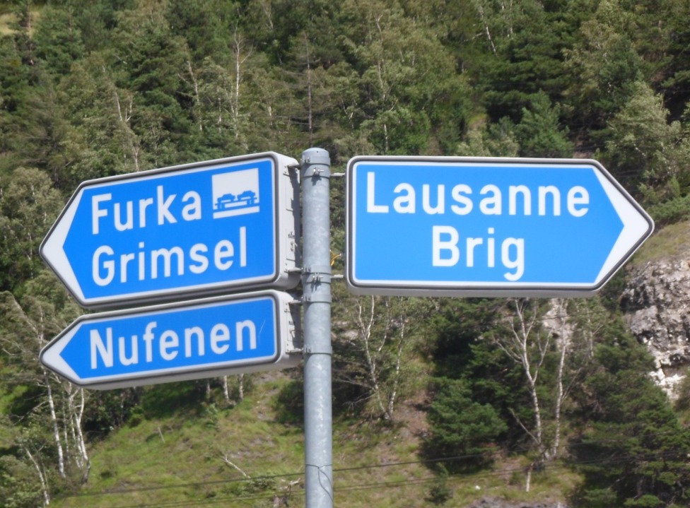
I like the blue signs with the big names; Furka,
Simplon, Nufenen, ..., sometimes for the pass, sometimes for a tunnel.
Expensive shopping in Visp – I can't remember anything of the village which I passed
twice in 1988. Shortly before Brig the road becomes a freeway.
I have to stay away from it and I hope I get on
the right track up to the Simplon Pass (and that I'm not going up rather steeply and find out I took the wrong turn).
|
Vinyards along the Rhône
|
Where to leave part of my freight,
that’s the question (I have to be sure to find it back easily, and I
know myself). I decide I'll drop it at
the village Hazel, just after the point where I will be back on the main
road (which
must be open for cyclists then, mustn't it?!), but this road passes the
village on a higher level, so that's not an option. I notice a
house/hut, carry my bike over the
guard rail and hesitate: there is a car, but there seems not to be any
living soul around. Anyway, I don't want to carry my entire luggage
another 1300m up, so
I stow away two panniers in an inconspicuous corner in the garden. An
oncoming biker, who apparently knows the area,
advises me to take the old road – the 'new' road does feel like a
freeway indeed – and I start following his advice,
which feels nice, until it starts descending, descending. This descending goes on
too long to feel right, so I turn around and carry my bike
back over the guard
rail. The main road is more or less a long viaduct as it stands out from
the mountain side. Until the first bend the wind is not so favorable,
but the slope
is okay. And stays okay the whole way. I pass a beautiful high bridge
(where it takes trouble to keep to the right
side of the road because of the wind). The last part is
less interesting, as it is 'roofed' for kms against water/snow(/stones?)
from above.
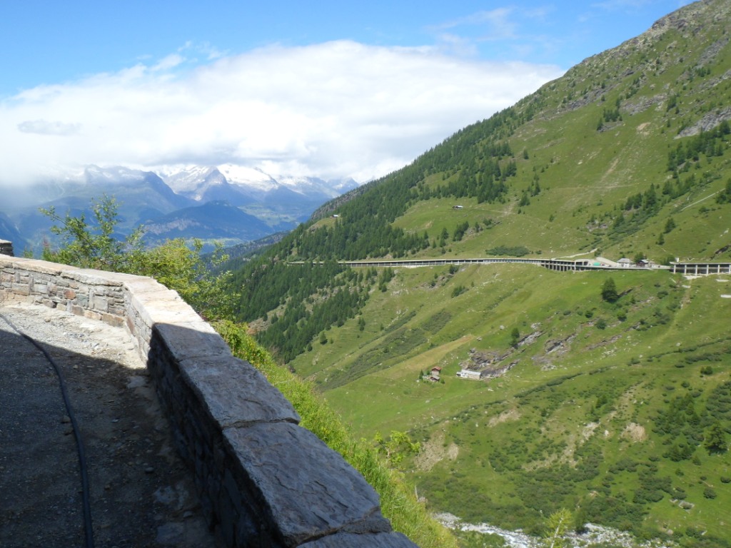
To and from Simplonpass
Long viaduct along the slope
|
Beautiful high bridge
|
'Roofed' road
|
More 'roofed' road
|
At the top
|
View to the 'other' side
|
On the way down
|
View onto the ... Breithorn?
|
View back to the long viaduct
|
|
Without trouble I make it to the top. The descent – with very nice views
during the
highest part (Nesthorn? Breithorn?, Eggishorn?) – is thrilling, indeed, I
can almost catch up with the cars (probably I go faster here than two
days ago,
but I have no attention for my speedometer). Back along the Rhône, from
Naters, I make a last picture of the road which
stands as a long viaduct out from the
mountain.
Sixteen km separate me from Fiesch, horizontally – vertically about
400m. It won't be an early arrival, even more so since I do need a
break. Sometimes when
you need a restaurant ... I leave the road in search of one in
Grengiols, and when I reach a house with a water tap in the garden I'm
quite satisfied with that;
I'm tired! I fill my bottle and a few hundred meters back to the main
road stuff myself up
with baguette avec fromage. I make two pictures of a train,
one high up, one close by, and later on realize it must have been the same train. Follows a climb of 2 km, and
the remaining part till Fiesch (pronounced as
if it had two syllables) is even. The Ferienzentrum consists of several buildings; I have difficulty finding the
reception.
Goal(s?) for tomorrow |
The swimming pool is closed on Sunday, but it's close to 7 anyway,
dinner time.
The youth hostel is modern, three-star, but sterile. Dinner is a bit
anonymous too, but the food is okay.
I find a nice, quiet reading corner, but I'm chased away by television
lovers. Luckily there's another such corner on
another floor, where I can enjoy a soft
bench and silence. I have a chat with Enya, which isn't good for my
night's rest: she found a reminder/threatening letter from my mortgage
bank; they
already sent someone from a collection agency, the wolves. This youth
hostel isn't fully booked by far.
In the morning I swap my Maigret for an English novel.
| 
Place for tonight |
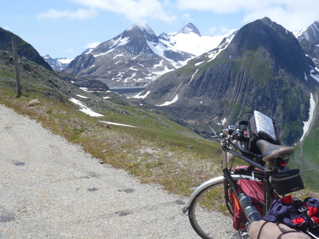
16-07-2012 FIESCH → BELLINZONA, distance 120 km, dénivelée 1400 m
The weather is okay, but I cannot see the Eggishorn, the famous mountain
here. The first 20 km until Ulrichen are slightly uphill. The second
half I ride up
with Dan from the U.S., whom I try to lure into/onto the Nufenenpass (he
told me he was a few days ahead of schedule), but he sticks to his
original plan,
including the Furkapass. In Ulrichen I have a coffee on a terrace with
one sunny corner. As it isn't too warm I am glad to put myself into it. I
have
a reasonably positive talk with the WUH Bank (at least, they will not
send another guy to my house – do they expect to find someone at home
during office
hours? or do they act like that on purpose?)
|
Fresh morning around Fiesch
|
Photograph by Dan
|
Start of today's challenge
|
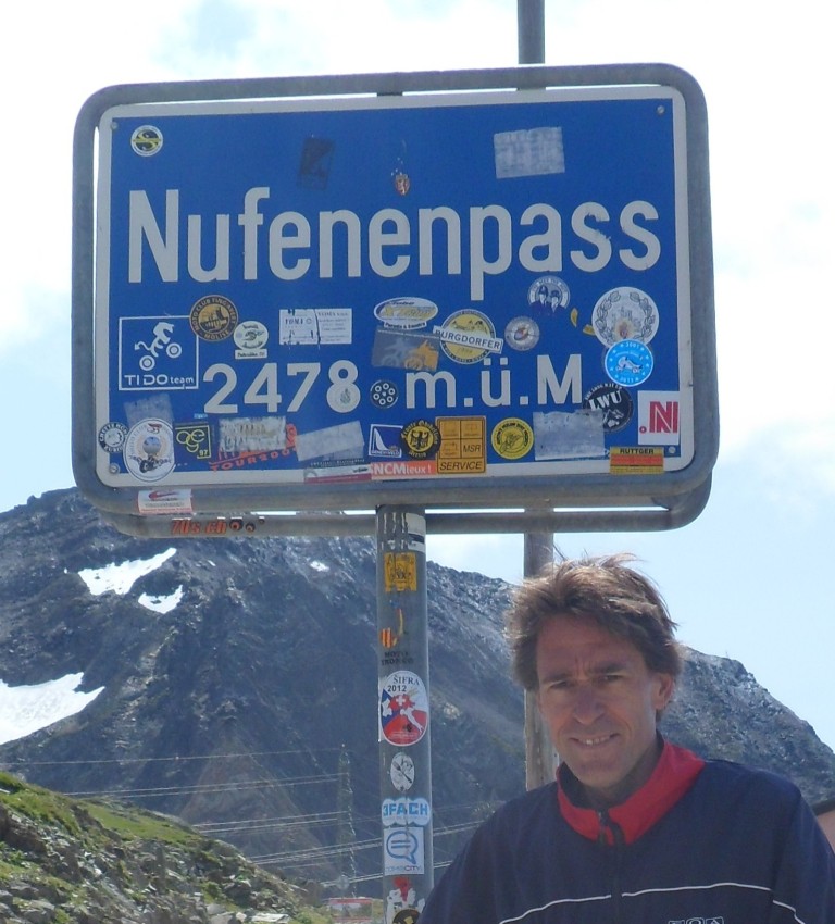
The Nufenenpass is another 'big one' lacking on
my list – I think it's the highest pass completely in
Switzerland (the Umbrailpass is higher, but that's on the border with
Italy). The difference in altitude, 1130m is not exceptional, the
average grade, 8.5%
is quite high for a distance of 13.5 km. Compared to the stages I have
accomplished in the last few days, this one is
quite easy: only 13.5 km of climbing, and then a
very long descent. I take it easy, taking photo-stops every now and
then, and even with that overtake two (elder) cyclists without luggage,
but it definitely
isn't easy. The scenery is very open, much snow, a big dam high up on
the south side, many nice views to take in.
It takes me seven quarters of an hour.
|
Rough climb . . . .
|
|
|
. . . . beautiful scenery . . . .
|
|
. . . . to Nufenen Pass
|
|
|
Already quite a bit behind me
|
|
Whiteness around the top
|
|
The views down get deeper
|
|
|
Impressive scenery around the top
|
|
As usual there's at least one dam
|
Me at the top
|
A short rest in the shelter of a restaurant
(against the wind), and then back/down to higher temperatures. Shortly
after the summit I make a self-portrait with a wall of snow behind me.
The first 10km
are about as steep as on the other side, then it slows down. I marvel at
the road going up to the Gotthardpass: of course I knew it already, but
what a brilliant
road builders the Swiss are, this road turns tens of meters away from
the mountain slope to make smooth curves.
It's pure art. From Airolo I have a look sort of from below, take
a(nother) picture, and turn right for the last
60 km – still 850m down – to Bellinzona.
Snow on the other side as well
|
More snow
|
And down again!
|
A view back
|
And another view back
|
A view up to the Gotthard Road
|
In the beginning the Ticino
valley is narrow; the old and the new road fight for room. There are
still considerably fast stretches. In one of the many villages with
Italian names
I have a break in a small park with a coke and a baguette with delicious
gorgonzola cheese. Further down I try the route indicated for cyclists -
time is on my
side! I'm afraid I will end up in dead-end roads, but my fear is
unnecessary: it is a very nice alternative, and ... very quiet. Okay,
it's unpaved part of
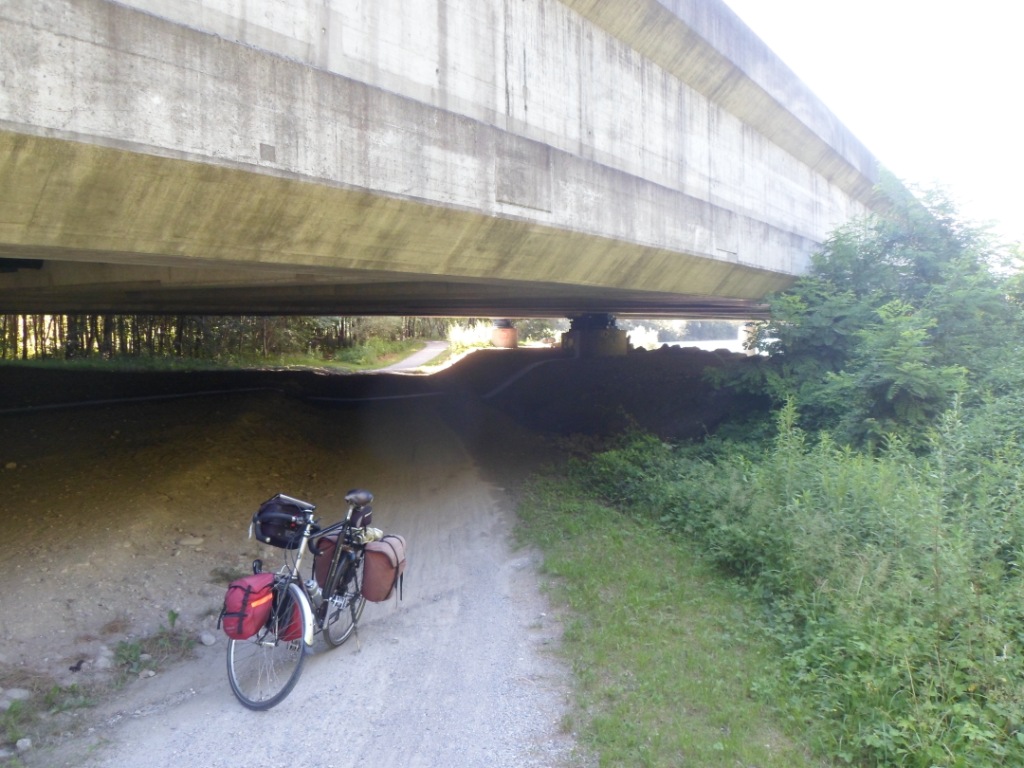
the time, sometimes just a tiny track, but I can easily keep riding all
the time (though I do get off under a dreadfully low viaduct). Also the
cycling
alternative offers much more shade, which is nice, because it's getting
very warm.
More of the Gotthard Road
|
Good cycling alternative
|
Busy Ticino Valley
|
All in all it does take more time,
but as I already wrote, today that is
on my side. In Bellinzona, around 5 p.m. it's 35 degrees. I know largely
the whereabouts of the youth hostel, and with the help of one friendly
Bellinzonian
(with an iPod) it is easily found. Compared to the y.h. in Fiesch this
one – in an old military hospital – has a much nicer atmosphere. While
relaxing in one of the
sofas in the lobby I make contact with Michael from Israel, we have a
chat, and agree to meet half an hour later
to go into town for dinner.
Delicious late lunch
|
Good cycling alternative
|
Dangerously low viaduct
|
Bellinzona youth hostel
|
The dormitory
I'm put into has twelve beds or so, most of them taken, but at this hour
no guests are there. When I meet Michael downstairs it appears that
Hardy, a 22 years
old student/musician from Taiwan, will join us. We are an unusual
threesome in search of a meal. Many places appear to be closed on
Mondays (or very
expensive) so we end up at a shawarma place and an ice-cream restaurant.
We cover several interesting topics. Michael announces he will rent a
bike and
accompany me tomorrow for an hour (or more; well, the start is quite
even). I think it's fun, but am sure this won’t happen. Early to bed,
tomorrow
two big climbs. Earlier than all my roommates.
17-07-2012 BELLINZONA → CHIAVENNA, distance 118 km, dénivelée 2500 m
I'm the first to have breakfast in the spacious dinner room on the 5th
floor – there is an elevator, and it's old-fashioned/slow/dangerous.
When I get ready to leave: no sign of Michael (I'm neither surprised nor
disappointed). To my dismay after
yesterday's evening rush hour today I also have to experience
morning rush hour in Bellinzona, where the temperature is already
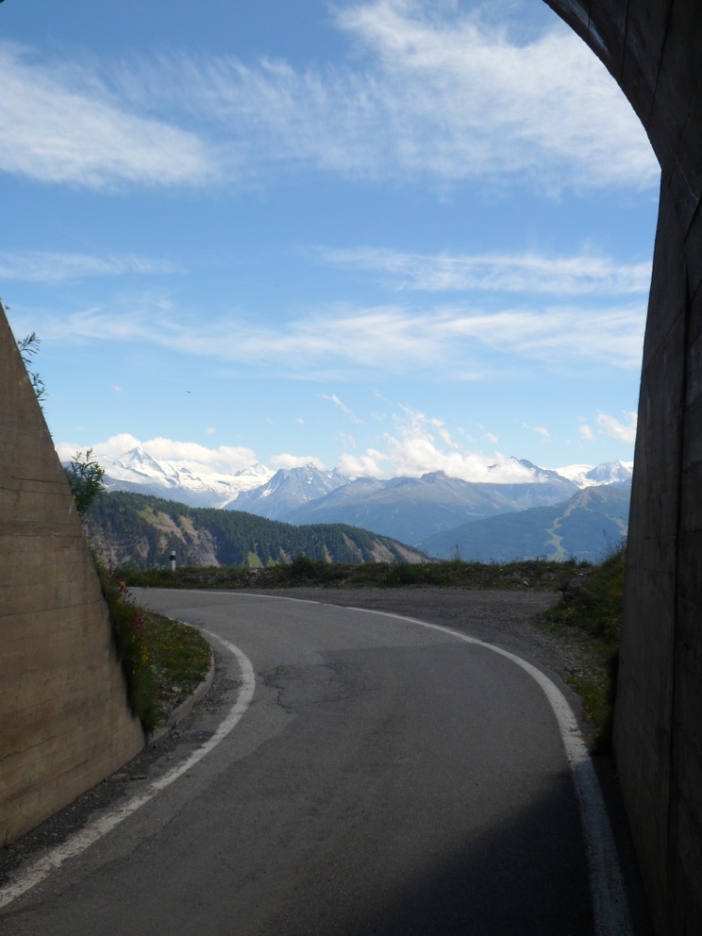
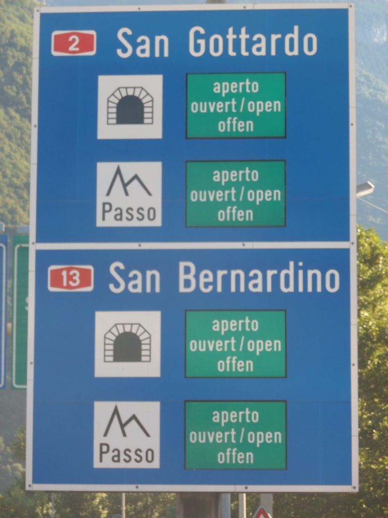
above 20 degrees. The preamble to the Passo San Bernardino (with according to Salite d'Europa almost the same
difficulty as the Col du Sanetsch!)
is very long and slow, and very green as well. During the first 22 km, at least till Lostallo, nothing happens
(as regards climbing).
View from my room
|
What's in store and what's not
|
Long relaxed (and beautiful) preamble
|
At a certain moment I
can see the road(s) going up very far before me, and quite high. Not much later comes the hardest part:
950m up in 13 km (and halfway one flat km).
Because of the freeway, that goes into a tunnel, the secondary road doesn't get much traffic, which is good!
At the 'local maximum' 1.5 km before San Bernardino you can say the pass is in the pocket.
There it gets going
|
Water along the road
|
More water after San Bernardino
|
That village seems a good place to have a rest; I see restaurants, I see
a Denner (the Swiss 'Casino'), I see a bench, I see a water point, and
when I have
stuffed myself up a bit, and relaxed my muscles, I see a cyclist appear,
just as heavily loaded as I am. However, he needs a rest, I have still a
long
distance to go, so I don't wait for him. The remaining seven km to the
pass are indeed less severe than what's already behind me, and the last
part, along a lake is even flat. It's a
nice climb, but I would not put it on the list of 'the 15 most beautiful
roads of the world' (as some people do).
The descent to the other side is even less
interesting: the road is like a staircase against the slope, going down
to the valley of the Hinterrhein.
Four scenes around the San Bernardino Pass
It is a spectacular sight to see the tunnel spitting
out cars from the mountain. I follow this river for about 10 km, passing
the village of Nufenen, by the way, until
Splügen. I have already seen
where I will be going, up again!, when I set myself on a doorstep, in
the shade, in the village last mentioned. I start the climb
simultaneously with a runner. We have
the same speed, and after the first bend, he turns left, off-road,
following a current.
I won't see him again till the top, where I see him taking the
Postbus back! For me the first part of the climb is steep, then it slows
down a bit,
and then comes a 'staircase' as the one from the San Bernardino, which
also gives 4 km of more than 8 %.
Four scenes around the Splügen Pass
Around the top – which I reach at 4:15 p.m. – the scenery is beautiful
in a rough way. Further down,
around the Lago Montespluga, I find it a bit boring.
There are tunnels where cars want to overtake me; stupid Italians (in
this respect). I have vague memories of the climb from the south in
1988:
very warm in the beginning, never ending, and a passage with 10 tornanti almost right above
each other. That passage comes shortly after Pianazzo, and also contains innumerous tunnels.
Molti tornanti
|
 |
Till the end very steep and reasonably steep stretches
alternate, until I've finally descended almost 1800 m till Chiavenna,
around 6 p.m. I find the Tourist Information at the railway station, an
end station.
Close by there's a 'hostel'. Close by means 500 m over a very steep
cobblestone road, where I have to walk and push my bike. It is a funny
place, nicely located a
little above the town. The people seem a bit at a loss to have a
customer who doesn't speak Italian, though I understand a woman from
Germany has arrived
just before me. When I'm putting my things in my three-bedded room,
which I don't have to share
(and the price is less than € 20,-), I think I hear someone
'from the house' talking to this German woman, so I see if I can invite
her to have dinner, but it appears to be someone else (who apologizes
she's too tired
to go into town). I decide to buy some salad, some dessert, and a
breakfast for tomorrow in a supermarket, and eat a pizza on a terrace.
On the terrace someone comes over
and invites me to join her: it's Ulrike, 'the woman from the hostel'.
She's also cycling, making a trip of three weeks through (mostly) Austria and
Switzerland. She also appears
to have studied mathematics, so there's enough to talk about.
'At home' I complete my dinner, while she sets her brakes, and later in
the evening I enjoy the soft couch in the nice living room, for the
first time listen
to part of the 7 gB of music that I put into my mp3 player, while I
write several pages in my journal.
|